Safety Score: 3,0 of 5.0 based on data from 9 authorites. Meaning we advice caution when travelling to Germany.
Travel warnings are updated daily. Source: Travel Warning Germany. Last Update: 2024-08-13 08:21:03
Delve into Bußmaate
The district Bußmaate of Nordhorn in Lower Saxony is a subburb in Germany about 267 mi west of Berlin, the country's capital town.
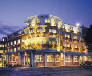
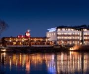
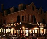
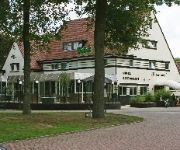
If you need a hotel, we compiled a list of available hotels close to the map centre further down the page.
While being here, you might want to pay a visit to some of the following locations: Wietmarschen, Lage, Georgsdorf, Engden and Esche. To further explore this place, just scroll down and browse the available info.
Local weather forecast
Todays Local Weather Conditions & Forecast: 8°C / 47 °F
| Morning Temperature | 8°C / 46 °F |
| Evening Temperature | 6°C / 43 °F |
| Night Temperature | 5°C / 41 °F |
| Chance of rainfall | 5% |
| Air Humidity | 67% |
| Air Pressure | 1010 hPa |
| Wind Speed | Moderate breeze with 13 km/h (8 mph) from East |
| Cloud Conditions | Broken clouds, covering 75% of sky |
| General Conditions | Light rain |
Monday, 18th of November 2024
7°C (45 °F)
4°C (39 °F)
Light rain, gentle breeze, broken clouds.
Tuesday, 19th of November 2024
1°C (34 °F)
3°C (37 °F)
Rain and snow, moderate breeze, overcast clouds.
Wednesday, 20th of November 2024
5°C (41 °F)
2°C (35 °F)
Light rain, moderate breeze, scattered clouds.
Hotels and Places to Stay
Hotel Am Stadtring
Riverside
de Schout
In-Side
Fletcher Hotel - Restaurant Dinkeloord
Neu Berliner Hof
Videos from this area
These are videos related to the place based on their proximity to this place.
Nordhorn - Unterwegs in Niedersachsen (Folge 11)
In dieser Folge zeige ich die Stadt Nordhorn in der Grafschaft Bentheim in Niedersachsen. Als einzelne Beiträge innerhalb dieser Folge besuchen wir in den Niederlanden die Städte Denekamp...
Nordhorn Grafschaft Bentheim: Glocke 1 der Katholischen Kirche
Nordhorn Grafschaft Bentheim: Glocke 1 der Katholischen St. Elisabethkirche für mehr Glockenvideos sehe: http://bit.ly/1b0l3nU http://www.youtube.com/denniswubs https://www.facebook.com/dennis.w ...
Nordhorn - Gewitter Timelapse Sony Alpha
Zeitraffer Gewitterwolkenauf/abzug über Norhorn, Grafschaft Bentheim. Gefilmt mit Sony Alpha 55 und GoPro Hero HD2. Timelapse thunderstorm. Nordhorner Sommer 2012 effektvoll in Szene gesetzt...
Rawe & Co Nordhorn
Bezoekje aan Rawe & Co 17-04-2010 Begin In 1896 werd een nieuw bedrijf geboren in Nordhorn, weverij "B. Rawe & Co". De aandeelhouders waren Bernard Rawe, Schnieder en Heinrich. Einde...
Imagefilm Inomatic GmbH Nordhorn
Zuverlässig, flexibel, und das mit höchstem Maß an Qualität – das ist Inomatic. Seit über 12 Jahren ist die Inomatic GmbH Ihr erfahrener Partner für innovative Elektroniklösungen...
MB Trac Feldtage Nordhorn 2014 Maishäckseln
Maishäckseln mit MB-Trac´s auf den MB-Trac Feldtagen in Nordhorn am Sonntag 21.09.2014.
Nordhorn Grafschaft Bentheim: Glocken der Evangelisch Lutherischen Kreuzkirche (Plenum)
Nordhorn Grafschaft Bentheim: Glocken der Evangelisch Lutherischen Kreuzkirche (Plenum) für mehr Glockenvideos sehe: http://bit.ly/1b0l3nU http://www.youtube.com/denniswubs ...
Nordhorn Grafschaft Bentheim: Glocken der Evangelisch Reformierten Kirche (Plenum)
Nordhorn Grafschaft Bentheim: Glocken der Evangelisch Reformierten Kirche (Plenum) für mehr Glockenvideos sehe: http://bit.ly/1b0l3nU http://www.youtube.com/denniswubs ...
Nordhorn Graftschaft Bentheim: Glocken der Katholische St. Josefkirche (Plenum)
Nordhorn Graftschaft Bentheim: Glocken der Katholische St. Jozefkirche (Plenum) für mehr Glockenvideos sehe: http://bit.ly/1b0l3nU http://www.youtube.com/denniswubs ...
Nordhorn Grafschaft Bentheim: Glocken der Katholischen St. Josefkirche (Plenum)
Nordhorn Grafschaft Bentheim: Glocken der Katholischen St. Jozefkirche (Plenum) für mehr Glockenvideos sehe: http://bit.ly/1b0l3nU http://www.youtube.com/denniswubs ...
Videos provided by Youtube are under the copyright of their owners.
Attractions and noteworthy things
Distances are based on the centre of the city/town and sightseeing location. This list contains brief abstracts about monuments, holiday activities, national parcs, museums, organisations and more from the area as well as interesting facts about the region itself. Where available, you'll find the corresponding homepage. Otherwise the related wikipedia article.
Dinkelland
' is a municipality in the eastern Netherlands. For a short time it was known as Denekamp (one of its component towns) until it was renamed in 2002.
Oldenzaal
Oldenzaal is a municipality and a city in the eastern province of Overijssel in the Netherlands. It is part of the region of Twente and is close to the German border. It received city rights in 1249. Historically, the city was part of the Hanseatic League as a subsidiary city of the fellow Hanseatic city of Deventer. Located on the A1 motorway from Amsterdam to Germany, Oldenzaal also has a rail connection to Hengelo.
Bentheim
County of Bentheim is a district (Landkreis) in Lower Saxony, Germany. It is bounded by (from the west and clockwise) the Dutch provinces of Overijssel and Drenthe, the district of Emsland, and the districts of Steinfurt and Borken in North Rhine-Westphalia.
RAF Nordhorn
Royal Air Force Station Nordhorn, more commonly known as RAF Nordhorn, is a military aviation bombing and gunnery range to the east of nearby Nordhorn, in Lower Saxony, Germany. The range is used by the British Royal Air Force (RAF), the German Luftwaffe, and other NATO air forces and aviation arms of their other branches. The first use for gunnery purposes was by the Wehrmacht in 1933, when the heaths to the east of the town of Nordhorn were used for artillery target practice.
Neuenhaus (Samtgemeinde)
Neuenhaus is a Samtgemeinde ("collective municipality") in the district of Bentheim, in Lower Saxony, Germany. Its seat is in the municipality Neuenhaus. The Samtgemeinde Neuenhaus consists of the following municipalities: Esche Georgsdorf Lage Neuenhaus
Schüttorf (Samtgemeinde)
Schüttorf is a Samtgemeinde ("collective municipality") in the district of the County of Bentheim, in Lower Saxony, Germany. Its seat is in the municipality Schüttorf. The Samtgemeinde Schüttorf consists of the following municipalities: Engden Isterberg Ohne Quendorf Samern
Beuningen, Overijssel
Beuningen is a small village in the municipality of Losser in the Dutch province of Overijssel, with 270 inhabitants in 2004. The village is situated along the river Dinkel, in a mainly rural area, approximately one kilometre South of Denekamp. Beuningen used to be part of the Parish Denekamp, in 1817 the marke Beuningen became part of the municipality of Losser. A Roman Catholic church from 1948 is located in the village.
Basilica of St Plechelm
The basilica of St Plechelm is a Roman Catholic church in the Dutch town of Oldenzaal dedicated to the 8th century Irish monk Saint Plechelm, whose festival on 15 July has been on the calendar of the medieval diocese of Utrecht ever since his canonisation in the 10th century. This festival is still celebrated annually at the basilica, and the saint's 1050th anniversary was celebrated there in 2004. The pope granted it the title of minor basilica in 1950.
Bad Bentheim station
Bad Bentheim is a railway station located in Bad Bentheim, Germany. The station was opened on 18 October 1865 and is located on the Almelo - Salzbergen railway. The train services are operated by Deutsche Bahn with NS Hispeed, Syntus and the Westfalenbahn. The station is a border station between The Netherlands and Germany. Dutch and German locomotives change here as the voltage is different in the countries. From Bad Bentheim, passengers can travel on the international service to Amsterdam.
Schüttorf railway station
Schüttorf is a railway station located in Schüttorf, Germany. The station is located on the Almelo - Salzbergen railway. The train services are operated by Westfalenbahn.
Grenzaa
Grenzaa is a river in Lower Saxony, Germany, near the town Twist. It forms some of the border between the Netherlands and Germany. \t\t \t\t\tSchoonebeker Diep9. jpg \t\t\t \t\t\t \t\t \t\t \t\t\tSchoonebeker Diep. jpg \t\t\t \t\t\t \t\t \t\t \t\t\tSchoonebeker Diep3. jpg \t\t\t \t\t\t \t\t \t\t \t\t\tSchoonebeker Diep4. jpg \t\t\t \t\t\t \t\t \t\t \t\t\tSchoonebekerdiep6. jpg \t\t\t \t\t\t \t\t \t\t \t\t\tSchoonebeekerdiep of Grenz Aa. jpg
Lee (Vechte)
Lee is a river of Lower Saxony, Germany.
De Lutte
De Lutte is a village in the Dutch province of Overijssel. It is located in the municipality of Losser. It is located close to the border between the Netherlands and Germany. De Lutte is connected to Germany (to the east) and Oldenzaal and Hengelo (to the west) by the A1. Restaurant De Bloemenbeek (one Michelin star) is located in the village.
Heemse
Heemse is a village in the Dutch province of Overijssel. It is located in the municipality of Hardenberg. Restaurant De Bokkenpruik (one Michelin star) is located in the village. In 1880, plans were being drafted for the building of tramlines from Zwolle to Coevorden and from Avereest to Gramsbergen. The mayor of Hardenberg, Willem van Ittersum, offered subsidies if that last line went to Hardenberg instead of Gramsbergen.
De Wanne
Restaurant De Wanne is a restaurant located in Ootmarsum, Netherlands. It is part of Hotel De Wiemsel. It is a fine dining restaurant that was awarded one Michelin star in the period 1985-1988 and from 1992 to present. Gault Millau awarded the restaurant 12 out of 20 points. Head chef of De Wanne is Gerhard Müller. In 1981, head chef was Johan Neppelerbroek. Originally, restaurant De Wanne was located at Stobbenkamp 2.
Burg Bentheim
Burg Bentheim (Bentheim Castle) is the early medieval hill castle in Bad Bentheim, Lower Saxony, Germany . The castle is first mentioned in the 11th century under the name binithem.


