Safety Score: 3,0 of 5.0 based on data from 9 authorites. Meaning we advice caution when travelling to Germany.
Travel warnings are updated daily. Source: Travel Warning Germany. Last Update: 2024-08-13 08:21:03
Explore Larberg
Larberg in Lower Saxony is a city in Germany about 231 mi (or 372 km) west of Berlin, the country's capital.
Local time in Larberg is now 02:55 AM (Sunday). The local timezone is named Europe / Berlin with an UTC offset of one hour. We know of 10 airports in the vicinity of Larberg, of which 4 are larger airports. The closest airport in Germany is Münster Osnabrück Airport in a distance of 20 mi (or 33 km), South-West. Besides the airports, there are other travel options available (check left side).
There are several Unesco world heritage sites nearby. The closest heritage site in Germany is Town Hall and Roland on the Marketplace of Bremen in a distance of 60 mi (or 97 km), North-East. We found 1 points of interest in the vicinity of this place. If you need a place to sleep, we compiled a list of available hotels close to the map centre further down the page.
Depending on your travel schedule, you might want to pay a visit to some of the following locations: Westerkappeln, Neuenkirchen, Wallenhorst, Lotte and Alfhausen. To further explore this place, just scroll down and browse the available info.
Local weather forecast
Todays Local Weather Conditions & Forecast: 8°C / 46 °F
| Morning Temperature | 8°C / 46 °F |
| Evening Temperature | 6°C / 42 °F |
| Night Temperature | 5°C / 41 °F |
| Chance of rainfall | 5% |
| Air Humidity | 69% |
| Air Pressure | 1009 hPa |
| Wind Speed | Moderate breeze with 12 km/h (7 mph) from East |
| Cloud Conditions | Overcast clouds, covering 88% of sky |
| General Conditions | Light rain |
Monday, 18th of November 2024
7°C (44 °F)
4°C (39 °F)
Light rain, gentle breeze, broken clouds.
Tuesday, 19th of November 2024
5°C (41 °F)
1°C (35 °F)
Rain and snow, moderate breeze, overcast clouds.
Wednesday, 20th of November 2024
5°C (41 °F)
2°C (36 °F)
Light rain, gentle breeze, broken clouds.
Hotels and Places to Stay
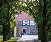
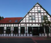
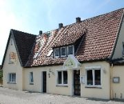
Akzent Hotel Haus Surendorff
Idingshof
Altes Gasthaus Schroer
Witte Gasthaus
Videos from this area
These are videos related to the place based on their proximity to this place.
BR78 zwischen Westerkappeln und Wersen
Dampflok der Baureihe 78 zwischen Westerkappeln und Wersen. Aufgenommen am 1.6.2009.
The Top 10 Wooden Rollercoasters in the world
Ein neues Top 10 Video von mir, wo ich die einzelnen Ränge anhand eines speziellen Punktesystems errechnet habe. Das bestätigt sozusagen die Platzierung der einzelnen Holzachterbahnen. Für...
4Direction - A 4th Dimensional Coaster [NoLimits 2]
Hier hab ich endlich mal wieder ein Video für euch! Diesmal meine absolute Fantasie-Achterbahn "4Direction", die man in der Realität zu 100% niemals bauen wird, da die Drehungen einfach viel...
Wood Typhoon No Limits Coaster 1.8
Eine Holzachterbahn mit mehreren Überschlägen und Steilkurven. Die Stützen für Überschläge, Steilkurven und Over-Turns sind Eigen-Entwurf. Als kleine Information am Rande: Meine 3. Holzachter...
Meine Top 10 Achterbahnen in Nordamerika
Das sind meine TopTen Achterbahnen in Nordamerika! Ich weiß, dass es noch viele. viele andere Bahnen gibt, aber die hier sind mir als erstes eingefallen! Es sind einfach größtenteils Achterbahne...
xTreme Woody - A NoLimits Wooden Coaster - NoLimits 1.8
Hier seht ihr meine neuste Kreation xTreme Woody, eine Holzachterbahn vom Hause Intamin. Extrem hoch, extrem schnell. extrem lang! Viel Spaß beim zuschauen der Achterbahn! Ich hoffe, dass...
Coasterman61 Initialvideo
Zehn Achterbahnen, die mit den einzelnen Buchstaben meines YouTube Namen Coasterman61 anfangen: C-O-A-S-T-E-R-M-A-N (zu 61 hab ich nix gefunden) Videos by: themeparkreview, E-Coaster, ...
WTF RollerCoaster - A NoLimits2 Funfair RollerCoaster - Trailer
Ein sehr extreme Kirmes-Achterbahn, die von der Firma Schwarzkopf GMBH gebaut worden wäre, denn es ist eine Eigenkonstruktion von mir. Die Daten und mehr Infos gibt es am 28. Februar, wo das...
HeidePark2014 - B&M WingRider - Official Layout
So, wie es in diesem Video zu sehen ist, wird ganz klar die Achterbahn, die zur Zeit im Heide Park Soltau gebaut wird. Das es ein WingCoaster wird, wurde ja schon bestätigt und ist ja auch...
Crafter - A (Wood-Hybrid) No Limits Coaster
Ein Wood-Hybrid Coaster der Firma Rocky-Mountain Construction Speziell ausgestattet mit einer Stahlspur, dass erstens eine angenehmere Fahrt herbeiführt und zweitens späktakulärere Elemente...
Videos provided by Youtube are under the copyright of their owners.
Attractions and noteworthy things
Distances are based on the centre of the city/town and sightseeing location. This list contains brief abstracts about monuments, holiday activities, national parcs, museums, organisations and more from the area as well as interesting facts about the region itself. Where available, you'll find the corresponding homepage. Otherwise the related wikipedia article.
Gehn
The Gehn is a small ridge of hills between Bramsche and Ueffeln in Germany's Central Uplands, that are an extension of the Wiehen Hills. The ridge runs from northwest to southeast and is about 5 kilometres long and an average of 2 kilometres wide. The highest point is the Kettelberg which is 108 m above sea level high. The Gehn forms a link between the Wiehen Hills and the Ankum Heights (Ankumer Höhe).
Achmer station
Achmer is a railway station located in Achmer, Germany.
Osnabrück Canal
The Osnabrück Canal (German: Stichkanal Osnabrück, formerly the Zweigkanal Osnabrück) or SKO, is an artificial waterway, about 14.5 km long, that links the Mittelland Canal in central Germany with the port in the town of Osnabrück. It was built between 1910 and 1915 and runs largely parallel to the unnavigable River Hase, the greatest distance between the two being about 1 km. The Canal was crossed by the 11th Armoured Division during World War II during its advance across Germany.


!['4Direction - A 4th Dimensional Coaster [NoLimits 2]' preview picture of video '4Direction - A 4th Dimensional Coaster [NoLimits 2]'](https://img.youtube.com/vi/JnR-uQEqU_M/mqdefault.jpg)


