Safety Score: 3,0 of 5.0 based on data from 9 authorites. Meaning we advice caution when travelling to Germany.
Travel warnings are updated daily. Source: Travel Warning Germany. Last Update: 2024-08-13 08:21:03
Delve into Buchladen
The district Buchladen of in Lower Saxony is a subburb in Germany about 127 mi west of Berlin, the country's capital town.
If you need a hotel, we compiled a list of available hotels close to the map centre further down the page.
While being here, you might want to pay a visit to some of the following locations: Gielde, Schladen, Heiningen, Flothe and Liebenburg. To further explore this place, just scroll down and browse the available info.
Local weather forecast
Todays Local Weather Conditions & Forecast: 2°C / 36 °F
| Morning Temperature | -0°C / 31 °F |
| Evening Temperature | 2°C / 36 °F |
| Night Temperature | 1°C / 35 °F |
| Chance of rainfall | 4% |
| Air Humidity | 81% |
| Air Pressure | 1001 hPa |
| Wind Speed | Fresh Breeze with 15 km/h (9 mph) from North-East |
| Cloud Conditions | Overcast clouds, covering 88% of sky |
| General Conditions | Snow |
Saturday, 23rd of November 2024
3°C (37 °F)
4°C (39 °F)
Light snow, moderate breeze, overcast clouds.
Sunday, 24th of November 2024
10°C (50 °F)
10°C (50 °F)
Moderate rain, fresh breeze, overcast clouds.
Monday, 25th of November 2024
12°C (54 °F)
8°C (46 °F)
Light rain, fresh breeze, overcast clouds.
Hotels and Places to Stay
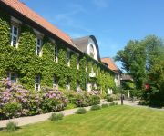
Wöltingerode Klosterhotel
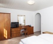
Hotel Goslarer Straße
Videos from this area
These are videos related to the place based on their proximity to this place.
Zu Besuch bei Jürgen Hergert - Schlangenfarm Schladen
Wir besuchten Europas größte Schlangenfarm in Schladen, sprachen mit dem Inhaber und Schlangenmelker Jürgen Hergert und betraten mit der Kamera das Krokodilgehege von Hassan. Besuchen...
Pokal Viertelfinale gegen SV Schladen
Viertelfinale Pokal E-Jugend 2009 SV Schladen : TuS Cremlingen Das Spiel endet 17:0 für den TuS Cremlingen.
Gaumen Schmaus Gaumen Graus Schnitzel Pitza
Gaumen Schmaus Gaumen Graus Schnitzel Pitza quelle: Kabel Eins Abenteuer Leben.
Campact Gegen Genmais - www.genmais-stoppen.de
Grüne Gentechnik wird indirekt über Futtermittel für Tiere als Fleisch auf unsere Tische gebracht. Als Honig können wir gentechnisch veränderte Pollen zu uns nehmen. Bt-Toxin zeigt Abbauproble...
Videos provided by Youtube are under the copyright of their owners.
Attractions and noteworthy things
Distances are based on the centre of the city/town and sightseeing location. This list contains brief abstracts about monuments, holiday activities, national parcs, museums, organisations and more from the area as well as interesting facts about the region itself. Where available, you'll find the corresponding homepage. Otherwise the related wikipedia article.
Wolfenbüttel (district)
Wolfenbüttel is a district in southeastern Lower Saxony, Germany. Neighboring districts are (clockwise from the north) the district-free City of Braunschweig, the district of Helmstedt, the district of Harz in Saxony-Anhalt, and the districts of Goslar, Hildesheim and Peine. The district-free city of Salzgitter cuts through the district of Wolfenbüttel in the southwest.
Goslar (district)
Goslar is a district in Lower Saxony, Germany. It is bounded by (from the south and clockwise) the districts of Osterode, Northeim, Hildesheim and Wolfenbüttel, the city of Salzgitter, and by the states of Saxony-Anhalt and Thuringia.
Braunschweig (region)
Brunswick (German Braunschweig) is one of the four former administrative regions of Lower Saxony, Germany, located in the southeast of the state. The region covers roughly the area of the former state of Brunswick-Lüneburg. Founded in 1978 out of Verwaltungsbezirk Braunschweig, it was dissolved in 2004. The region of Brunswick is the most R&D-intensive area in the whole European Economic Area investing 7.1% of its GDP for research & technology. (Eurostat, 2006)
Asse (hills)
The Asse is a small hill range in the district of Wolfenbüttel in southeastern Lower Saxony with a median height of 200 metres ASL; the highest elevation is the Remlinger Herse with a height of 234 m. There are more than 600 different plants found here; the Asse is mostly covered by trees. It has been inhabited since the 6th millennium BC by farmers coming from the Danube region. For several hundred years, salt has been mined in Asse.
Burgberg Cable Car
The Burgberg Cable Car is a cable car in Bad Harzburg, Germany. It was built in 1929 by the Bleichert engineering corporation and has a length of 481 metres. Its hauling cable has a diameter of 18 mm, its carrying cable a diameter of 37 mm. It is driven by a 40 metric horsepower engine at the summit station. It has two cabins carrying up to 18 passengers each. The cable car is named after the Burgberg mountain, site of the historic Harzburg Castle, built by Emperor Henry IV about 1068.
Oderwald
Oderwald is a Samtgemeinde ("collective municipality") in the district of Wolfenbüttel, in Lower Saxony, Germany. It is situated along the river Oker, approx. 10 km south of Wolfenbüttel. It is named after the Oderwald, a small chain of hills in the municipality. Its seat is in the village Börßum. The Samtgemeinde Oderwald consists of the following municipalities: Börßum Cramme Dorstadt Flöthe Heiningen
Salzgitter-Bad
With a population of about 20,000, Salzgitter-Bad is the second biggest quarter of the German city Salzgitter in Lower Saxony. Salzgitter's name derives from it; the quarter is regarded as the historical and cultural centre of Salzgitter.
Central Registry of State Judicial Administrations
The Central Registry of State Judicial Administrations (German: Zentrale Erfassungsstelle der Landesjustizverwaltungen, ZESt) in Salzgitter-Bad, West Germany was established on 24 November 1961 in the aftermath of the construction of the Berlin Wall. Its function was to verify human rights violations by the government of East Germany like homicide at the Inner German border, political persecution, torture and maltreatment, etc.
Schladen (Samtgemeinde)
Schladen is a Samtgemeinde ("collective municipality") in the district of Wolfenbüttel, in Lower Saxony, Germany. Its seat is in the village Schladen. The Samtgemeinde Schladen consists of the following municipalities: Gielde Hornburg Schladen
Salzgitter Bismarck Tower
The Salzgitter Bismarck Tower is an observation tower completed in 1900 in Salzgitter, Germany. Unlike most other Bismarck towers, it does not consist of all-stone design, but instead has a base of bricks with a lattice tower on top. On one side, it resembles an Eiffel Tower with a bow between its feet. The Harz Club voted to build the Bismarck Tower at Salzgitter on 8 May 1899. The same day, the site was chosen and bought by the forest cooperative of Gitter.
Herzog August Library
The Herzog August Library (German: Herzog August Bibliothek — "HAB"), in Wolfenbüttel, Lower Saxony, known also as Bibliotheca Augusta, is a library of international importance for its collection from the Middle Ages and Early modern Europe. The library is overseen by the Lower Saxony Ministry for Science and Culture.
Fachhochschule Braunschweig/Wolfenbüttel
Ostfalia Hochschule für angewandte Wissenschaften (German for "Eastphalia University of Applied Sciences", known as Fachhochschule Braunschweig/Wolfenbüttel until 2009), is a Fachhochschule in eastern Lower Saxony, Germany. The predecessor of the college, Staatliche Ingenieurschule Wolfenbüttel (State Engineering School Wolfenbuettel), was founded in 1928. It merged with two other independent institutions in August 1971.
Romkerhall
Romkerhall (also Romkerhalle) is a former hunting residence of George V of Hanover in the Oker Valley, Harz, Germany. It lies next to the B 498 federal road and was built in 1862.
Salzgitter Hills
The Salzgitter Hills (German: Salzgitter-Höhenzug, also Salzgitterscher Höhenzug) is an area of upland up to 322.9 metres in height, in the Lower Saxon Hills between Salzgitter and Goslar in the districts of Wolfenbüttel and Goslar and in the territory of the independent town of Salzgitter. The hills lie in the German federal state of Lower Saxony.
Gelmke
The Gelmke is a small stream, roughly 10 kilometres long, and right-hand tributary of the Abzucht in Lower Saxony, Germany. The stream flows through part of the town of Goslar.
Sudmerberg
Sudmerberg is a suburb of Goslar on the edge of the Harz Mountains in Germany, which is named after the prominent, 354 metre high hill to the east. It lies between Goslar and Bad Harzburg on the B 6 federal road and has 1,880 inhabitants.
Kästeklippen
The Kästeklippen, often shortened to Käste, is a rocky tor above the Oker valley in the Upper Harz mountains of central Germany. It lies at a height of 602 m above NN. Near the Käste are other similar granite rock formations such as the Hexenküche ("Witch's Kitchen"), Mausefalle ("Mousetrap"), Feigenbaumklippe and the Treppenstein. Next to the observation platform is a protruding rock which resembles the face of an old man and is called Der Alte vom Berge ("Old Man of the Mountain").
Treppenstein
The Treppenstein is a rock formation in the Oker valley in the Harz mountains of central Germany. It lies on the trail from the Romkerhall Waterfall to the Kästeklippen. The rocks consist of granite and have clearly undergone so-called "wool sack weathering" (Wollsackverwitterung). The Treppenstein is a popular destination and part of the system of checkpoints (no. 117) in the Harzer Wandernadel hiking trail network.
Feigenbaumklippe
The Feigenbaumklippe is a rock formation in the Oker valley in the Harz mountains of central Germany. They lie on the hiking trail from the Kästeklippen crags to Romkerhall Waterfall. These granite rocks, which show clear signs of "wool sack weathering" (Wollsackverwitterung) are a favourite destination for hikers and offer a good view of the valley towards the west. The observation point has safety railings.
Oker (Goslar)
Oker has been part of the borough of Goslar in central Germany since 1972. It lies on the edge of the Harz mountains and has a population of 7,282 (as at 2006). Previously Oker had been a parish within Wolfenbüttel district since 1952.
Imperial Palace of Goslar
The Imperial Palace of Goslar is a historical building complex at the foot of the Rammelsberg hill in the south of the town of Goslar north of the Harz mountains, central Germany. It covers an area of about 340 by 180 metres and stands. The palace grounds originally included the Kaiserhaus, the old collegiate church of St. Simon and St. Jude, the palace chapel of St. Ulrich and the Church of Our Lady (Liebfrauenkirche).
Goslar Cathedral
The church known as Goslar Cathedral was the collegiate church of St. Simon and St. Jude in the town of Goslar in central Germany. It was built between 1040 and 1050 and stood in the district of the Imperial Palace of Goslar. It was demolished in 1819–1822. Today only the porch of the north portal remains. It was a church of Benedictine canons.
Werner-von-Siemens-Gymnasium
The state-school Werner-von-Siemens-Gymnasium in the district of Goslar is one of three high schools in Bad Harzburg. Pupils do not only come from Bad Harzburg, but also from the city of Vienenburg and Goslar (and the surrounding area). Pupils from Year 5 / age 10 visit the school. It is named after the inventor Werner von Siemens.
Harly Forest
The Harly Forest (German: Harly-Wald, also Harlywald or just Harly) is a hill range up to 256 m above NN in the district of Goslar in southeastern Lower Saxony in Germany.
Sachsenbrunnen
The Sachsenbrunnen is an enclosed spring at the Säperstelle near Bad Harzburg in the Harz Mountains of Germany. It is located on the Emperor Way (Kaiserweg) south of the spa town. From here drinking water was piped to castle of Harzburg over several hundred metres of wooden pipes in the Middle Ages and Early Modern Period. The Säperstelle is checkpoint no. 121 in the Harzer Wandernadel hiking network.


