Safety Score: 3,0 of 5.0 based on data from 9 authorites. Meaning we advice caution when travelling to Germany.
Travel warnings are updated daily. Source: Travel Warning Germany. Last Update: 2024-08-13 08:21:03
Delve into Bröckelbeck
Bröckelbeck in Lower Saxony is located in Germany about 197 mi (or 317 km) north-west of Berlin, the country's capital town.
Current time in Bröckelbeck is now 02:42 AM (Friday). The local timezone is named Europe / Berlin with an UTC offset of one hour. We know of 10 airports close to Bröckelbeck, of which 3 are larger airports. The closest airport in Germany is Nordholz Airport in a distance of 18 mi (or 29 km), West. Besides the airports, there are other travel options available (check left side).
There are several Unesco world heritage sites nearby. The closest heritage site is Wadden Sea in Denmark at a distance of 24 mi (or 39 km). The closest in Germany is Town Hall and Roland on the Marketplace of Bremen in a distance of 44 mi (or 39 km), South-West. If you need a hotel, we compiled a list of available hotels close to the map centre further down the page.
While being here, you might want to pay a visit to some of the following locations: Lamstedt, Mittelstenahe, Cadenberge, Armstorf and Oberndorf. To further explore this place, just scroll down and browse the available info.
Local weather forecast
Todays Local Weather Conditions & Forecast: 3°C / 38 °F
| Morning Temperature | -1°C / 30 °F |
| Evening Temperature | 1°C / 34 °F |
| Night Temperature | 1°C / 35 °F |
| Chance of rainfall | 0% |
| Air Humidity | 87% |
| Air Pressure | 995 hPa |
| Wind Speed | Fresh Breeze with 14 km/h (9 mph) from North-East |
| Cloud Conditions | Overcast clouds, covering 94% of sky |
| General Conditions | Rain and snow |
Saturday, 23rd of November 2024
2°C (35 °F)
3°C (38 °F)
Rain and snow, fresh breeze, overcast clouds.
Sunday, 24th of November 2024
9°C (48 °F)
10°C (50 °F)
Moderate rain, fresh breeze, overcast clouds.
Monday, 25th of November 2024
12°C (54 °F)
8°C (46 °F)
Light rain, fresh breeze, overcast clouds.
Hotels and Places to Stay
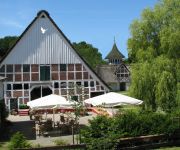
Boutique-Hotel Taubenhof
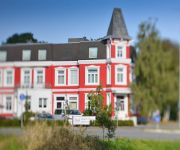
Peters Das Genusshotel in der Wingst
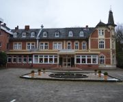
Parkhotel Keck
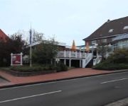
Zum weißen Roß
Forsthaus Ferienhotel am Dobrock
Videos from this area
These are videos related to the place based on their proximity to this place.
Paintballgruppe Stade in V-Force Arena Hemmoor . 10. Nov. 2012 - UNCUT - Teil 3/3
Check us on Facebook: Paintballgruppe Stade Wir waren mal wieder in der V-Force Arena in Hemmoor! (Facebook: Paintball Hemmoor) 15ha unberührtes Woodland! mit alter Fabrik, Sandkuhle, Wald,...
Dobrock-Turnier 2011 Mächtigkeits-Springprüfung
Mächtigkeits-Springprüfung KI.S* unter Flutlicht. Sieger: Der polnische Reiter Oskar Murawski mit dem neunjährigen Hannoveraner Wallach Continuo 2 , (19. August 2011)
Paintballgruppe Stade in V-force Arena Hemmoor - 10. Nov. 2012 - UNCUT - Teil 1/3
Check us on Facebook: Paintballgruppe Stade Wir waren mal wieder in der V-Force Arena in Hemmoor! (Facebook: Paintball Hemmoor) 15ha unberührtes Woodland! mit alter Fabrik, Sandkuhle, Wald, ...
Kuppelcup Nordahn 2015 - Finale - Bülkau I - Nordahn I
Es gibt auch eine lange Version des Finales, leider wurde diese aufgrund des Aufmarschliedes von Youtube gesperrt. Sollte der Ton herausgeschnitten werden ?
Videos provided by Youtube are under the copyright of their owners.
Attractions and noteworthy things
Distances are based on the centre of the city/town and sightseeing location. This list contains brief abstracts about monuments, holiday activities, national parcs, museums, organisations and more from the area as well as interesting facts about the region itself. Where available, you'll find the corresponding homepage. Otherwise the related wikipedia article.
Hemmoor (Samtgemeinde)
Hemmoor is a Samtgemeinde ("collective municipality") in the district of Cuxhaven, in Lower Saxony, Germany. Its seat is in Hemmoor. The Samtgemeinde Hemmoor consists of the following municipalities: Hechthausen Hemmoor
Silberberg (Wingst)
The Silberberg is a low hill, 74 metres high, in the Wingst ridge in the district of Cuxhaven in the north German state of Lower Saxony. It is the highest natural elevation in the Elbe-Weser Triangle, but is overshadowed by the observation tower of the nearby hill of Deutscher Olymp. It was formed from an ice age moraine. There used to be a small silver mine here which gave the hill its name.
Westerberg (Lamstedt)
The Westerberg is a low ridge in North Germany in the north of the collective municipality of Börde Lamstedt in the state of Lower Saxony. It is covered with mixed forest and, like the nearby Wingst ridge, it is an end moraine from the Saale glaciation period. Together with the Wingst it forms part of the eastern boundary of Land Hadeln. The Georgenhöhe ("George Heights") is its highest elevation at 66 metres .


