Safety Score: 3,0 of 5.0 based on data from 9 authorites. Meaning we advice caution when travelling to Germany.
Travel warnings are updated daily. Source: Travel Warning Germany. Last Update: 2024-08-13 08:21:03
Delve into Bischhausen
Bischhausen in Lower Saxony is a city located in Germany about 160 mi (or 257 km) south-west of Berlin, the country's capital town.
Current time in Bischhausen is now 09:39 PM (Thursday). The local timezone is named Europe / Berlin with an UTC offset of one hour. We know of 12 airports closer to Bischhausen, of which 5 are larger airports. The closest airport in Germany is Kassel-Calden Airport in a distance of 30 mi (or 49 km), West. Besides the airports, there are other travel options available (check left side).
There are several Unesco world heritage sites nearby. The closest heritage site in Germany is Mines of Rammelsberg, Historic Town of Goslar and Upper Harz Water Management System in a distance of 28 mi (or 45 km), North-East. In need of a room? We compiled a list of available hotels close to the map centre further down the page.
Since you are here already, you might want to pay a visit to some of the following locations: Freienhagen, Siemerode, Schachtebich, Steinheuterode and Glasehausen. To further explore this place, just scroll down and browse the available info.
Local weather forecast
Todays Local Weather Conditions & Forecast: 2°C / 35 °F
| Morning Temperature | -2°C / 28 °F |
| Evening Temperature | -0°C / 31 °F |
| Night Temperature | -2°C / 29 °F |
| Chance of rainfall | 0% |
| Air Humidity | 65% |
| Air Pressure | 998 hPa |
| Wind Speed | Moderate breeze with 11 km/h (7 mph) from East |
| Cloud Conditions | Overcast clouds, covering 87% of sky |
| General Conditions | Light snow |
Friday, 22nd of November 2024
2°C (35 °F)
2°C (35 °F)
Snow, fresh breeze, broken clouds.
Saturday, 23rd of November 2024
2°C (35 °F)
2°C (35 °F)
Light snow, moderate breeze, overcast clouds.
Sunday, 24th of November 2024
8°C (46 °F)
8°C (47 °F)
Moderate rain, moderate breeze, overcast clouds.
Hotels and Places to Stay
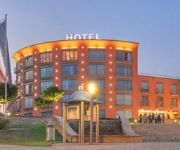
Best Western Plus Hotel am Vitalpark
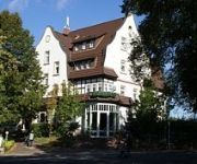
Stadthotel
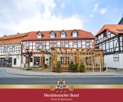
Norddeutscher Bund
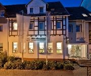
Am Jüdenhof
Videos from this area
These are videos related to the place based on their proximity to this place.
Rengelrode | Eichsfeld - Im Steinbruch bei Rengelrode
Unterwegs im Steinbruch bei Rengelrode. http://www.Renato-Pietsch.de . Aufgenommen mit dem Handy Nokia N97.
☻☺ Прохождение игры Гадкий Я : Minion Rush - 207 уровень. Despicable Me: - 207 level Walkthrough☻☺
Вот и дошли мы до 207 уровня игры Гадкий Я Миньон Раш. 207 Уровень игры Миньон Раш мы играем на карте Вулкан....
Penthouse Holzweg 3 in Heilbad Heiligenstadt - www.herrmannimmobilien.de
Fläche ca. 169m² herrlicher Ausblick über Heiligenstadt super Dachterrasse 2 Bäder Abstellraum + Wirtschaftsraum Gästezimmer gehobene Ausstattung sehr ruhig Stellplätze vorhanden Fahrstuhl...
Heilbad Heiligenstadt | Eichsfeld versinkt im Schutt - Abriss Mainzer Hof und jüdische Synagoge
Abriss in 37308 Heilbad Heiligenstadt in der Stubenstraße. Der Mainzer Hof und die jüdische Synagoge werden wegen Baufälligkeit abgerissen.
Hurkutstein bei Reinhausen
Der Hurkutstein im Reinhäuser Wald ist eine künstlich geschaffene Eremitenhöhle.
Flugbetrieb Flugplatz Günterode/Heiligenstadt
Große Flugzeuge auf dem Flugplatz Günterode/Heiligenstadt 1. Pilatus PC-12 2. Mitsubishi Mu-2 Original von Thomas M.
Ölspurbeseitigung Freiwillige Feuerwehr Heilbad Heiligenstadt
Die Freiwillige Feuerwehr Heilbad Heiligenstadt beseitigt eine Ölspur, die mehrere Kilometer lang ist.
Queens on Trikes in Heilbad Heiligenstadt
20. Juni 2010 Königinnentag in Heilbad Heiligenstadt. Die Triker fungieren als Chauffeure der blaublütigen Schönheiten beim Festumzug.
Videos provided by Youtube are under the copyright of their owners.
Attractions and noteworthy things
Distances are based on the centre of the city/town and sightseeing location. This list contains brief abstracts about monuments, holiday activities, national parcs, museums, organisations and more from the area as well as interesting facts about the region itself. Where available, you'll find the corresponding homepage. Otherwise the related wikipedia article.
Bremke
Bremke is a village in the Gemeinde Gleichen in southern Lower Saxony. The village of 879 residents is located about ten kilometers south-east of Göttingen and lies in the shadow of the two small mountains called the Gleichen for the castles that once stood on their peaks. Bremke is the location of an outdoor stage, the Brüder Grimm Waldbühne, built in 1949, which stages performances in the summer.
Bischhausen
Bischhausen is a village in the Gemeinde Gleichen in southern Lower Saxony with a population of 366 (as of December 2010). The village is located close to the previous border with what was the GDR and near the peaks called the Gleichen, with their castle ruins. It consists almost entirely of residences - primarily those of farmer families and of commuters to Göttingen. In addition, there is a very small village pond and the Lutheran church of St. Martin with its Late Gothic wooden sculpture.
Beienrode
Beienrode-im-Gartetal is a village in the municipality (Gemeinde) Gleichen in the district Göttingen, Germany. The nucleated village of 250 residents (as of December 31, 2005) is primarily agricultural. The village mayor is Marlene Hille. The village's escutcheon is of a green linden tree on a silver background.
Gelliehausen
Gelliehausen is a nucleated village just south of Benniehausen in the Gemeinde Gleichen in southern Lower Saxony with a population of 452 (as of 12 December 2005). The village is located at the foot of the twin hills called the Gleichen. The small community has a pond next to its "Bürgerhaus. " The mayor is Gerhard Nolte. The most famous person associated with Gelliehausen is Gottfried August Bürger, an eighteenth-century poet who lived there for a while.
Kerstlingerode
Kerstlingerode is a village in the municipality (Gemeinde) Gleichen in the district Göttingen, Germany. It lies on L569 between Beienrode and Rittmarshausen, about ten kilometers south-east of Göttingen. The village of 255 residents (as of December 31, 2005) is primarily agricultural. There is one church and the largest school in the municipality. There is a volunteer fire department and a wind-instrument band. The village mayor is Claudia Schuppe-Blödow.
Rittmarshausen
Rittmarshausen is a nucleated village in the municipality (Gemeinde) Gleichen in the district Göttingen, Germany. The village of 776 residents (as of December 31, 2005) is primarily agricultural and home of people working in Göttingen. "Ökozentrum Rittmarshausen" is an association dedicated to the development and marketing of regionally produced natural foods, which are marketed under the Leinehöfe label.
Wöllmarshausen
Wöllmarshausen is a village in the Garte valley in the municipality (Gemeinde) Gleichen in the district Göttingen, Germany. The nucleated village of 401 residents (as of December 31, 2005) is primarily agricultural. There are a number of natural springs in and around the wooded village.
Die Gleichen
Die Gleichen are a pair of hills, up to 430 metres high, in the district of Göttingen in South Lower Saxony in Germany. The twin hills, that were once the site of two fortifications, gave their name to the village of Gleichen.


