Safety Score: 3,0 of 5.0 based on data from 9 authorites. Meaning we advice caution when travelling to Germany.
Travel warnings are updated daily. Source: Travel Warning Germany. Last Update: 2024-08-13 08:21:03
Explore Bentierode
Bentierode in Lower Saxony is a city in Germany about 152 mi (or 244 km) west of Berlin, the country's capital.
Local time in Bentierode is now 11:11 PM (Thursday). The local timezone is named Europe / Berlin with an UTC offset of one hour. We know of 12 airports in the vicinity of Bentierode, of which 5 are larger airports. The closest airport in Germany is Braunschweig Wolfsburg Airport in a distance of 40 mi (or 64 km), North-East. Besides the airports, there are other travel options available (check left side).
There are several Unesco world heritage sites nearby. The closest heritage site in Germany is Fagus Factory in Alfeld in a distance of 12 mi (or 20 km), North-West. If you need a place to sleep, we compiled a list of available hotels close to the map centre further down the page.
Depending on your travel schedule, you might want to pay a visit to some of the following locations: Kalefeld, Winzenburg, Everode, Harbarnsen and Neuhof. To further explore this place, just scroll down and browse the available info.
Local weather forecast
Todays Local Weather Conditions & Forecast: 3°C / 37 °F
| Morning Temperature | 0°C / 33 °F |
| Evening Temperature | 0°C / 32 °F |
| Night Temperature | -0°C / 31 °F |
| Chance of rainfall | 0% |
| Air Humidity | 72% |
| Air Pressure | 997 hPa |
| Wind Speed | Moderate breeze with 11 km/h (7 mph) from East |
| Cloud Conditions | Scattered clouds, covering 39% of sky |
| General Conditions | Snow |
Friday, 22nd of November 2024
3°C (38 °F)
2°C (36 °F)
Snow, fresh breeze, overcast clouds.
Saturday, 23rd of November 2024
3°C (37 °F)
4°C (39 °F)
Overcast clouds, moderate breeze.
Sunday, 24th of November 2024
8°C (47 °F)
8°C (47 °F)
Moderate rain, fresh breeze, overcast clouds.
Hotels and Places to Stay
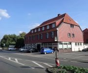
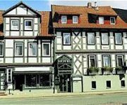
Zur Altenburg
Greene Landhaus
Gerichtsschänke Garni
Videos from this area
These are videos related to the place based on their proximity to this place.
Viel Betrieb in Kreiensen
Spur Null vom Feinsten auf der berühmten Anlage. Zum Schluss gibt es noch eine umfassende Kameramitfahrt.
Weihnachtsmarkt in Kreiensen am zweiten Adventssonntag
Zahlreiche Besucher lockte der Weihnachtsmarkt in der Einbecker Ortschaft Kreiensen zu einem Besuch am zweiten Adventssonntag. In der Wilhelmstraße waren Glühwein, gebrannte Mandeln, Gyros.
Alarmfahrt FF Kreiensen
MTW, LF 8-2 und TLF 16/24-Tr der Freiwilligen Feuerwehr Kreiensen auf "Alarmfahrt" durch Kreiensen. http://www.ff-kreiensen.de.
Ein langer Tag in Kreiensen 22.08.2013 (A long day in Kreiensen)
Aufnahmen von 6:00 Uhr bis 13:00 Uhr Wem das Vidoe zu lang ist brauch es sich ja nicht anzugucken ;P Viel Spaß beim Anschauen!
Kajaktour auf der Leine - Kreiensen bis Alfeld
Jedes Jahr Mitte Oktober findet auf der Leine eine gemeinsame Kanutour vieler norddeutscher Vereine statt - angelehnt an die Gegend und die Herkunft hat sie den Namen "Schneewittchenfahrt"...
Grundschulfest Kreiensen - Vorführungen der FF Kreiensen - HD
http://www.ff-kreiensen.de Die Beteiligung der Freiwilligen Feuerwehr Kreiensen am Grundschulfest der Grundschule Kreiensen als Videodukomentation. Kamera: Dennis Schünemann Made by: ...
Bahnverkehr in Kreiensen am 07.04.2011 Teil 3
Aufnahmen aus dem Bahnhof in Kreiensen! Die Aufnahmen enstanden von 8:30-13:00 Uhr!
Bauarbeiten auf dem Bahnhof in Kreiensen nähern sich dem Ende
Die seit Monaten dauernden Bauarbeiten in Kreiensen nähern sich dem Ende. Barrierefrei sind ab sofort die Gleise zu erreichen, Bürgermeisterin Dr. Sabine Michalek nahm die zwei Aufzüge ...
Videos provided by Youtube are under the copyright of their owners.
Attractions and noteworthy things
Distances are based on the centre of the city/town and sightseeing location. This list contains brief abstracts about monuments, holiday activities, national parcs, museums, organisations and more from the area as well as interesting facts about the region itself. Where available, you'll find the corresponding homepage. Otherwise the related wikipedia article.
Clus Abbey
Clus Abbey (Kloster Clus) was an abbey near Bad Gandersheim in Lower Saxony. It was a daughter-house of Gandersheim Abbey, having been founded in 1127 by Agnes, Abbess of Gandersheim, niece of the Emperor Henry IV, and was part of the Cluniac Reform movement.
Gandersheim Abbey
Gandersheim Abbey is a former house of secular canonesses (Frauenstift) in the present town of Bad Gandersheim in Lower Saxony, Germany. It was founded in 852 by Duke Liudolf of Saxony, progenitor of the Liudolfing or Ottonian dynasty, whose rich endowments ensured its stability and prosperity.
Aue (Leine)
Aue is a river of Lower Saxony, Germany.
Gandersheimer Domfestspiele
Gandersheimer Domfestspiele is a theatre festival in Germany.


