Safety Score: 3,0 of 5.0 based on data from 9 authorites. Meaning we advice caution when travelling to Germany.
Travel warnings are updated daily. Source: Travel Warning Germany. Last Update: 2024-08-13 08:21:03
Discover Altharlingersiel
Altharlingersiel in Lower Saxony is a place in Germany about 248 mi (or 399 km) west of Berlin, the country's capital city.
Current time in Altharlingersiel is now 05:30 AM (Friday). The local timezone is named Europe / Berlin with an UTC offset of one hour. We know of 13 airports near Altharlingersiel, of which 5 are larger airports. The closest airport in Germany is Wangerooge Airport in a distance of 9 mi (or 15 km), North-East. Besides the airports, there are other travel options available (check left side).
There are two Unesco world heritage sites nearby. The closest heritage site is Wadden Sea in Denmark at a distance of 34 mi (or 55 km). The closest in Germany is Town Hall and Roland on the Marketplace of Bremen in a distance of 60 mi (or 55 km), East. We encountered 1 points of interest in the vicinity of this place. If you need a hotel, we compiled a list of available hotels close to the map centre further down the page.
While being here, you might want to pay a visit to some of the following locations: Werdum, Spiekeroog, Stedesdorf, Wittmund and Dunum. To further explore this place, just scroll down and browse the available info.
Local weather forecast
Todays Local Weather Conditions & Forecast: 4°C / 39 °F
| Morning Temperature | 0°C / 32 °F |
| Evening Temperature | 6°C / 43 °F |
| Night Temperature | 5°C / 41 °F |
| Chance of rainfall | 5% |
| Air Humidity | 87% |
| Air Pressure | 995 hPa |
| Wind Speed | Fresh Breeze with 15 km/h (9 mph) from North-East |
| Cloud Conditions | Broken clouds, covering 82% of sky |
| General Conditions | Rain and snow |
Saturday, 23rd of November 2024
3°C (38 °F)
4°C (39 °F)
Moderate rain, fresh breeze, overcast clouds.
Sunday, 24th of November 2024
10°C (50 °F)
11°C (52 °F)
Moderate rain, fresh breeze, overcast clouds.
Monday, 25th of November 2024
11°C (52 °F)
8°C (46 °F)
Light rain, strong breeze, overcast clouds.
Hotels and Places to Stay
Hinrichs
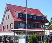
Cafe Caro
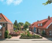
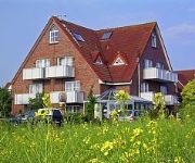
Aparthotel Harleblick
Siebzehn80
Friesenhus
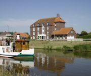
Hotel zum alten Kornspeicher
Schluister Park
Harlesiel
Neuharlingersiel Strandhotel
Landhotel Bauernstuben
Videos from this area
These are videos related to the place based on their proximity to this place.
Sunny Sunday Panoramic Drive with the GoPro HD Hero 2 (Part 3 of 3)
I took a wide angle, 170° panoramic drive through my home area around Wilhelmshaven in Germany with my Golf, using the GoPro HD Hero 2 on a sunny Sunday in January 2012. In this third part...
Nordsee-Urlaub im Juni 2014
Impressionen von unserem Nordseeurlaub im Juni 2014. Die Aufnahmen stammen aus Baltrum, Norddeich, Dornum, Dornumersiel, Carolinensiel und Harlesiel so wie der Landschaft dazwischen..
Ostfriesland - Meer und mehr
Ostfriesland bietet Meer und mehr, ein kleiner Streifzug an der deutschen Nordseeküste - Reise und Urlaub, Ratgeber, Service, Reise-Tipps.
Werdum Ostfriesland: Kerkklok Lutherse kerk
Werdum (D): Lutherse kerk Werdum (D): Lutherische Kirche rechte Luidas Gerades Joch cis' Opname: Maandag 4 februari 2008 12:01 uur (Angelus läuten)
Neuharlingersiel - Unterwegs in Niedersachsen (Folge 26)
IN DIESER FOLGE AUS NEUHARLINGERSIEL: Wir zeigen Ihnen die Sehenswürdigkeiten des Küstenortes. Unter anderem werfen wir einen Blick auf den Hafen, die Station der Gesellschaft zur ...
Bettelnde junge Silbermöwe
Das Viedeo wurde am 06.09.2012 in Neuharlingersiel aufgenommen. Ich hatte noch ein paar Brotstückchen übrig, die ich dann verfüttert habe. Die große holte sich das meiste und so wurde von...
Videos provided by Youtube are under the copyright of their owners.
Attractions and noteworthy things
Distances are based on the centre of the city/town and sightseeing location. This list contains brief abstracts about monuments, holiday activities, national parcs, museums, organisations and more from the area as well as interesting facts about the region itself. Where available, you'll find the corresponding homepage. Otherwise the related wikipedia article.
Harlebucht
The Harlebucht or Harle Bay was originally a bay approximately 15 kilometers wide that reached about 10 kilometers inland north of Wittmund in today’s East Frisia. (A more appropriate translation of bucht here might be Bight; the German word can mean either. ) The water encroachments into the hinterland in the Grote Mandrenke (Second Marcellus Flood) in 1362, which reached as far as the Geest near Jever, gave rise to side bays and greatly enlarged the Harlebucht.


