Safety Score: 3,0 of 5.0 based on data from 9 authorites. Meaning we advice caution when travelling to Germany.
Travel warnings are updated daily. Source: Travel Warning Germany. Last Update: 2024-08-13 08:21:03
Discover Paul-Lincke-Ufer
The district Paul-Lincke-Ufer of Berlin in Land Berlin is a subburb in Germany and is a district of the nations capital.
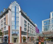
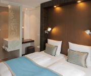
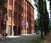
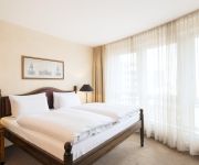
If you need a hotel, we compiled a list of available hotels close to the map centre further down the page.
While being here, you might want to pay a visit to some of the following locations: Schoenefeld, Ahrensfelde, Grossbeeren, Rangsdorf and Schulzendorf. To further explore this place, just scroll down and browse the available info.
Local weather forecast
Todays Local Weather Conditions & Forecast: 2°C / 36 °F
| Morning Temperature | 1°C / 34 °F |
| Evening Temperature | 2°C / 36 °F |
| Night Temperature | 1°C / 33 °F |
| Chance of rainfall | 0% |
| Air Humidity | 72% |
| Air Pressure | 999 hPa |
| Wind Speed | Moderate breeze with 10 km/h (6 mph) from North-East |
| Cloud Conditions | Overcast clouds, covering 96% of sky |
| General Conditions | Overcast clouds |
Friday, 22nd of November 2024
2°C (36 °F)
1°C (34 °F)
Snow, moderate breeze, overcast clouds.
Saturday, 23rd of November 2024
3°C (38 °F)
2°C (36 °F)
Light snow, gentle breeze, clear sky.
Sunday, 24th of November 2024
6°C (43 °F)
9°C (48 °F)
Moderate rain, moderate breeze, overcast clouds.
Hotels and Places to Stay
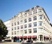
Hotel Orania.Berlin
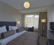
Vier Jahreszeiten Kreuzberg
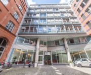
Holiday Inn BERLIN - CITY EAST SIDE
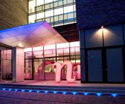
nhow Berlin
Select Hotel Berlin Ostbahnhof
Mercure Hotel Berlin Tempelhof Airport
Motel One Mitte
Plus Hotel & Hostel
NH Berlin Kreuzberg
MOXY Berlin Ostbahnhof
Videos from this area
These are videos related to the place based on their proximity to this place.
{B*} - Türkenmarkt (Turks Market) - Maybachufer - Berlin Kreuzberg
http://www.berlin-street-view.de Video from the "Türkenmark" (Turks Market) BiOriental at the Maybachufer in Berlin Kreuzberg. The weekly market takes place every tuesday and friday from 11:00...
Spot On Ullis Tipps Berlin Summer 2014 Paul Lincke Ufer
Walk from Kottbusser Brücke along Paul-Lincke-Ufer in Berlin-Kreuzberg Spaziergang am Paul-Lincke-Ufer in Berlin-Kreuzberg Filmed with Panasonic Lumix GH4 Lenses: Lumix G X Vario 12-35mm,...
{B*} - Kottbusser Brücke - Berlin Kreuzberg
http://www.berlin-street-view.de 360° video from the Kottbusser Brücke between Maybachufer and Paulincke Ufer in Berlin Kreuzberg. The bridge crosses the Landwehrkanal and connects the two...
Kreuzberg Erinnerung - Holiday on Ice - auf dem Landwehrkanal
Die Kreuzberger Party auf dem zugefrorenen Landwehrkanal am 11.02.2012. Buntes Treiben und Spaß lassen die Kälte vergessen.
Oxo 86 - Wenn Könige Reisen (live @ Huxley's Berlin, 02.02.2013)
Oxo 86 (Berlin, D) performing "Wenn Könige Reisen" live at Berlin SKA City Festival at Huxley's Berlin, 02.02.2013 http://oxo86.blogsport.de/ http://berlinskacity.blogspot.de/
The Talks - Can Stand The Rain (live @ Huxley's Berlin, 02.02.2013)
The Talks (UK) performing "Can Stand The Rain" live at Berlin SKA City Festival, Huxley's Berlin, 02.02.2013 http://berlinskacity.blogspot.de/
Roy Ellis & The Magic Touch - Come On And Dance With Me (live @ Huxley's Berlin, 02.02.2013)
Mr. Symarip a.k.a. Roy Ellis (JAM/CH) and Magic Touch (D) performing "Come On And Dance With Me" live at Berlin SKA City Festival at Huxley's Berlin, 02.02.2013 http://www.roy-ellis.ch http://thema...
Roy Ellis & The Magic Touch - I Don't Want You (live @ Huxley's Berlin, 02.02.2013)
Mr. Symarip a.k.a. Roy Ellis (JAM/CH) and Magic Touch (D) performing "I Don't Want You I Don't Need You Anymore" live at Berlin SKA City Festival at Huxley's Berlin, 02.02.2013 http://www.roy-ellis...
The Valkyrians - I Don't Wanna Go Home (live @ Huxley's Berlin, 02.02.2013)
The Valkyrians (FIN) performing "I Don't Wanna Go Home" live at Berlin SKA City Festival, Huxley's Berlin, 02.02.2013 http://www.thevalkyrians.com/ http://berlinskacity.blogspot.de/
„Bitte helft uns, bevor einer stirbt!“ - Ladenbesitzer am Görlitzer Park
Eingeschlagene Scheiben, Streit und Messerstechereien. Die Lage in Berlins Drogenpark Nr.1 eskaliert immer weiter. Besonders die Ladenbesitzer in direkter Nähe zum Görlitzer Park fühlen...
Videos provided by Youtube are under the copyright of their owners.
Attractions and noteworthy things
Distances are based on the centre of the city/town and sightseeing location. This list contains brief abstracts about monuments, holiday activities, national parcs, museums, organisations and more from the area as well as interesting facts about the region itself. Where available, you'll find the corresponding homepage. Otherwise the related wikipedia article.
East Side Gallery
The East Side Gallery is an international memorial for freedom. It is a 1.3 km long section of the Berlin Wall located near the centre of Berlin on Mühlenstraße in Friedrichshain-Kreuzberg. The actual border at this point was the river Spree. The gallery is located on the so-called "hinterland mauer", which closed the border to East Berlin.
Schlesisches Tor (Berlin U-Bahn)
Schlesisches Tor is a Berlin U-Bahn station on the U1 line.
Görlitzer Bahnhof (Berlin U-Bahn)
Görlitzer Bahnhof is a Berlin U-Bahn station on the viaduct of the U1. It is located in Kreuzberg, in an area that offers a wide range of nightlife but is also notorious for its riots on May 1.
Kottbusser Tor (Berlin U-Bahn)
Kottbusser Tor is a Berlin U-Bahn station located on the U1 and U8. Many Berliners use the affectionate term Kotti. It is located in central Kreuzberg. The area has a bad reputation for the relatively high, mainly drug-related crime rate, instances of which have recently become quite rare in most other parts of the district. The original Kottbusser Tor was a southern city gate of Berlin; the road through the gate led via the Neukölln suburb to the town of Cottbus.
Oberbaum Bridge
The Oberbaum Bridge is a double-deck bridge crossing Berlin's River Spree, considered one of the city landmarks. It links Friedrichshain and Kreuzberg, former boroughs that were divided by the Berlin Wall, and has become an important symbol of Berlin’s unity. The lower deck of the bridge carries a roadway, which connects Oberbaum Straße to the south of the river with Warschauer Straße to the north.
Berlin Ostbahnhof
Berlin Ostbahnhof (translates from German as Berlin East railway station) is a mainline railway station in Berlin, Germany. It is in Friedrichshain, now part of Friedrichshain-Kreuzberg district, and has undergone several name changes in its history. It was known as Berlin Hauptbahnhof from 1987 to 1998, a name now applied to Berlin's new central station.
Rathaus Neukölln (Berlin U-Bahn)
Rathaus Neukölln is a Berlin U-Bahn station located on the U7. It was built in 1926 by A. Grenander. The platform was extended in 1968. In 1989 a lift was build in. It was indeed the first subway station in Neukölln that was handicapped accessible. The next stop is Karl-Marx-Straße.
Karl-Marx-Straße (Berlin U-Bahn)
Karl-Marx-Straße is a Berlin U-Bahn station located on the U7. The station was opened in 1926 as "Bergstrasse" (arch. Grenander) and renamed in 1946, although Karl Marx was a hero of the socialist republic of East Germany the station is in former West-Berlin. 1968 the station was elongated to 105m, due to this a lot of the original appearance was lost. 1993 parts of the platform fell into the rail track so that the station had to be closed for a few days.
Hermannplatz (Berlin U-Bahn)
Hermannplatz is a station in the Neukölln district of Berlin which serves as an interchange between the lines U7 and U8. Operated by the BVG, it is one of the busiest stations on the Berlin U-Bahn system.
Schönleinstraße (Berlin U-Bahn)
Schönleinstraße is a Berlin U-Bahn station located on the U8. Opened in 1928 and designed by Grenander it was shortly closed in 1945 and renamed in 1951 to Kottbusser Damm. In 1992 the station was named Schönleinstrasse again.
Boddinstraße (Berlin U-Bahn)
Boddinstraße is a Berlin U-Bahn station located on the U8. It was opened in 1927 (A. Fehse, A. Grenander). At that time trains could only go one station further to Schönleinstrasse. But 1928 the line was extended to Leinestrasse. Grey tiles on the walls and blue tiles on the columns are the main attributes of this station.
Berlin Görlitzer Bahnhof
Görlitzer Bahnhof was the name of the Berlin railway terminus for the mainline link between the capital, Cottbus in Brandenburg and Görlitz in Lower Silesia. It stood overlooking Spreewaldplatz in the eastern part of Kreuzberg but wartime bombing and Cold War tensions led to its closure and eventual demolition. The Görlitzer Bahnhof (Berlin U-Bahn) station was named after this historic station and is located on a different site nearby.
Stralauer Tor (Berlin U-Bahn)
Stralauer Tor was a Berlin U-Bahn station in Berlin-Friedrichshain. As an elevated station built into the north-eastern part of the Oberbaumbrücke viaduct, it operated between Warschauer Straße and Schlesisches Tor stations on today's U1.
O2 World (Berlin)
O2 World (stylised as O2 World) is a multi-use indoor arena in the Friedrichshain neighborhood of Berlin, Germany, that opened in September 2008. Developed by Anschutz Entertainment Group, it was named O2 World, when O2 Germany purchased the naming rights. With a capacity of 17,000 people, it is home to the Eisbären Berlin ice hockey club and the ALBA Berlin basketball team, and is used for other ice hockey, basketball and handball matches as well as concerts.
SO36
The SO36 club, is a music club on Oranienstrasse near Heinrichplatz in the district of Kreuzberg in Berlin, Germany. It takes its name from the historic postcode of that area SO36, in which the SO stands for Südost (South East). The Kreuzberg district has historically been home to the Berlin punk rock movement, as well as other alternative subcultures in Germany.
St. Thomas, Berlin
The church St. Thomas is a Protestant church in the Kreuzberg district of Berlin. Friedrich Adler designed and built the church between 1865 and 1869. Prior to the construction of the Berliner Dom, it was the largest church in Berlin, and the congregation was one of the largest in Western Christendom. It is located directly between the Luisenstädtischer Kanal and Mariannenplatz, once a central location.
Tabor Church
Tabor Church is the church of the Evangelical Tabor Congregation, a member of the Protestant umbrella organisation Evangelical Church of Berlin-Brandenburg-Silesian Upper Lusatia. The church building is located in Berlin, borough Friedrichshain-Kreuzberg, in the quarter Outer Luisenstadt or colloquially SO 36. The church was named in memory of the Transfiguration of Jesus, which allegedly took place on Mount Tabor הר תבור in today's Israel.
St. Michael's Church, Berlin
Saint Michael's church is a Roman Catholic church in Berlin, Germany, dedicated to the Archangel Michael. The church was completed in 1851, then also serving as garrison church for Catholic soldiers, and was partially destroyed during the Second World War. It is protected as a historical monument in Berlin. The church was designed by August Soller and is regarded as a good implementation of the arched style of his teacher Karl Friedrich Schinkel.
Rütli School
The Rütli School was a Hauptschule in Neukölln, Germany, one of Berlin's poorest neighbourhoods. The school made news in 2006 when teachers wrote a letter to the senate office demanding the school be closed down, as they were no longer able to deal with violent youngsters. The letter was made public and sparked a debate about the German school system, school violence and the integration of immigrant youngsters. In 2009, it was renamed the 1.
Fichte-Bunker
The Fichte-Bunker is a nineteenth-century gasometer in the Kreuzberg district of Berlin, Germany that was made into an air-raid shelter in World War II and subsequently was used as a shelter for the homeless and for refugees, in particular for those fleeing East Berlin for the West. It is the last remaining brick gasometer in Berlin. The Fichte-Bunker is located between Fichtestraße and Körtestraße in an area of Jugendstil apartment houses, many of which are now under historic protection.
Berlin Wriezener Bahnhof
Berlin Wriezener Bahnhof was a passenger railway terminus in Berlin, Germany. The station was situated close to the modern Ostbahnhof, and its goods station (Wriezener Güterbahnhof) was extended between it and Warschauer Straße station. From 1867 to 1882, nearby the Wriezener Bahnhof, it worked the Old Ostbahnhof.
Luisenstadt Canal
The Luisenstadt Canal, or Luisenstädtischer Kanal, is a 2.3-kilometre long former canal in Berlin, Germany. It is named after the Luisenstadt district and ran through today's districts of Kreuzberg and Mitte, linking the Landwehr Canal with the Spree River, and serving a central canal basin known as the Engelbecken or Angel's Pool. The canal is named after Queen Louise, the wife of King Friedrich Wilhelm III.
Ufo (Club, Berlin)
The Ufo (lit. UFO) was the first Acid House club in Berlin. It was the pioneer place for the Techno scene during the reunification. Club's residents and guests DJs included, among others, to Tanith, Jonzon, Rok, Dr. Motte, Mike van Dijk and the then 13-year-old Kid Paul.
Core Tex Records
Core Tex Records is a punk and hardcore record label based in the Kreuzberg district of Berlin, Germany. It was established in 1988 . Core Tex has become a centre for live music, playing host to a string of in-store live events as well as participating in an annual music festival called Myfest.
Paul-Lincke-Ufer
Paul-Lincke-Ufer is a street in Berlin running along the Landwehr Canal Canal in the Kreuzberg quarter of the city. The street runs from Kottbusser Brücke all the way to the Treptow Canal Opposite is found the Maybach Ufer where the Turkish Market takes place on Tuesday, Thursday and Saturday.


