Safety Score: 3,0 of 5.0 based on data from 9 authorites. Meaning we advice caution when travelling to Germany.
Travel warnings are updated daily. Source: Travel Warning Germany. Last Update: 2024-08-13 08:21:03
Explore Hallesches Tor
The district Hallesches Tor of Berlin in Land Berlin is located in Germany and is a district of the nations capital.
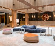
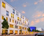
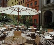
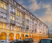
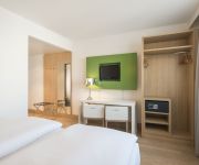
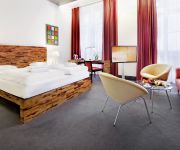
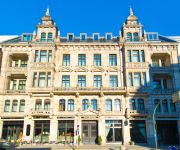
If you need a place to sleep, we compiled a list of available hotels close to the map centre further down the page.
Depending on your travel schedule, you might want to pay a visit to some of the following locations: Schoenefeld, Grossbeeren, Kleinmachnow, Ahrensfelde and Stahnsdorf. To further explore this place, just scroll down and browse the available info.
Local weather forecast
Todays Local Weather Conditions & Forecast: 2°C / 35 °F
| Morning Temperature | 1°C / 34 °F |
| Evening Temperature | 2°C / 35 °F |
| Night Temperature | 0°C / 33 °F |
| Chance of rainfall | 0% |
| Air Humidity | 80% |
| Air Pressure | 998 hPa |
| Wind Speed | Moderate breeze with 10 km/h (6 mph) from North-East |
| Cloud Conditions | Overcast clouds, covering 89% of sky |
| General Conditions | Rain and snow |
Friday, 22nd of November 2024
1°C (34 °F)
1°C (34 °F)
Snow, gentle breeze, overcast clouds.
Saturday, 23rd of November 2024
2°C (36 °F)
2°C (36 °F)
Light snow, gentle breeze, few clouds.
Sunday, 24th of November 2024
7°C (44 °F)
10°C (50 °F)
Moderate rain, moderate breeze, overcast clouds.
Hotels and Places to Stay
NH Collection Berlin Mitte Checkpoint Charlie
Select Hotel Berlin The Wall
Mercure Hotel & Residenz Berlin Checkpoint Charlie
Vilhelm 7 Berlin Residences
Select Hotel Berlin Checkpoint Charlie
NH Berlin Potsdamer Platz
Moevenpick
Riehmers Hofgarten
Angleterre
Crowne Plaza BERLIN - POTSDAMER PLATZ
Videos from this area
These are videos related to the place based on their proximity to this place.
BerlinTour 20 - Leipziger Straße bis Potsdamer Platz /Berlin Mitte
Rundfahrt von der Leipziger Straße bis zum Potsdamer Platz Aufgenommen bei der Informationsfahrt für politisch interessierte Bürger http://youtu.be/lbv7j4qRqWs.
Berlin: Eine rasante Autofahrt vom Alexanderplatz zum Potsdamer Platz. A quick car ride
Berlin: Eine rasante Autofahrt vom Alexanderplatz zum Potsdamer Platz A quick car ride from Alexanderplatz to Potsdamer Platz Die Fahrt beginnt am Alexanderplatz - an mehreren Einkaufszentren...
{B*} - Marheineke Markthalle - Marheinekeplatz / Bergmannstraße - Berlin Kreuzberg
http://www.berlin-street-view.de Marheineke Markthalle one of the last Berlin market halls located between the Marheinekeplatz and Bergmannstraße, a popular shopping street with many cafes,...
Stadtteilansicht Wohngebiete Kreuzberg am Landwehrkanal in Berlin - Kreuzberg
BERLIN 09.10.2012 Video- Stadtteilansicht Wohngebiete Kreuzberg am Landwehrkanal in Berlin - Kreuzberg. // View residential district Kreuzberg the Landwehr Canal in Berlin - Kreuzberg.
BERLIN BIKE TOUR-Spaziergang Wildes Kreuzberg
Video zum "Wildes Kreuzberg" Stadtspaziergang. Unser Kooperationspartner rent-a-guide hat uns auf diesem Spaziergang begleitet. Das Ergebnis spiegelt sehr schön den Charakter der Tour wieder!
DER FILM ZUM OBJEKT! KREUZBERGSTRASSE IN KREUZBERG - ZIEGERT IMMOBILIEN
Sonnenplatz am "Kaiserstein" Am Viktoriapark in Berlin Kreuzberg entsteht ein moderner Neubau mit insgesamt 4 Gewerbeeinheiten und 16 Etagenwohnungen. Flexible Grundrisse und eine bequeme.
{B*} - Anhalter Bahnhof - Askanischer Platz - Berlin Kreuzberg
http://www.berlin-street-view.de Anhalter Bahnhof, a former railway terminus at the Askanischer Platz in Kreuzberg near Potsdamer Platz. Today there are only the ruins of the portal and the...
Berlin: Der Weg vom Checkpoint Charlie über die Friedrichstrasse zur Strasse Unter den Linden
Berlin: Der Weg vom Checkpoint Charlie über die Friedrichstrasse zur „Strasse Unter den Linden". Die Friedrichstrasse war einst die Amüsiermeile der Stadt. Am Checkpoint Charlie standen...
Berlin: Gang über die berühmte Friedrichstraße. Walk over the famous Friedrichstrasse
Die Friedrichstraße führt von Kreuzberg über den Checkpoint Charlie und den Boulevard "Unter den Linden" am Bahnhof Friedrichstraße /Tränenpalast und am Friedrichstraßenpalast vorbei....
Videos provided by Youtube are under the copyright of their owners.
Attractions and noteworthy things
Distances are based on the centre of the city/town and sightseeing location. This list contains brief abstracts about monuments, holiday activities, national parcs, museums, organisations and more from the area as well as interesting facts about the region itself. Where available, you'll find the corresponding homepage. Otherwise the related wikipedia article.
Checkpoint Charlie
Checkpoint Charlie (or "Checkpoint C") was the name given by the Western Allies to the best-known Berlin Wall crossing point between East Berlin and West Berlin during the Cold War. GDR leader Walter Ulbricht agitated and maneuvered to get the Soviet Union's permission for the construction of the Berlin Wall in 1961 to stop Eastern Bloc emigration westward through the Soviet border system, preventing escape across the city sector border from East Berlin to West Berlin.
Jewish Museum, Berlin
The Jewish Museum Berlin (Jüdisches Museum Berlin) is one of the largest Jewish Museums in Europe. In two buildings, one of which is a new addition specifically built for the museum by architect Daniel Libeskind, two millennia of German Jewish history are on display in the permanent exhibition as well as in various changing exhibitions.
Killing of Peter Fechter
Peter Fechter (14 January 1944 – 17 August 1962) was a German bricklayer from Berlin in what became East Germany in 1945. He was 18 when he became one of the first victims of the Berlin Wall's border guards while trying to cross over to what was then West Berlin.
Hallesches Tor (Berlin U-Bahn)
The underground station Hallesches Tor is part of the Berlin U-Bahn network at the intersection of the east-west bound U1 and the north-south bound U6 in the Kreuzberg district.
Möckernbrücke (Berlin U-Bahn)
Möckernbrücke is a station of the Berlin U-Bahn network in the western Kreuzberg district, named after a nearby bridge crossing the Landwehrkanal. It is on the U1 and on U7 lines, in the vicinity of Potsdamer Platz.
Berlin Observatory
The Berlin Observatory (Berliner Sternwarte in German) is a series of observatories and related organizations in and around the city of Berlin in Germany, starting from the 18th century. It has its origins in 1700 when Gottfried Leibniz initiated the Societät der Wissenschaften (Brandenburgische Science Society) which would later (1744) become the Preußischen Akademie der Wissenschaften.
Gneisenaustraße (Berlin U-Bahn)
Gneisenaustraße is a station on the U7 U-Bahn in Berlin, Germany. The station was opened in 1924 and created by Alfred Grenander. 1945 it was closed for a few months, 1967/68 the platform was elongated. Due to this the station has lost its appearance as it was when Grenander has planned it. The station is named after August von Gneisenau, a 19th-century Prussian Generalfeldmarschall. The next station is Sudstern.
E-Werk
The E-Werk was a techno music club in Berlin, which was previously an electrical substation. Located near Checkpoint Charlie, It was from 1993 to 1997 the most influential venue in the techno scene. As the first major exhibition, which was entirely devoted to techno-art, first time in 1994 Chromapark took place in e-business. The club was operated by Hille Saul, Andreas Rossmann, Ralf Regitz and Lee Waters.
Berlin Anhalter Bahnhof
The Anhalter Bahnhof is a former railway terminus in Berlin, Germany, approximately 600 metres (0.5 mi) southeast of Potsdamer Platz. Although the station was closed in 1952, the name lives on in the Berlin S-Bahn station of the same name.
Kochstraße (Berlin U-Bahn)
Kochstraße is a Berlin U-Bahn station located on the U6. It is close to Checkpoint Charlie and the Checkpoint Charlie Museum. It was build by Grenander / Fehse in 1923. Due to a lack of money, the platform was made only 80 metres long. The station was closed for a few months in 1945, and from 1961 to 1990 it was the last stop in West Berlin. In 1995, the platform was lengthened by 26 metres.
Mehringdamm (Berlin U-Bahn)
Mehringdamm is a Berlin U-Bahn station located on the U6 and the U7. Opened in 1924 as Belle-Alliance Strasse it was built by Grenander and later renovated by Rümmler. In 1946 the station was renamed Franz-Mehring-Straße, after the socialist politician. In 1947, the station received its current name Mehringdamm. Following renovations in 1965, passengers could transfer from the U6 to the U7 on the same platform.
Hotel Excelsior
Hotel Excelsior occupied number 112/113, Königgrätzer Straße (today’s Stresemannstrasse) on Askanischer Platz in the Berlin district of Kreuzberg. It was once one of the largest and most luxurious hotels in Europe but its destruction during World War II resigned it to the German capital's list of lost historical landmarks.
Mehringplatz
Mehringplatz is a round plaza (or circus) at the southern peak of the Friedrichstadt neighbourhood in Kreuzberg, Berlin. It marks the southern end of Friedrichstraße. Until 1970 also Lindenstraße and Wilhelmstrasse ended in the square. Since 1947 it is named after the publicist Franz Mehring (1846–1919).
Landwehr Canal
The Landwehr Canal, or Landwehrkanal in German, is a 10.7-kilometre long canal parallel to the Spree river in Berlin, Germany, built between 1845 and 1850 according to plans by Peter Joseph Lenné. It connects the upper part of the Spree at the Osthafen (Eastern Harbour) in Friedrichshain with its lower part in Charlottenburg, flowing through Kreuzberg and Tiergarten.
Checkpoint Charlie Museum
The Checkpoint Charlie Museum (German: Haus am Checkpoint Charlie or Mauermuseum) is a museum in Berlin. It is named after the famous crossing point on the Berlin Wall, and was created to document the so-called "best border security system in the world". On display are the photos and related documents of successful escape attempts from East Germany, together with the escape apparatus: hot-air balloons, getaway cars, chairlifts, and a mini-U-Boat.
Schwules Museum
The Schwules Museum (Gay Museum) is an LGBT museum in Berlin which opened in 1985.
Jerusalem Church (Berlin)
Jerusalem Church (German: Jerusalemkirche or Jerusalemer Kirche) is one of the churches of the Evangelical Congregation in the Friedrichstadt (under this name since 2001), a member of the Protestant umbrella organisation Evangelical Church of Berlin-Brandenburg-Silesian Upper Lusatia. The present church building is located in Berlin, borough Friedrichshain-Kreuzberg, in the quarter of Friedrichstadt.
Freedom Memorial
The Freedom Memorial was a memorial to the victims of the Berlin Wall in the vicinity of the Checkpoint Charlie Museum in Berlin. It opened on October 31, 2004, and was praised by both victims of the GDR communist regime and human rights advocates alike. The memorial proved extremely popular with visitors to the city, attracting thousands of visitors per week. The memorial was controversially demolished by the leftist Berlin city government on July 5, 2005, sparking international protests.
Europahaus
Europahaus (English: House of Europe), is a large high-rise office block in Berlin, Germany, located in the Kreuzberg district on Stresemannstraße, facing the remains of the former Anhalter Bahnhof across Askanischer Platz. In 1924 a design competition was held for what was hailed as the largest new business premises in Berlin, occupying a key site in what was then still called Königgrätzer Straße (it was not renamed Stresemannstraße until 1930).
Amerika-Gedenkbibliothek
The Amerika-Gedenkbibliothek (English: American Memorial Library) is one of the largest public libraries in Berlin, Germany. It was a donation from the United States after the Berlin Blockade, which took place in 1948/49. The building was designed by American and German architects, including Fritz Bornemann and Willy Kreuer. It was opened on September 17, 1954 and was originally planned to become the Central Library of Berlin.
Anhalter Steg
The Anhalter Steg is a footbridge over the Landwehrkanal between the Möckern and Schoneberg Bridges, in Kreuzberg, on the southern side of Berlin city centre. Opened in February 2001, it links the German Museum of Technology (Berlin) with the Hallesches Ufer. It rests on the foundations of the railway bridge leading south from the Anhalter Bahnhof, which was destroyed by bombing in World War II.
Berlinische Galerie
The Berlinische Galerie is a museum of modern art, photography and architecture in Berlin. It is located in Kreuzberg, on Alte Jakobstraße, not far from the Jewish Museum.
Prinz-Albrecht-Palais
The Prinz-Albrecht-Palais was a Rococo city palace in the historic Friedrichstadt suburb of Berlin, Germany. It was located on Wilhelmstrasse 102 in the present-day Kreuzberg district, in the vicinity of Potsdamer Platz.
Path of Visionaries
The Path of Visionaries is a city art project under construction in Berlin, Germany. Located on the southern end of Friedrichstraße in Kreuzberg plaques are embedded in the sidewalks.
Tempodrom
The Tempodrom is an event venue in Berlin. It was initially launched in 1980 as a kind of alternative circus in a tent on the west side of the Potsdamer Platz in what was at the time the immediate vicinity of the Berlin Wall by a former nurse, Irene Moessinger with an inheritance. It has since moved several times and is now located in the Kreuzberg neighborhood in a building inspired by the early tent.


