Safety Score: 3,0 of 5.0 based on data from 9 authorites. Meaning we advice caution when travelling to Germany.
Travel warnings are updated daily. Source: Travel Warning Germany. Last Update: 2024-08-13 08:21:03
Delve into Unkenhof
Unkenhof in Regierungsbezirk Kassel (Hesse) is located in Germany about 202 mi (or 326 km) south-west of Berlin, the country's capital town.
Current time in Unkenhof is now 06:16 PM (Monday). The local timezone is named Europe / Berlin with an UTC offset of one hour. We know of 12 airports close to Unkenhof, of which 5 are larger airports. The closest airport in Germany is Fritzlar Airport in a distance of 51 mi (or 83 km), North-West. Besides the airports, there are other travel options available (check left side).
There are several Unesco world heritage sites nearby. The closest heritage site in Germany is Wartburg Castle in a distance of 34 mi (or 55 km), North-East. If you need a hotel, we compiled a list of available hotels close to the map centre further down the page.
While being here, you might want to pay a visit to some of the following locations: Hilders, Birx, Oberweid, Unterweid and Hausen. To further explore this place, just scroll down and browse the available info.
Local weather forecast
Todays Local Weather Conditions & Forecast: 9°C / 47 °F
| Morning Temperature | 4°C / 39 °F |
| Evening Temperature | 5°C / 42 °F |
| Night Temperature | 10°C / 51 °F |
| Chance of rainfall | 1% |
| Air Humidity | 75% |
| Air Pressure | 1012 hPa |
| Wind Speed | Gentle Breeze with 9 km/h (5 mph) from North-East |
| Cloud Conditions | Broken clouds, covering 78% of sky |
| General Conditions | Light rain |
Tuesday, 26th of November 2024
7°C (44 °F)
5°C (41 °F)
Moderate rain, gentle breeze, overcast clouds.
Wednesday, 27th of November 2024
6°C (43 °F)
6°C (43 °F)
Moderate rain, fresh breeze, overcast clouds.
Thursday, 28th of November 2024
3°C (37 °F)
3°C (38 °F)
Light rain, fresh breeze, overcast clouds.
Hotels and Places to Stay
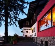
Lothar-Mai-Haus Berghotel in der Rhönsonne
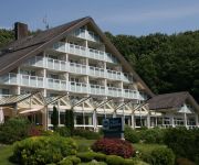
Best Western Hotel Rhön Garden
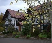
Landhaus Ehrengrund
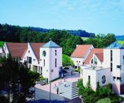
Gersfelder Hof
Lisas-Welt Gasthof & Pension
Genussgasthof Fuldaquelle
Zum Rosenbachschen Löwen Gasthaus
Dreiländereck Pension
Rhoenhaeuschen
Milseburg
Videos from this area
These are videos related to the place based on their proximity to this place.
45. ADAC/MSC Rhön Hauenstein Bergrennen 2014
Aufnahmen von der Joop-Kurve Wertungsläufe am Sonntag. Wertungsgruppe E1 Gruppe H bis und über 3000ccm. Unter anderem Wüstefeld / Mercedes 190 DTM, Handa / Lancia Delta Integrale, Stolz.
Hochrhöner im Winter - Wandern in der Rhön - outdoor-life -
Unser Tour zwischen den Jahren führt uns in diesem Winter in die tief verschneite Rhön. Wir begehen einen Teil des " Hochröhner" von der Wasserkuppe bis zum Kloster Kreuzberg.
Milseburgweg Wanderweg Rhön Etappe 2 Hilders bis Aschenhausen
Das Video beschreibt die zweite Tour auf dem Milseburgweg vom Parkplatz Spinne (oberhalb von Hilders/Batten) bis nach Aschenhausen in der Thüringischen Rhön. Infos zu den Wander- und ...
Die Rhön: Urlaub mit Hund
In zahlreichen Hotels und Pensionen in der Rhön sind Hunde herzlich willkommen. Das Mittelgebirge und Biosphärenreservat lädt außerdem zu erholsamen Spaziergängen und ausgedehnten ...
Skilift Zuckerfeld, Wasserkuppe, Rhön: Kamerafahrt Hauptpiste
Die Hauptpiste des Skiliftes Zuckerfeld verläuft parallel zum Schlepplift. Sie ist leicht und rund 800 Meter lang. Der Skilift Zuckerfeld liegt in Obernhausen, einem Ortsteil von Gersfeld,...
Piste Skilift Zuckerfeld/Rhön bei Flutlicht
http://www.dein-skigebiet.tv - Kamerafahrt bei Flutlicht auf der Piste beim Skilift Zuckerfeld. Der Lift befindet sich am Südhang der Wasserkuppe in der hessischen Rhön.
Alarm Ehrenberg-Wüstensachsen zur Übung 130 Jahre FF mit Gästen aus Nachbarort Bischofsheim/Rhön
Der Sirenen-Probealarm in Wüstensachsen (HE) gibt den Startpunkt für eine Alarmübung. Alle Ortseile sowie eine Gastgruppe aus Bischofsheim (BY) ziehen per Alarmfahrt zum ehem.
Gleitschirmfliegen lernen mit Papillon Paragliding auf der Wasserkuppe und in den Alpen!
http://www.papillon.aero präsentiert: Lerne glücklich und sicher Gleitschirmfliegen mit Papillon Paragliding, Europas größter und Deutschlands beliebtester Gleitschirmflugschule (gem. erteilten...
2014 Modell Groß Segler Schlepp auf der Wasserkuppe
HD - Modell-Groß-Segler Schlepp Aus Anlass 90 Jahre Fliegerschule machen wir zum Modell-Groß-Segler Treffen einen Modell-Großsegler-Schlepp auf dem Südhang. Es sind alle Modellflieger...
Videos provided by Youtube are under the copyright of their owners.
Attractions and noteworthy things
Distances are based on the centre of the city/town and sightseeing location. This list contains brief abstracts about monuments, holiday activities, national parcs, museums, organisations and more from the area as well as interesting facts about the region itself. Where available, you'll find the corresponding homepage. Otherwise the related wikipedia article.
Fulda (river)
The Fulda is a river in Hesse, Germany. It is one of two headstreams of the Weser (the other one being the Werra). The Fulda is 218 km in length. The source is located at Wasserkuppe in the Rhön mountains. From here it runs northeast surrounded by the Knüll mountains in the west and the Seulingswald in the east. Near Bebra it changes direction to the northwest.
Mathesberg
Mathesberg is a mountain of Hesse, Germany.
Steinkopf (Rhön)
Steinkopf (Rhön) is a mountain of Hesse, Germany.


