Safety Score: 3,0 of 5.0 based on data from 9 authorites. Meaning we advice caution when travelling to Germany.
Travel warnings are updated daily. Source: Travel Warning Germany. Last Update: 2024-08-13 08:21:03
Explore Ottlar
Ottlar in Regierungsbezirk Kassel (Hesse) is located in Germany about 217 mi (or 349 km) south-west of Berlin, the country's capital.
Local time in Ottlar is now 01:00 AM (Tuesday). The local timezone is named Europe / Berlin with an UTC offset of one hour. We know of 10 airports in the wider vicinity of Ottlar, of which 3 are larger airports. The closest airport in Germany is Paderborn Lippstadt Airport in a distance of 20 mi (or 32 km), North. Besides the airports, there are other travel options available (check left side).
There are several Unesco world heritage sites nearby. The closest heritage site in Germany is Bergpark Wilhelmshöhe in a distance of 30 mi (or 48 km), East. If you need a place to sleep, we compiled a list of available hotels close to the map centre further down the page.
Depending on your travel schedule, you might want to pay a visit to some of the following locations: Korbach, Bromskirchen, Vohl, Bestwig and Rhoden. To further explore this place, just scroll down and browse the available info.
Local weather forecast
Todays Local Weather Conditions & Forecast: 6°C / 42 °F
| Morning Temperature | 4°C / 39 °F |
| Evening Temperature | 4°C / 39 °F |
| Night Temperature | 3°C / 37 °F |
| Chance of rainfall | 1% |
| Air Humidity | 79% |
| Air Pressure | 1019 hPa |
| Wind Speed | Gentle Breeze with 8 km/h (5 mph) from East |
| Cloud Conditions | Scattered clouds, covering 41% of sky |
| General Conditions | Light rain |
Wednesday, 27th of November 2024
3°C (38 °F)
2°C (35 °F)
Moderate rain, fresh breeze, overcast clouds.
Thursday, 28th of November 2024
2°C (35 °F)
2°C (36 °F)
Rain and snow, fresh breeze, overcast clouds.
Friday, 29th of November 2024
3°C (37 °F)
-2°C (29 °F)
Sky is clear, light breeze, clear sky.
Hotels and Places to Stay
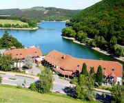
Göbel´s Seehotel Diemelsee
Waldecker Hof
Edelweiss Garni
Romantik Hotel Stryckhaus
Post-Hotel Usseln Ringhotel
Brügges Loui
H+ Hotel Willingen
H+ Appartementhaus
Berghof
Hotel Leise garni
Videos from this area
These are videos related to the place based on their proximity to this place.
Anno 1404 Breda 46000 v2.2013
Trying to get bout 150.000 people in this city spread over few islands like myown city in real life Anno 1404 Breda 46000 people for now Visit it now Other Websites: http://www.kiesuwautoverzek...
Welleringhausen Nov 2012
Fliegen im November im Sauerland, Welleringhausen bei Südwind mit "Staulage" = Nebel.
Ein tierisches Vergnügen: Wiebke Pohlmann ist Kuhreiterin
Welleringhausen, 17. April 2014: Die 17-jährige Schülerin Wiebke Pohlmann aus Welleringhausen reitet keine Pferde - sie sitzt auf Kühen. Mit Kuh Lara hat sie auch schon Tricks einstudiert....
Soaring im Sauerland
During 4 hours soaring at a small hill near by Welleringhausen (Sauerland/ Germany) I took some videos with my Nokia N95. You can find the better video quality here: http://www.mattes-homepage....
Soaring im Sauerland (2008)
Leider wurde das originale Video wegen Verletzung von Musiklizenzen gesperrt. - - Deshalb jetzt ohne Musik - Soaring am Hügel bei Welleringhausen. Als Helmkamera habe ich die Ixus 960IS...
flying Silke
"flying Silke" 5. Flug am 24. September 2011 in Welleringhausen beim Schnupperkurs Gleitschirmfliegen powered by Reinholds Flugschule.
Usseln: Motorrad rammt Ferrari, Rettungshubschrauber.mpg
Düdinghausen/Usseln. Nach der Kollision zwischen einem Motorrad und einem Ferrari ist am Samstag (18.08.2012) ein weiterer Kradfahrer in der Unfallstelle zwischen Düdinghausen und Usseln...
Frau stirbt bei Unfall nahe Usseln.mpg
Usseln. Bei einem schweren Verkehrsunfall auf der B 251 ist am frühen Mittwochnachmittag (18.04.2012) eine 95 Jahre alte Frau aus den Niederlanden verstorben. Ihr 92-jähriger Mann erlitt...
Curioseum in Usseln: Kurioses vom Skelett über Astronaut bis zu Oldtimern
http://www.youtube.com/hnaonline - Usseln, 15.05.2012: Für Oldtimer-Fan Hans Schlömer ist kurios und unmöglich nicht genug. Sein Curioseum in Usseln beherbergt auf 1500 Quadratmetern alles...
Videos provided by Youtube are under the copyright of their owners.
Attractions and noteworthy things
Distances are based on the centre of the city/town and sightseeing location. This list contains brief abstracts about monuments, holiday activities, national parcs, museums, organisations and more from the area as well as interesting facts about the region itself. Where available, you'll find the corresponding homepage. Otherwise the related wikipedia article.
Dommel (mountain)
Dommel (Berg) is a mountain of Landkreis Waldeck-Frankenberg, Hesse, Germany.
Osterkopf
Osterkopf is a mountain of Landkreis Waldeck-Frankenberg, Hesse, Germany.
Sähre
Sähre is a mountain of Landkreis Waldeck-Frankenberg, Hesse, Germany.
Itter (Diemel)
Itter (Diemel) is a river of Hesse, Germany.


