Safety Score: 3,0 of 5.0 based on data from 9 authorites. Meaning we advice caution when travelling to Germany.
Travel warnings are updated daily. Source: Travel Warning Germany. Last Update: 2024-08-13 08:21:03
Delve into Rittershausen
Rittershausen in Regierungsbezirk Gießen (Hesse) is located in Germany about 248 mi (or 400 km) south-west of Berlin, the country's capital town.
Current time in Rittershausen is now 09:08 AM (Monday). The local timezone is named Europe / Berlin with an UTC offset of one hour. We know of 10 airports close to Rittershausen, of which 4 are larger airports. The closest airport in Germany is Siegerland Airport in a distance of 13 mi (or 21 km), South-West. Besides the airports, there are other travel options available (check left side).
There are several Unesco world heritage sites nearby. The closest heritage site in Germany is Upper Middle Rhine Valley in a distance of 53 mi (or 86 km), South-West. If you need a hotel, we compiled a list of available hotels close to the map centre further down the page.
While being here, you might want to pay a visit to some of the following locations: Erndtebrueck, Siegbach, Mittenaar, Breidenbach and Wilnsdorf. To further explore this place, just scroll down and browse the available info.
Local weather forecast
Todays Local Weather Conditions & Forecast: 12°C / 54 °F
| Morning Temperature | 9°C / 49 °F |
| Evening Temperature | 12°C / 53 °F |
| Night Temperature | 8°C / 46 °F |
| Chance of rainfall | 5% |
| Air Humidity | 73% |
| Air Pressure | 1009 hPa |
| Wind Speed | Moderate breeze with 9 km/h (6 mph) from North-East |
| Cloud Conditions | Broken clouds, covering 62% of sky |
| General Conditions | Moderate rain |
Tuesday, 26th of November 2024
7°C (45 °F)
3°C (37 °F)
Sky is clear, gentle breeze, clear sky.
Wednesday, 27th of November 2024
7°C (45 °F)
4°C (39 °F)
Moderate rain, moderate breeze, overcast clouds.
Thursday, 28th of November 2024
5°C (42 °F)
2°C (35 °F)
Overcast clouds, moderate breeze.
Hotels and Places to Stay
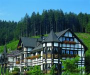
Jagdhof Glashütte Relais & Chateaux
Lahnquelle Forsthaus
Jokebes Gasthof
Videos from this area
These are videos related to the place based on their proximity to this place.
Eis + Schnee - Trails zwischen Ilse- und Siegquelle.mp4
Trailteile des Rothaarsteigs ab Ilsequelle über Friedhof Heiligenborn, Eschengraben, Ochsenborn, Lahnquelle, Ilmquelle zur Siegquelle. Gefahren am So., 15.01.2012 mit Mountainbike RED BULL...
Haiger Rodenbach - mein Hund am winterlichen Bach
Mein Hund liebt das Wasser, und er ist nur schwer davon abzuhalten nicht darein zu springen. Das Video ist in Rodenbach einem Ortsteil von Haiger in Hessen aufgenommen worden. Der Bach ist...
irmgarteichen int
Irmgarteichen ist ein Dorf im südlichen Siegerland, an der südlichen Grenze des Rothaargebirges, gerade mal 4km von der Grenze NRW-Hessen entfernt. Es gehört zu der Stadt Netphen. Dort führt...
06.12.2013: Kleinlaster landet nach Rutschpartie im Graben (Irmgarteichen/NRW)
Rohmaterial anfordern unter www.hercher.tv.
Eine Postkarte entsteht: Foto-Shooting in Bad Laasphe / Bernshausen/Germany
Hier ein kleiner lebendiger Eindruck, welche Stimmung bei dem Foto-Shooting in Bernshausen herrschte, als das Motiv für diese Postkarte "Abendgebet" eingefangen wurde.
Theologische Hochschule Ewersbach: Lernen Begegnen Senden
Lernen, begegnen und senden, darum geht es an der Theologischen Hochschule Ewersbach. Lass dich in unserem Bachelor- und Masterstudiengang als Pastor/in, für den missionarischen Dienst ...
Wohnhausbrand in Dietzhölztal-Ewersbach: 200.000 Euro Schaden
2015 www.24hessen.de Dietzhölztal-Ewersbach | Am Samstag, 21.03.2015, um 07.10 Uhr, geriet ein zweigeschossiges Einfamilienhaus in Dietzhölztal-Ewersbach aus unbekannten Gründen in Brand.
Fellerdilln zwischen Westerwald und Rothaargebirge
Fellerdilln ist eine alte Siedlung keltischen Ursprungs, die zwischen den Ausläufern des Rothaargebirges und dem hessischen Westerwald liegt, Die erste urkundliche Erwähnung ist auf das Jahr...
Videos provided by Youtube are under the copyright of their owners.
Attractions and noteworthy things
Distances are based on the centre of the city/town and sightseeing location. This list contains brief abstracts about monuments, holiday activities, national parcs, museums, organisations and more from the area as well as interesting facts about the region itself. Where available, you'll find the corresponding homepage. Otherwise the related wikipedia article.
Eichholzkopf
Eichholzkopf is a mountain of Hesse, Germany. At an elevation of 610m, its peak peak is located near the local center Rittershausen, which is part of the municipality Dietzhölztal.


