Safety Score: 3,0 of 5.0 based on data from 9 authorites. Meaning we advice caution when travelling to Germany.
Travel warnings are updated daily. Source: Travel Warning Germany. Last Update: 2024-08-13 08:21:03
Discover Eichelhain
Eichelhain in Regierungsbezirk Gießen (Hesse) is a city in Germany about 223 mi (or 359 km) south-west of Berlin, the country's capital city.
Local time in Eichelhain is now 08:05 AM (Monday). The local timezone is named Europe / Berlin with an UTC offset of one hour. We know of 12 airports in the vicinity of Eichelhain, of which 5 are larger airports. The closest airport in Germany is Hanau Army Air Field in a distance of 31 mi (or 50 km), South-West. Besides the airports, there are other travel options available (check left side).
There are several Unesco world heritage sites nearby. The closest heritage site in Germany is Messel Pit Fossil Site in a distance of 51 mi (or 81 km), South-West. We discovered 1 points of interest in the vicinity of this place. Looking for a place to stay? we compiled a list of available hotels close to the map centre further down the page.
When in this area, you might want to pay a visit to some of the following locations: Lautertal, Grebenhain, Schwalmtal, Lauterbach and Freiensteinau. To further explore this place, just scroll down and browse the available info.
Local weather forecast
Todays Local Weather Conditions & Forecast: 10°C / 51 °F
| Morning Temperature | 6°C / 42 °F |
| Evening Temperature | 9°C / 49 °F |
| Night Temperature | 7°C / 44 °F |
| Chance of rainfall | 7% |
| Air Humidity | 68% |
| Air Pressure | 1011 hPa |
| Wind Speed | Moderate breeze with 10 km/h (6 mph) from North |
| Cloud Conditions | Broken clouds, covering 70% of sky |
| General Conditions | Moderate rain |
Tuesday, 26th of November 2024
6°C (43 °F)
3°C (37 °F)
Light rain, gentle breeze, clear sky.
Wednesday, 27th of November 2024
5°C (42 °F)
4°C (39 °F)
Light rain, moderate breeze, overcast clouds.
Thursday, 28th of November 2024
4°C (39 °F)
1°C (34 °F)
Light rain, moderate breeze, overcast clouds.
Hotels and Places to Stay
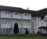
Apartments Golfpark Schlossgut Sickendorf
Herbstein
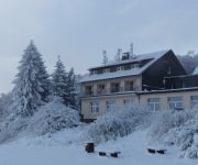
Hoherodskopf Berghotel
Groh Landgasthof
Ätna
Videos from this area
These are videos related to the place based on their proximity to this place.
Blickpunkt Coburger Land - Gemeinde Lautertal - I. Quart. 2013
Die Gemeinde Lautertal im Landkreis Coburg stellt sich vor.
Energieautarkes Lautertal im Vogelsberg am 30. Mai 2014
Woher bezieht eine Gemeinde ihren Strom, wenn die auf dem Gemeindegebiet installierten unzähligen Windfabriken ausfallen, weil kein Wind weht? Aus französischen Atomkraftwerke? Oder wird...
20140131 stromautarkes Lautertal ohne Strom 161103
31. Januar 2014 Die Energiewende boomt und die Einspeisezahlen überschlagen sich gerade. Die Energieautarken Gemeinden, saugen sich zur Zeit mit Strom aus den Atom und Kohlekraftwerken ...
Cold Water Challenge 2014 - Feuerwehr Ulrichstein
Wir bedanken uns bei der Feuerwehr Mücke- Sellnrod für die Nominierung!!! Wir nominieren die Feuerwehr Lautertal- Engelrod.
Springerzug Herbstein 2015
Montag, 16. Februar 2015: Es war ziemlich pünktlich um 10.11 Uhr, als Christoph Dehn ans Fenster des Vereinsheims trat und mit dem traditionellen Eröffnungsvers das größte Fastnachtsabenteuer...
Deutschland einig Schnarcherland
Schwachwindmühlen = Schwachsinnmühlen liefern bei Windstille auch keinen Strom.
Vorstellung der Hebloser Chronik zum 1200jährigen Jubiläum 2012
Am 20. Mai 2012 stellte Kurt Eifert im Rahmen der 1200-Jahr-Feier von Heblos die neue Chronik vor. Thema war auch die schwierige Recherche nach den Quellen, die das 1200jährige Jubiläum ...
Grenzwanderung rund um Heblos 2012
Grenzwanderung rund um Heblos am 17. Mai 2012 anlässlich der 1200-Jahr-Feier. An der 9,5km langen Wanderung nahmen über 120 interessierte Bürger teil. Die Videoaufnahmen im Mittelteil ...
Ansprachen zur 1200-Jahr-Feier von Heblos 2012
Ansprachen zur 1200-Jahr-Feier von Heblos am 19. Mai 2012 u.a. von Ortsvorsteherin Euler und Bürgermeister Vollmöller.
Videos provided by Youtube are under the copyright of their owners.
Attractions and noteworthy things
Distances are based on the centre of the city/town and sightseeing location. This list contains brief abstracts about monuments, holiday activities, national parcs, museums, organisations and more from the area as well as interesting facts about the region itself. Where available, you'll find the corresponding homepage. Otherwise the related wikipedia article.
Vogelsberg Mountains
The Vogelsberg Mountains or Vogelsberg (German for Bird's Mountain) are a large volcanic massif in eastern Upper Hesse separated from the Rhön Mountains by the Fulda River and its valley. Arising approximately 19 million years ago, the Vogelsberg, Germany's only shield volcano, is also Central Europe's largest basalt formation, consisting of a multitude of layers which, having flowed over each other, fall downward from their peak in ring-shaped terraces to the base.
Geiselstein
Geiselstein is a mountain of Bavaria, Germany.
Taufstein (Vogelsberg)
Taufstein (Vogelsberg) is a mountain of Hesse, Germany.


