Safety Score: 3,0 of 5.0 based on data from 9 authorites. Meaning we advice caution when travelling to Germany.
Travel warnings are updated daily. Source: Travel Warning Germany. Last Update: 2024-08-13 08:21:03
Delve into Wüstwillenroth
Wüstwillenroth in Regierungsbezirk Darmstadt (Hesse) is located in Germany about 228 mi (or 367 km) south-west of Berlin, the country's capital town.
Current time in Wüstwillenroth is now 09:11 PM (Monday). The local timezone is named Europe / Berlin with an UTC offset of one hour. We know of 12 airports close to Wüstwillenroth, of which 5 are larger airports. The closest airport in Germany is Hanau Army Air Field in a distance of 24 mi (or 38 km), South-West. Besides the airports, there are other travel options available (check left side).
There are several Unesco world heritage sites nearby. The closest heritage site in Germany is Messel Pit Fossil Site in a distance of 43 mi (or 69 km), South-West. We encountered 1 points of interest near this location. If you need a hotel, we compiled a list of available hotels close to the map centre further down the page.
While being here, you might want to pay a visit to some of the following locations: Grebenhain, Birstein, Freiensteinau, Kefenrod and Lautertal. To further explore this place, just scroll down and browse the available info.
Local weather forecast
Todays Local Weather Conditions & Forecast: 13°C / 55 °F
| Morning Temperature | 6°C / 43 °F |
| Evening Temperature | 12°C / 54 °F |
| Night Temperature | 10°C / 49 °F |
| Chance of rainfall | 2% |
| Air Humidity | 65% |
| Air Pressure | 1010 hPa |
| Wind Speed | Moderate breeze with 10 km/h (6 mph) from North-East |
| Cloud Conditions | Broken clouds, covering 70% of sky |
| General Conditions | Moderate rain |
Tuesday, 26th of November 2024
9°C (48 °F)
7°C (44 °F)
Moderate rain, gentle breeze, overcast clouds.
Wednesday, 27th of November 2024
8°C (47 °F)
7°C (45 °F)
Moderate rain, fresh breeze, overcast clouds.
Thursday, 28th of November 2024
5°C (41 °F)
5°C (40 °F)
Broken clouds, moderate breeze.
Hotels and Places to Stay
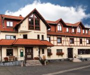
Deutsches Haus Landgasthof
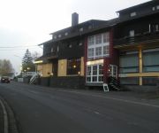
Jöckel
Videos from this area
These are videos related to the place based on their proximity to this place.
Den Vogelsberg entdecken: Grebenhain
Grebenhain bestehend aus 15 Ortsteilen liegt verstreut mitten im Naturpark Hoher Vogelsberg. Hier kreuzen sich mehrere Wander- und Radwege und Hoherodskopf und Taufstein befinden sich in ...
RC: Narrated FPV Flight 1 - Dive Training
Hello everyone! Today I am back with another little "FPV" flight video from my holiday in germany but instead of a summary I decided to do a narrated flight for a change, just to see how that...
Obermooser See
Der Obermooser See liegt unberührt am Rande des hessischen "Naturpark Hoher Vogelsberg" in der Nähe von Hartmannshain, ca. 80 km von Frankfurt am Main entfernt. Ein lohnendes Ausflugsziel...
Aussiedlerhof: Attraktiver Pferde-/Bauernhof mit Halle, Wohn
Aussiedlerhof: Attraktiver Pferde-/Bauernhof mit Halle, Wohnhaus, Pferdestall und 7,5 ha Land - Bauernhof in Freiensteinau - ObjNr: 31360-612 Auf diesem großzügigen Bauernhof in der gesunden...
Eschenröder Faschingswagen 2013 ( Offizial Aftermove)
Faschingsumzug in Freiensteinau mit denn Besten Feierschweine Ever.
Demo Rote Karte Al-Wazir Teil 1
Leider sind einige Aufnahmen fehlerhaft, somit ist Dr. Nikolai Ziegler sowie Karl Graf zu Solms-Laubach im Video nicht zu sehen.
Birstein VideoPano
zwischen Unterreichenbach und Obersotzbach ;-) Zu allen 3 Videos noch soviel, die wurden im "Rohzustand" hochgeladen und erst auf Youtube ein wenig nachbearbeitet und mit hier offiziellen...
Feuerwehr Hellstein - HR-Hessenjournal vom 26.07.2006 - Unwetter über Birstein.mpg
Bericht des HR-Hessenjournal von einen Strakregenschauer am 26.07.2006 über der Gemeinde Birstein. Die Feuerwehren der Gemeinde Birstein, sowie die Feuerwehr Hellstein waren im Einsatz um.
Videos provided by Youtube are under the copyright of their owners.
Attractions and noteworthy things
Distances are based on the centre of the city/town and sightseeing location. This list contains brief abstracts about monuments, holiday activities, national parcs, museums, organisations and more from the area as well as interesting facts about the region itself. Where available, you'll find the corresponding homepage. Otherwise the related wikipedia article.
Völzberger Köpfchen
Völzberger Köpfchen is a mountain of Hesse, Germany.


