Safety Score: 3,0 of 5.0 based on data from 9 authorites. Meaning we advice caution when travelling to Germany.
Travel warnings are updated daily. Source: Travel Warning Germany. Last Update: 2024-08-13 08:21:03
Explore Schwalbach am Taunus
Schwalbach am Taunus in Regierungsbezirk Darmstadt (Hesse) with it's 14,192 inhabitants is a city in Germany about 267 mi (or 429 km) south-west of Berlin, the country's capital.
Local time in Schwalbach am Taunus is now 10:04 PM (Tuesday). The local timezone is named Europe / Berlin with an UTC offset of one hour. We know of 9 airports in the vicinity of Schwalbach am Taunus, of which 5 are larger airports. The closest airport in Germany is Frankfurt am Main International Airport in a distance of 9 mi (or 14 km), South. Besides the airports, there are other travel options available (check left side).
There are several Unesco world heritage sites nearby. The closest heritage site in Germany is Messel Pit Fossil Site in a distance of 19 mi (or 30 km), South-East. We found 4 points of interest in the vicinity of this place. If you need a place to sleep, we compiled a list of available hotels close to the map centre further down the page.
Depending on your travel schedule, you might want to pay a visit to some of the following locations: Kriftel, Hofheim am Taunus, Bad Homburg vor der Hoehe, Schmitten and Glashutten. To further explore this place, just scroll down and browse the available info.
Local weather forecast
Todays Local Weather Conditions & Forecast: 8°C / 47 °F
| Morning Temperature | 6°C / 43 °F |
| Evening Temperature | 8°C / 46 °F |
| Night Temperature | 7°C / 45 °F |
| Chance of rainfall | 0% |
| Air Humidity | 66% |
| Air Pressure | 1026 hPa |
| Wind Speed | Light breeze with 3 km/h (2 mph) from South-West |
| Cloud Conditions | Overcast clouds, covering 100% of sky |
| General Conditions | Overcast clouds |
Wednesday, 6th of November 2024
12°C (54 °F)
8°C (47 °F)
Few clouds, light breeze.
Thursday, 7th of November 2024
11°C (52 °F)
8°C (47 °F)
Scattered clouds, light breeze, broken clouds.
Friday, 8th of November 2024
11°C (52 °F)
8°C (47 °F)
Sky is clear, light breeze, few clouds.
Hotels and Places to Stay
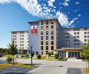
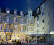
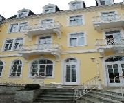
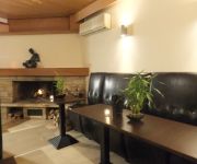
Concorde Viktoria
Dorint Main Taunus Zentrum
Mercure Hotel Frankfurt Eschborn Sued
H+ Hotel Bad Soden
Best Western Plus Io
Rheinischer Hof
Milbor
Bonjour
Salina
Thermenhotel
Videos from this area
These are videos related to the place based on their proximity to this place.
Velotour Rund um den Finanzplatz Eschborn-Frankfurt 2012 (lange Version)
Längere Zusammenfassung des Jedermannradrennens Velotour "Rund um den Finanzplatz Eschborn-Frankfurt" am 1. Mai 2012 über 70 Kilometer.
Sound of Gotha meets Niederhöchstadt Eschborn Helau!
Auf dem Faschingsumzug Niederhöchstadt Eschborn...
Lost Place Airport Eschborn Frankfurt Konova K3 Slider
A short clip on the old airport in Eschborn near Frankfurt am Main. I hope you enjoy it. GEAR Canon Eos 60D / Canon 50mm 1.4 USM / Konova K3 31 inch (80cm) / B+W 64x ND Filter / Hama Vario...
Radrennen Eschborn-Frankfurt (2013)
Ausschnitte aus einer Fernsehsendung des Hessischen Rundfunks vom 1. Mai 2013 über das Radrennen Rund um den Finanzplatz.
Velotour Rund um den Finanzplatz Eschborn-Frankfurt 2012
Kurze Zusammenfassung des Jedermannradrennens Velotour "Rund um den Finanzplatz Eschborn-Frankfurt" am 1. Mai 2012 über 70 Kilometer. Ein ausführlicherer Zusammenschnitt folgt.
Struvite production and experiment / MAP-Düngerproduktion und Experiment
Video clip from children's show in German TV with English subtitles (for English subtitles please press CC at the right corner of the video window). At the main building of the headquarters...
Struvite production / MAP-Düngerproduktion
Video clip from children's show in German TV with English subtitles (for English subtitles please press CC at the right corner of the video window). At the main building of the headquarters...
Radrennen (2010)
Radrennen der Berufsradfahrer "Rund um den Finanzplatz Eschborn - Frankfurt" vom 1. Mai 2010. Ausschnitte aus einer Fernsehsendung des Hessischen Rundfunks. Gezeigt werden die Teile, die in...
Cold Water Challenge 2014 - DRK OV Bad Soden [HD]
Nominiert durch das DRK OV Hattersheim fand unsere Cold Water Challenge am 18.05.2014 statt. Wir nominieren nun das DRK OV Liederbach, das DRK OV Kelkheim und die DRK Rettungswache ...
Videos provided by Youtube are under the copyright of their owners.
Attractions and noteworthy things
Distances are based on the centre of the city/town and sightseeing location. This list contains brief abstracts about monuments, holiday activities, national parcs, museums, organisations and more from the area as well as interesting facts about the region itself. Where available, you'll find the corresponding homepage. Otherwise the related wikipedia article.
Braun (company)
Braun GmbH (commonly pronounced as "braun" in English), formerly Braun AG, is a German consumer products company based in Kronberg. From 1984 until 2005, Braun was a wholly owned subsidiary of The Gillette Company, which had purchased a controlling interest in the company in 1967. Braun is now a wholly owned subsidiary of Procter & Gamble, which acquired Gillette in 2005. On 16 April 2012, the Italian company De'Longhi acquired the household part of Braun from Procter & Gamble.
1. FC Eschborn
1. FC Eschborn is a German association football club which plays in Eschborn, a suburb of Frankfurt, Hesse.
Arboretum Main-Taunus
The Arboretum Main-Taunus (76 hectares) is an arboretum located on Am Weissen Stein, just southwest of Eschborn, Hesse, Germany. The arboretum was begun in 1982 on the site of a former military airport, and currently contains over 600 tree and shrub species from around the northern hemisphere, including Central Europe, Asia Minor, the Himalayas, China, Japan, and North America.
Eschborn Airfield
Eschborn Airfield (Fliegerhorst Eschborn) is an abandoned military airfield in Germany located approximately 10 km northwest of Frankfurt am Main (Hessen) and 435 km southwest of Berlin. The airfield was built by the Luftwaffe and opened in the early 1940s. Its primary use was as an interceptor fighter airfield during the Defense of the Reich campaign.
Urselbach
Urselbach is a river of Hesse, Germany.
Bad Soden (Taunus) station
Bad Soden (Taunus) station is the northern terminus of the Soden Railway in the German state of Hesse. It is also the northern terminus of the line S 3 services of the Rhine-Main S-Bahn over the Limes Railway (Limesbahn).
Niederhöchstadt station
Niederhöchstadt station is a junction station in the Niederhöchstadt district of the town of Eschborn in the German state of Hesse. The stations of Eschborn and Eschborn Süd are nearby. Just north-west of the station the Limes Railway to Bad Soden separates from the Kronberg Railway to Kronberg. The station is classified by Deutsche Bahn as a category 5 station.
Kronberg Castle
Kronberg Castle is a High Middle Ages Rock castle in Kronberg im Taunus, Hochtaunuskreis district, Germany. The castle is beside Altkönig in Taunus. The castle was built in 1220 to 1230.





!['Cold Water Challenge 2014 - DRK OV Bad Soden [HD]' preview picture of video 'Cold Water Challenge 2014 - DRK OV Bad Soden [HD]'](https://img.youtube.com/vi/XCn2BOJ0hn4/mqdefault.jpg)


