Safety Score: 3,0 of 5.0 based on data from 9 authorites. Meaning we advice caution when travelling to Germany.
Travel warnings are updated daily. Source: Travel Warning Germany. Last Update: 2024-08-13 08:21:03
Discover Panrod
Panrod in Regierungsbezirk Darmstadt (Hesse) is a city in Germany about 276 mi (or 445 km) south-west of Berlin, the country's capital city.
Local time in Panrod is now 04:22 AM (Friday). The local timezone is named Europe / Berlin with an UTC offset of one hour. We know of 10 airports in the vicinity of Panrod, of which 3 are larger airports. The closest airport in Germany is Wiesbaden Army Airfield in a distance of 17 mi (or 27 km), South-East. Besides the airports, there are other travel options available (check left side).
There are several Unesco world heritage sites nearby. The closest heritage site in Germany is Upper Middle Rhine Valley in a distance of 20 mi (or 32 km), West. Looking for a place to stay? we compiled a list of available hotels close to the map centre further down the page.
When in this area, you might want to pay a visit to some of the following locations: Kaltenholzhausen, Burgschwalbach, Netzbach, Hahnstatten and Schiesheim. To further explore this place, just scroll down and browse the available info.
Local weather forecast
Todays Local Weather Conditions & Forecast: 1°C / 34 °F
| Morning Temperature | -1°C / 31 °F |
| Evening Temperature | 2°C / 36 °F |
| Night Temperature | 1°C / 34 °F |
| Chance of rainfall | 2% |
| Air Humidity | 93% |
| Air Pressure | 1006 hPa |
| Wind Speed | Moderate breeze with 12 km/h (8 mph) from East |
| Cloud Conditions | Broken clouds, covering 80% of sky |
| General Conditions | Snow |
Saturday, 23rd of November 2024
3°C (37 °F)
3°C (38 °F)
Rain and snow, moderate breeze, overcast clouds.
Sunday, 24th of November 2024
11°C (52 °F)
9°C (48 °F)
Overcast clouds, gentle breeze.
Monday, 25th of November 2024
12°C (54 °F)
7°C (44 °F)
Light rain, moderate breeze, overcast clouds.
Hotels and Places to Stay
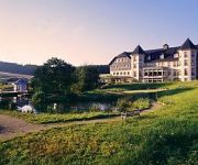
Georgenthal Hofgut
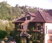
Wiesenmühle Landgasthof
Videos from this area
These are videos related to the place based on their proximity to this place.
Hahnstätten aus der Luft via Quadrocopter
Rundflug an der Lutz Hütte, nahe Hahnstätten (Rheinland-Pfalz), anschliessend Höhenflug mit Panoramablick auf Hahnstätten, das Aar Tal, Palmbachtal, Kaltenholzhausen, Goldener Grund, usw........
IGE Aarbergen 2012 Jedermann
IGE Aarbergen Jedermannslauf 14.04.2012 aufgenommen mit Liquid Image 720P.
MSR Moto Cross, 08.06.2013, Kaltenholzhausen, MX2 National, 1. Lauf
MSR Moto Cross, 08.06.2013, Kaltenholzhausen, MX2 National, 1. Lauf.
Maiden Flight with the Dragonlink V2
Maiden Flight with the Dragonlink V2 and my Skywalker 1900. Some super views of Burg Schwalbach as well as some surrounding towns. The Dragonlink worked perfectly, but my video needs some ...
Basti's Burgschwalbach Bixler 2 Flight
Basti's Burgschwalbach Bixler 2 Flight with some nice views of Burg Schwalbach Highlights: 4:45 view of the Castle "Burg Schwalbach". 6:50 rollover and dive. 8:50 near Crash into the trees.
Burgschwalbach im Nebel
DJI Quadrocopter Flug durch die Nebeldecke, mit Panoramablick von Oben. GPS Position: N50°17.238 E008°05.026 By ta1 für die Burgschwalbacher Geocacher ;-)
2nd flight with the Dragonlink V2
2nd flight with the Dragonlink V2 and my Skywalker 1900. Some super views of Burg Schwalbach. I forgot to turn on the GoPro so only Sony CCD Cam view. But this shows the quality of the cam...
Videos provided by Youtube are under the copyright of their owners.


