Safety Score: 3,0 of 5.0 based on data from 9 authorites. Meaning we advice caution when travelling to Germany.
Travel warnings are updated daily. Source: Travel Warning Germany. Last Update: 2024-08-13 08:21:03
Discover Kemel
Kemel in Regierungsbezirk Darmstadt (Hesse) is a town in Germany about 284 mi (or 457 km) south-west of Berlin, the country's capital city.
Current time in Kemel is now 03:29 AM (Friday). The local timezone is named Europe / Berlin with an UTC offset of one hour. We know of 10 airports near Kemel, of which 3 are larger airports. The closest airport in Germany is Mainz-Finthen Airport in a distance of 15 mi (or 24 km), South-East. Besides the airports, there are other travel options available (check left side).
There are several Unesco world heritage sites nearby. The closest heritage site in Germany is Upper Middle Rhine Valley in a distance of 14 mi (or 23 km), West. We discovered 1 points of interest in the vicinity of this place. Looking for a place to stay? we compiled a list of available hotels close to the map centre further down the page.
When in this area, you might want to pay a visit to some of the following locations: Bad Schwalbach, Reckenroth, Eisighofen, Dorsdorf and Berndroth. To further explore this place, just scroll down and browse the available info.
Local weather forecast
Todays Local Weather Conditions & Forecast: -0°C / 31 °F
| Morning Temperature | -2°C / 29 °F |
| Evening Temperature | 0°C / 33 °F |
| Night Temperature | -0°C / 32 °F |
| Chance of rainfall | 2% |
| Air Humidity | 89% |
| Air Pressure | 1007 hPa |
| Wind Speed | Moderate breeze with 12 km/h (7 mph) from East |
| Cloud Conditions | Overcast clouds, covering 95% of sky |
| General Conditions | Snow |
Saturday, 23rd of November 2024
1°C (33 °F)
2°C (35 °F)
Light snow, moderate breeze, overcast clouds.
Sunday, 24th of November 2024
9°C (48 °F)
5°C (41 °F)
Overcast clouds, gentle breeze.
Monday, 25th of November 2024
10°C (51 °F)
5°C (40 °F)
Light rain, moderate breeze, overcast clouds.
Hotels and Places to Stay
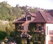
Erlebnis Resort Taunusblick
Kaiserhof
Gemmer Landgasthof
Victoria
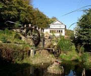
Wambacher Mühle
Wiesenmühle Landgasthof
Videos from this area
These are videos related to the place based on their proximity to this place.
Blink-Blink, extreme Weihnachtsbeleuchtung Schlangenbad - nun 2011
und es kann noch etwas mehr sein. Auf eine neue Lichtersession im Jahr 2011, mit noch mehr Weihnachtsfiguren, an einem einzigen Haus und Vorgarten in Schlangenbad.
Kultlandschaftspfad in Hausen vor der höhe (1).mp4
Es war ein sehr schöner Sonniger Tag, und der erste Schnee für diese Jahr war auch da es war wunderbar. Das ist eine Ortsteil von Kurort Schangenbad.
Bad Schwalbach'er Wald
Heute leider kein Downhill-Video. Wir haben uns dazu entschlossen, heute den Wald, von unserer Nachbarstadt Bad Schwalbach zuzeigen. ---Taunus Downhill'er 2 ist noch in Bearbeitung und ...
Bundeswertungsspielen Bad Schwalbach: Ergebnisbekanntgabe Teil 1/II Musikzug Ennest
Das Sinfonische Blasorchester des Musikzgs Ennest der Freiwilligen Feuerwehr Attendorn erreichte beim Bundeswertungsspielen des Deutschen Feuerwehrverbands vom 03.-05. Oktober 2014 in Bad ...
Bundeswertungsspielen Bad Schwalbach: Ergebnisbekanntgabe Teil 2/II Musikzug Ennest
Das Sinfonische Blasorchester des Musikzgs Ennest der Freiwilligen Feuerwehr Attendorn erreichte beim Bundeswertungsspielen des Deutschen Feuerwehrverbands vom 03.-05. Oktober 2014 in Bad ...
Moorbahn Bad Schwalbach 13.02.2011
Nach einer längeren Pause wurde die Strecke wieder freigegeben und auch das Wetter zeigte sich mild gestimmt und es blieb trocken. Hier ein paar Impressionen vom unteren Teil der Strecke.
Bad Schwalbach von Oben via Quadrocopter Drohne
Kurzer Rundflug über Bad Schwalbach. Startpunkt: Elisabethentempel. DJI Quadcopter + GoPro Hero3 Cam.
NAO Schule - Adventskonzert 17.12.2014
Das Adventskonzert der Nikolaus August Otto Schule Bad Schwalbach vom 15.12.2014 --- eine Videoproduktion von: Lucas Leitsch mit freundlicher Unterstützung von: Dolby Digital.
Videos provided by Youtube are under the copyright of their owners.
Attractions and noteworthy things
Distances are based on the centre of the city/town and sightseeing location. This list contains brief abstracts about monuments, holiday activities, national parcs, museums, organisations and more from the area as well as interesting facts about the region itself. Where available, you'll find the corresponding homepage. Otherwise the related wikipedia article.
Mappershainer Kopf
Mappershainer Kopf is a mountain peak in Hesse, Germany, part of the Taunus range. It rises to a height of 548m, making it the highest peak in the western part of the Taunus. The nearest settlement is Mapperhain and the nearest town is Heidenrod. The mountain is located about one kilometer west of the watershed point between the Dörsbach river to the north and the Wisper in the west, both of which originate here, and the Aar in the east (all tributaries of the river Lahn).


