Safety Score: 3,0 of 5.0 based on data from 9 authorites. Meaning we advice caution when travelling to Germany.
Travel warnings are updated daily. Source: Travel Warning Germany. Last Update: 2024-08-13 08:21:03
Discover Hasselbach
Hasselbach in Regierungsbezirk Darmstadt (Hesse) is a city in Germany about 265 mi (or 427 km) south-west of Berlin, the country's capital city.
Local time in Hasselbach is now 01:02 AM (Wednesday). The local timezone is named Europe / Berlin with an UTC offset of one hour. We know of 7 airports in the vicinity of Hasselbach, of which 3 are larger airports. The closest airport in Germany is Wiesbaden Army Airfield in a distance of 20 mi (or 32 km), South. Besides the airports, there are other travel options available (check left side).
There are several Unesco world heritage sites nearby. The closest heritage site in Germany is Upper Middle Rhine Valley in a distance of 31 mi (or 50 km), West. We discovered 2 points of interest in the vicinity of this place. Looking for a place to stay? we compiled a list of available hotels close to the map centre further down the page.
When in this area, you might want to pay a visit to some of the following locations: Waldems, Weinbach, Gravenwiesbach, Schmitten and Glashutten. To further explore this place, just scroll down and browse the available info.
Local weather forecast
Todays Local Weather Conditions & Forecast: 13°C / 55 °F
| Morning Temperature | 5°C / 41 °F |
| Evening Temperature | 8°C / 46 °F |
| Night Temperature | 6°C / 43 °F |
| Chance of rainfall | 0% |
| Air Humidity | 64% |
| Air Pressure | 1029 hPa |
| Wind Speed | Calm with 2 km/h (1 mph) from South |
| Cloud Conditions | Few clouds, covering 18% of sky |
| General Conditions | Few clouds |
Thursday, 7th of November 2024
12°C (53 °F)
6°C (43 °F)
Broken clouds, light breeze.
Friday, 8th of November 2024
12°C (53 °F)
6°C (43 °F)
Sky is clear, light breeze, clear sky.
Saturday, 9th of November 2024
14°C (57 °F)
7°C (44 °F)
Few clouds, calm.
Hotels and Places to Stay
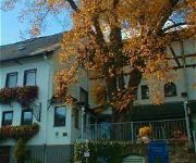
Zur Linde
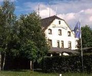
Waldschloss
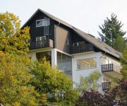
Seminarhaus am Liebfrauenberg
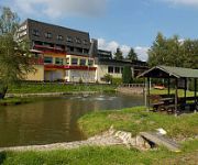
Sonnenberg
Videos from this area
These are videos related to the place based on their proximity to this place.
Cold Water Challenge Waldems-Wüstems
Liebe Kameraden die Feuerwehr Reichenbach und Idtsein-Nieder/Oberrod haben uns nominiert. Wir nominieren die Feuerwehren: Rohrdorf/Isny Schmitten-Seelenberg Waldems-Steinfischbach Wir ...
Steinfischbach
Hochtaunus: Steinfischbach aus der Luft. DJI Quadrocopter + GoPro Hero3 Actioncamera HD.
Olaf Kiefer - Komm Her (1984) - Live in Langenbach (Titel 1)
Anläßlich des 50-jährigen Jubiläums der FFW Langenbach präsentierte Olaf Kiefer den Titel "Komm Her". Die Moderation kam von Fred van Geez, der irrtümlich den Titel mit "Woher" völlig...
thecrankcase.com Ducati Mike Hailwood replica directors (rough) cut.
This is my first ever try at making a movie, free software by movie maker but the usual troubles, such as it's too big to save when it's only 73kb and so on. Some things I'll never understand....
MOTOTRACKS - Kleine Sonntagsrunde mit der Yamaha TDM 850 und Sony HDR AS15
heute mal ne kleine Runde mit der TDM gedreht und dabei gleich mal meine neue Helmkamera Sony HDR AS15 getestet.
New Perspectives - DJI Inspire 1
First Impressions of aerial videos with the DJI Inspire 1. Erste Eindrücke der Luftaufnahmen mit der DJI Inspire 1.
Videos provided by Youtube are under the copyright of their owners.
Attractions and noteworthy things
Distances are based on the centre of the city/town and sightseeing location. This list contains brief abstracts about monuments, holiday activities, national parcs, museums, organisations and more from the area as well as interesting facts about the region itself. Where available, you'll find the corresponding homepage. Otherwise the related wikipedia article.
Koberg (Taunus)
Koberg (Taunus) is a mountain of Hesse, Germany.
Sommerberg (Taunus)
Sommerberg (Taunus) is a mountain of Hesse, Germany.
Stückelberg (Taunus)
Stückelberg is a Taunus mountain of Hesse, Germany.
Suterkopf
Suterkopf is a mountain of Hesse, Germany.
Langenbach (Eichelbach)
Langenbach (Eichelbach) is a river of Hesse, Germany.


