Safety Score: 3,0 of 5.0 based on data from 9 authorites. Meaning we advice caution when travelling to Germany.
Travel warnings are updated daily. Source: Travel Warning Germany. Last Update: 2024-08-13 08:21:03
Discover Unterhain
Unterhain in Free State of Thuringia is a city in Germany about 163 mi (or 263 km) south-west of Berlin, the country's capital city.
Local time in Unterhain is now 01:07 AM (Monday). The local timezone is named Europe / Berlin with an UTC offset of one hour. We know of 11 airports in the vicinity of Unterhain, of which 5 are larger airports. The closest airport in Germany is Erfurt Airport in a distance of 25 mi (or 40 km), North. Besides the airports, there are other travel options available (check left side).
There are several Unesco world heritage sites nearby. The closest heritage site in Germany is Bauhaus and its Sites in Weimar and Dessau in a distance of 25 mi (or 40 km), North. Looking for a place to stay? we compiled a list of available hotels close to the map centre further down the page.
When in this area, you might want to pay a visit to some of the following locations: Oberhain, Mellenbach-Glasbach, Allendorf, Sitzendorf and Unterweissbach. To further explore this place, just scroll down and browse the available info.
Local weather forecast
Todays Local Weather Conditions & Forecast: 9°C / 49 °F
| Morning Temperature | 4°C / 40 °F |
| Evening Temperature | 5°C / 42 °F |
| Night Temperature | 8°C / 46 °F |
| Chance of rainfall | 0% |
| Air Humidity | 67% |
| Air Pressure | 1012 hPa |
| Wind Speed | Moderate breeze with 10 km/h (6 mph) from North |
| Cloud Conditions | Overcast clouds, covering 93% of sky |
| General Conditions | Overcast clouds |
Tuesday, 26th of November 2024
7°C (45 °F)
3°C (38 °F)
Light rain, gentle breeze, broken clouds.
Wednesday, 27th of November 2024
6°C (42 °F)
7°C (45 °F)
Light rain, fresh breeze, overcast clouds.
Thursday, 28th of November 2024
4°C (40 °F)
4°C (39 °F)
Light rain, moderate breeze, broken clouds.
Hotels and Places to Stay
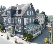
Burghof
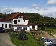
Jägerhof Hotel-Restaurant
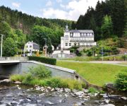
Waldfrieden Flair Hotel
Videos from this area
These are videos related to the place based on their proximity to this place.
118 749-1 Bahnübergang Sitzendorf
118-749-1 mit dem "Raanzer" von Katzhütte nach Rottenbach am Bahnübergang in Sitzendorf.
94 1538 bei Bechstedt-Trippstein
94 1538 mit dem "Raanzer" (Zug 88343 von Rottenbach nach Katzhütte) auf der Schwarzatalbahn zwischen Rottenbach und Bechstedt-Trippstein, kurz vor dem Haltepunkt Bechstedt-Trippstein.
Mankenbach / Neu-Leibis
Fahrt mit PKW von Mankenbach nach Neu-Leibis ins Schwarzatal. bis zu 17% Gefälle; in Mankenbach bis zu 18% ------------------------------------------------------------------- Drive by car...
Dampfzug-Sonderfahrt Teil 1(mp4)_ Mitfahrt von Rottenbach bis Katzhütte
Teil 1 des Videos zeigt die Ankunft des "Raanzer" in Rottenbach, das Umsetzen der Lok BR 41 1144-9 und anschließend die Fahrt mit allen(!) Halt's an der OBS-Strecke 562. Zu sehen ist auch...
Talsperre Leibis Lichte Thüringen
Besichtigung der Baustelle der Talsperre Leibis-Lichte im Rahmen der BWK-Exkursion 2004, anschließend eine Fahrt mit der Bergbahn nach Lichtenheim Cursdorf.
Schwarzatalbahn
Schwarzatalbahn ------------------------------------------------------------------- Im Süden Thüringens, in der Nähe von Bad Blankenburg, fährt die Schwarzatalbahn. Sie fährt von Rottenbach...
Ausfahrt BR 641 aus Mellenbach-Glasbach
Eine Reise, die mich aus meiner gewohnten Umgebung herausführte, musste ich unternehmen, um diesen Walfisch in seinem natürlichen Lebensraum erlegen zu können: Ein Zug der BR 641 fährt...
Oberweißbacher Bergbahn (Talfahrt)
Oberweißbacher Berg- und Schwarzatalbahn ------------------------------------------------------------------- Im Süden Thüringens, in der Nähe von Bad Blankenburg, fährt die Schwarzatalbahn....
Oberweißbacher Bergbahn (Bergfahrt)
Oberweißbacher Berg- und Schwarzatalbahn ------------------------------------------------------------------- Im Süden Thüringens, in der Nähe von Bad Blankenburg, fährt die Schwarzatalbahn....
Oberweißbacher Bergbahn und Schwarzatalbahn - Standseilbahn in Thüringen
Fotoreportage van de Oberweißbacher Bergbahn und Schwarzatalbahn. Die Oberweißbacher Bergbahn ist eine Bahnstrecke im Thüringer Schiefergebirge. Sie verbindet seit 1922 den an der ...
Videos provided by Youtube are under the copyright of their owners.
Attractions and noteworthy things
Distances are based on the centre of the city/town and sightseeing location. This list contains brief abstracts about monuments, holiday activities, national parcs, museums, organisations and more from the area as well as interesting facts about the region itself. Where available, you'll find the corresponding homepage. Otherwise the related wikipedia article.
Mittleres Schwarzatal
Mittleres Schwarzatal is a Verwaltungsgemeinschaft ("municipal association") in the district Saalfeld-Rudolstadt, in Thuringia, Germany. The seat of the Verwaltungsgemeinschaft is in Sitzendorf. The Verwaltungsgemeinschaft Mittleres Schwarzatal consists of the following municipalities: Allendorf Bechstedt Döschnitz Dröbischau Mellenbach-Glasbach Meura Oberhain Rohrbach Schwarzburg Sitzendorf Unterweißbach
Lichte (river)
The Lichte River is a right tributary of the Schwarza in Thuringia, Germany, and is 17 km long.
Blambach
Blambach is a river of Thuringia, Germany.


