Safety Score: 3,0 of 5.0 based on data from 9 authorites. Meaning we advice caution when travelling to Germany.
Travel warnings are updated daily. Source: Travel Warning Germany. Last Update: 2024-08-13 08:21:03
Explore Oberlödla
The district Oberlödla of Rödigen in Free State of Thuringia is located in Germany about 114 mi south of Berlin, the country's capital.
If you need a place to sleep, we compiled a list of available hotels close to the map centre further down the page.
Depending on your travel schedule, you might want to pay a visit to some of the following locations: Lodla, Rositz, Gohren, Monstab and Altenburg. To further explore this place, just scroll down and browse the available info.
Local weather forecast
Todays Local Weather Conditions & Forecast: 4°C / 39 °F
| Morning Temperature | -0°C / 32 °F |
| Evening Temperature | 2°C / 35 °F |
| Night Temperature | 3°C / 37 °F |
| Chance of rainfall | 0% |
| Air Humidity | 71% |
| Air Pressure | 1023 hPa |
| Wind Speed | Fresh Breeze with 14 km/h (9 mph) from South-East |
| Cloud Conditions | Broken clouds, covering 62% of sky |
| General Conditions | Light snow |
Sunday, 24th of November 2024
11°C (52 °F)
10°C (50 °F)
Overcast clouds, fresh breeze.
Monday, 25th of November 2024
13°C (56 °F)
10°C (51 °F)
Broken clouds, moderate breeze.
Tuesday, 26th of November 2024
8°C (46 °F)
6°C (43 °F)
Light rain, moderate breeze, clear sky.
Hotels and Places to Stay
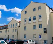
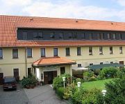
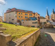
Boutique Hotel Mason
Astor
Kertscher-Hof Landhotel
Parkhotel Altenburg
Treppengasse Pension
Videos from this area
These are videos related to the place based on their proximity to this place.
Historisches Lanz Bulldog und Schleppertreffen Rositz
5. Historisches Bulldog- und Schleppertreffen in Rositz bei Altenburg / Sachsen. Das Traktortreffen fand am 10.5.08 statt.
Speedo GPS Speed Tracker, Car Speedometer, Cycle Computer, Trip Computer, Route Tracking, HUD
Speedo GPS is a fancy and unique combination of GPS Speedometer and Trip computer in one application. What you get when buying Speedo GPS A lot of great features built-in. Speedo GPS gather...
SV Rositz - OTG Gera 3:0 (2:0)
http://svrositz.de | Einen verdienten Heimsieg der Rositzer Mannschaft erlebten die rund 200 Zuschauer am heutigen Nachmittag auf der Sportanlage Rositz/Gorma. Die Gastgeber bestimmten über...
iPad Version of Speedo GPS Speed Tracker, Car Speedometer, Cycle Computer, Trip Computer, HUD
Speedo GPS is a fancy and unique combination of GPS Speedometer and Trip computer in one application. What you get when buying Speedo GPS A lot of great features built-in. Speedo GPS gather...
SV Rositz - Osterland Lumpzig 3:0 (2:0)
http://svrositz.de | Der SV Rositz konnte den Rückstand auf den Tabellenführer aus Roschütz auf 2 Punkte verkürzen. So lautete die positive Nachricht nach dem erfolgreichen Punktspiel am...
Altenburger Brauereipokal - Sporttage Rositz 2012
http://svrositz.de | Der ZFC Meuselwitz konnte am Freitagabend der Sporttage 2012 den Altenburger BrauereiPokal in Rositz verteidigen. Eröffnet wurde das Turnier mit dem Spiel vom Gastgebenden...
SV Rositz - FSV Gößnitz 1:0 (1:0)
http;//svrositz.de | Bei schönstem Wetter sahen die zahlreichen Besucher auf dem Sportplatz in Gorma einen wichtigen Sieg für die Gastgeber. Nach den Ergebnissen des Vortages, hatte man heute...
Dampfwalze - steam road roller - Locomobile
Diese Dampfwalze habe ich beim 5. Historischen Bulldog- und Schleppertreffen, am 10.5.08 in Rositz bei Altenburg aufgenommen.
Big Towers Game iPhone, iPad, iPod Touch Gameplay
Information: http://www.appzer.de/Big-Towers.html Download: http://itunes.apple.com/app/id973590084 Big Towers is an addictive one-tap game. Build up to the sky and higher ... Can you do...
Videos provided by Youtube are under the copyright of their owners.
Attractions and noteworthy things
Distances are based on the centre of the city/town and sightseeing location. This list contains brief abstracts about monuments, holiday activities, national parcs, museums, organisations and more from the area as well as interesting facts about the region itself. Where available, you'll find the corresponding homepage. Otherwise the related wikipedia article.
Altenburger Land
Altenburger Land is a district in Thuringia, Germany. It is bounded by (from the west and clockwise) the district of Greiz, the Burgenlandkreis, and the districts Leipziger Land, Mittweida, Chemnitzer Land, Zwickauer Land in Saxony.
Leipzig-Altenburg Airport
Leipzig-Altenburg Airport, until February 2008 known as Altenburg-Nobitz Airport, is a German regional airport in Nobitz, 6 km southeast of Altenburg and 42 km south of Leipzig in the state of Thuringia. It is the second largest airport in Thuringia. In 2007, it served almost 140,000 passengers.
Sprotte
The Sprotte is a left tributary of the Pleiße in East Thuringia. The headwaters of the river come from three source streams, which begin west of Crimmitschau and are as follows: The Western Sprotte, whose source is near Rückersdorf The Middle Heukewalder Sprotte, which begins near Nischwitz The Eastern Mannichswalder Sprotte The western branch flows northwest and meets with the Heukewalder Sprotte near Vollmershain. Between Posterstein and Nöbdenitz these flow into the Eastern Sprotte.
Thierbach Power Station
Thierbach Power Station was a brown-coal fired power station at Espenhain-Thierbach, Germany. It had a 300 metre tall chimney, which belonged to the tallest free-standing structures of former Eastern Germany.
Rositz (Verwaltungsgemeinschaft)
Rositz is a Verwaltungsgemeinschaft ("collective municipality") in the district Altenburger Land, in Thuringia, Germany. The seat of the Verwaltungsgemeinschaft is in Rositz. The Verwaltungsgemeinschaft Rositz consists of the following municipalities: Kriebitzsch Lödla Monstab
Altenburger Land (Verwaltungsgemeinschaft)
Altenburger Land is a Verwaltungsgemeinschaft ("collective municipality") in the district Altenburger Land, in Thuringia, Germany. The seat of the Verwaltungsgemeinschaft is in Mehna. The Verwaltungsgemeinschaft Altenburger Land consists of the following municipalities: Altkirchen Dobitschen Drogen Göhren Göllnitz Lumpzig Mehna
Oberes Sprottental
Oberes Sprottental is a Verwaltungsgemeinschaft ("collective municipality") in the district Altenburger Land, in Thuringia, Germany. The seat of the Verwaltungsgemeinschaft is in Nöbdenitz. The Verwaltungsgemeinschaft Oberes Sprottental consists of the following municipalities: Heukewalde Jonaswalde Löbichau Nöbdenitz Posterstein Thonhausen Vollmershain
Pleißenaue
Pleißenaue is a Verwaltungsgemeinschaft ("collective municipality") in the district Altenburger Land, in Thuringia, Germany. The seat of the Verwaltungsgemeinschaft is in Treben. The Verwaltungsgemeinschaft Pleißenaue consists of the following municipalities: Fockendorf Gerstenberg Haselbach Treben
Wieratal
Wieratal is a Verwaltungsgemeinschaft ("collective municipality") in the district Altenburger Land, in Thuringia, Germany. The seat of the Verwaltungsgemeinschaft is in Langenleuba-Niederhain. The Verwaltungsgemeinschaft Wieratal consists of the following municipalities: Frohnsdorf Göpfersdorf Jückelberg Langenleuba-Niederhain
Dornburg-Camburg (Verwaltungsgemeinschaft)
Dornburg-Camburg is a Verwaltungsgemeinschaft ("collective municipality") in the district Saale-Holzland, in Thuringia, Germany. The seat of the Verwaltungsgemeinschaft is in Dornburg-Camburg. The Verwaltungsgemeinschaft Dornburg-Camburg consists of the following municipalities:
Battle of Möckern
"Battle of Möckern" may also refer to a separate battle later in 1813. The Battle of Möckern was a series of heavy clashes between allied Prusso-Russian troops and Napoleonic French forces south of Möckern. It occurred on 5 April 1813. It ended in a French defeat and formed the successful prelude to the "Liberation War" against Napoleon (the German name for the German theatre of the War of the Sixth Coalition).
Haselbacher See
Haselbacher See is a lake in Leipzig/ Altenburger Land, Germany. At an elevation of 151 m, its surface area is 3.35 km².
Botanischer Erlebnisgarten Altenburg
The Botanischer Erlebnisgarten Altenburg (8000 m²) is a botanical garden located at Heinrich-Zille-Straße 12, Altenburg, Thuringia, Germany. It is open daily. The garden was created between 1928-1930 by sewing machine manufacturer Karl K. Dietrich to designs by landscape gardener Hans Dippel. After World War II it came into municipal possession.
Glaskopf
Glaskopf is a mountain of Hesse, Germany.
Glauchau (Sachs) station
Glauchau station is the main station of Glauchau in southwest of the German state of Saxony on the Dresden–Werdau line. Glauchau also has another station at Glauchau-Schönbörnchen.
Lindenau-Museum
The Lindenau-Museum is an art museum in Altenburg, Thuringia, Germany. The museum originated as the house-museum of baron and collector Bernhard August von Lindenau. The building was completed in 1876. Its main attraction is the collection of Italian paintings from the late Gothic and early Renaissance age (13th-15th centuries), considered amongst the largest outside Italy. They include, among the others, Filippo Lippi's St.
Altenburg station
Altenburg station is on the Saxon-Bavarian Railway from Leipzig to Hof in the city of Altenburg in the German state of Thuringia. South of Altenburg, in Lehndorf, the line to Gera branches to the west. Passenger services on other lines have been closed to Zeitz and to Narsdorf.
Lungwitzbach
Lungwitzbach is a river of Saxony, Germany.
Schnauder
Schnauder is a river of Saxony, Germany.
Wyhra
Wyhra is a river of Saxony, Germany.
Eisstadion im Sahnpark
Eisstadion im Sahnpark, is an arena in Crimmitschau, Germany. It is primarily used for ice hockey, and is the home to the ETC Crimmitschau of the 2nd Bundesliga. It opened in 1964 and holds 5,222 spectators.


