Safety Score: 3,0 of 5.0 based on data from 9 authorites. Meaning we advice caution when travelling to Germany.
Travel warnings are updated daily. Source: Travel Warning Germany. Last Update: 2024-08-13 08:21:03
Delve into Poppenberg
Poppenberg in Free State of Thuringia is a town located in Germany about 187 mi (or 302 km) south-west of Berlin, the country's capital town.
Time in Poppenberg is now 12:09 AM (Friday). The local timezone is named Europe / Berlin with an UTC offset of one hour. We know of 13 airports closer to Poppenberg, of which 5 are larger airports. The closest airport in Germany is Fritzlar Airport in a distance of 38 mi (or 61 km), North-West. Besides the airports, there are other travel options available (check left side).
There are several Unesco world heritage sites nearby. The closest heritage site in Germany is Wartburg Castle in a distance of 16 mi (or 27 km), North-East. In need of a room? We compiled a list of available hotels close to the map centre further down the page.
Since you are here already, you might want to pay a visit to some of the following locations: Voelkershausen, Unterbreizbach, Martinroda, Woelferbuett and Dorndorf. To further explore this place, just scroll down and browse the available info.
Local weather forecast
Todays Local Weather Conditions & Forecast: 1°C / 34 °F
| Morning Temperature | -2°C / 28 °F |
| Evening Temperature | -1°C / 30 °F |
| Night Temperature | -4°C / 25 °F |
| Chance of rainfall | 0% |
| Air Humidity | 71% |
| Air Pressure | 999 hPa |
| Wind Speed | Moderate breeze with 11 km/h (7 mph) from East |
| Cloud Conditions | Overcast clouds, covering 100% of sky |
| General Conditions | Light snow |
Friday, 22nd of November 2024
1°C (34 °F)
1°C (34 °F)
Snow, fresh breeze, broken clouds.
Saturday, 23rd of November 2024
1°C (34 °F)
1°C (34 °F)
Light snow, moderate breeze, overcast clouds.
Sunday, 24th of November 2024
8°C (46 °F)
5°C (40 °F)
Light rain, moderate breeze, overcast clouds.
Hotels and Places to Stay
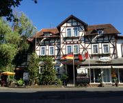
Thüringer Hof
Videos from this area
These are videos related to the place based on their proximity to this place.
Das Rhönlied
Neufassung hier: http://youtu.be/J7NWLQZKHEU Aus einer MIDI-Datei von mir an meinem PC instrumentiert und meinem MIDI-Equipment aufgezeichnet. Das Rhönlied, auch Hymne des Rhönklubs ...
Viking Mark I - Völkershausen
Unser erster Umgebauter Aufsitzmäher für die Kirmes! Erbauer: Alexander B. und Hannes O.
Vacha - die bunte Stadt vor der Rhön
Aufnahmen in und um Vacha/Rhön (Thüringen) Created with MAGIX Video deluxe 17.
Lufthansa A321 descending to Frankfurt am Main
Airbus A321-231 (reg. D-AIDH / delivered 20.5.2011 [cn 4710]) descending to Frankfurt/Main (EDDF) at 8.12.2011. Flight LH847 from Helsinki (EFHK). Video was taken from seat 21F and recorded...
Trauer nach Grubenunglück mit drei Toten in Unterbreizbach
Nach dem schweren Grubenunglück in Unterbreizbach herrschen Trauer und Betroffenheit. Am Dienstag waren bei einem Kohlendioxideinbruch nach einer Sprengung in der Kaligrube drei Menschen ...
Harlem Shake @ Playground Unterbreizbach
Auch an uns ist der Hype nicht vorbei gegangen - Der Harlem Shake in U-Bach ! Danke an alle für die Unterstützung !
Vacha Thüringen
Schon vor 100 Jahren wurde für Konsumprodukte geworben. Damals nannte man die Werbung jedoch Reklame und jede Firma welche was auf sich hielt, produzierte kleine Briefmarken ähnliche ...
Videos provided by Youtube are under the copyright of their owners.
Attractions and noteworthy things
Distances are based on the centre of the city/town and sightseeing location. This list contains brief abstracts about monuments, holiday activities, national parcs, museums, organisations and more from the area as well as interesting facts about the region itself. Where available, you'll find the corresponding homepage. Otherwise the related wikipedia article.
Vacha (Verwaltungsgemeinschaft)
Vacha is a Verwaltungsgemeinschaft in the district Wartburgkreis in Thuringia, Germany. The seat of the Verwaltungsgemeinschaft is in Vacha. The Verwaltungsgemeinschaft Vacha consists of the following municipalities: Martinroda Vacha Völkershausen
Ulster (river)
The Ulster is a 56 km long river in Thuringia and Hesse, Germany, left tributary of the Werra. Its source is in the Rhön Mountains, near Ehrenberg. The Ulster flows generally north through the towns Hilders, Tann, Geisa and Unterbreizbach. It flows into the Werra in Philippsthal.


