Safety Score: 3,0 of 5.0 based on data from 9 authorites. Meaning we advice caution when travelling to Germany.
Travel warnings are updated daily. Source: Travel Warning Germany. Last Update: 2024-08-13 08:21:03
Explore Sankt Pauli
The district Sankt Pauli of Obersorghof in Free State of Thuringia is located in Germany about 181 mi south-west of Berlin, the country's capital.
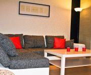
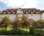
If you need a place to sleep, we compiled a list of available hotels close to the map centre further down the page.
Depending on your travel schedule, you might want to pay a visit to some of the following locations: Bad Salzungen, Leimbach, Barchfeld, Tiefenort and Urnshausen. To further explore this place, just scroll down and browse the available info.
Local weather forecast
Todays Local Weather Conditions & Forecast: 11°C / 52 °F
| Morning Temperature | 4°C / 40 °F |
| Evening Temperature | 6°C / 44 °F |
| Night Temperature | 5°C / 42 °F |
| Chance of rainfall | 0% |
| Air Humidity | 60% |
| Air Pressure | 1025 hPa |
| Wind Speed | Light breeze with 4 km/h (2 mph) from North |
| Cloud Conditions | Broken clouds, covering 74% of sky |
| General Conditions | Broken clouds |
Wednesday, 6th of November 2024
12°C (53 °F)
5°C (41 °F)
Few clouds, light breeze.
Thursday, 7th of November 2024
11°C (53 °F)
5°C (41 °F)
Sky is clear, light breeze, few clouds.
Friday, 8th of November 2024
12°C (53 °F)
6°C (42 °F)
Few clouds, light breeze.
Hotels and Places to Stay
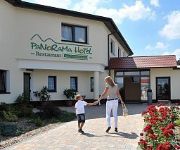
Panorama Hotel Am Frankenstein
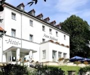
Haus Elisabeth
Haus Hufeland
solewerk
Zur Grünen Kutte Landhotel
Rhön Feeling Freizeithotel
Morgenweck Pension
Videos from this area
These are videos related to the place based on their proximity to this place.
By train from SULZANGEN to BACHSTEIN and back by bus.
By train from "Sulzangen" to "Bachstein" and take the bus back - this is new DC Car Model Railway in H0 scale 1:87 in July 2012. One module and the parade route are still under construction....
Bad Salzungen 2001
Bad Salzungen und Umgebung im Jahre 2001 gefilmt mit der Sony Handycam "DCR-PC110E " und bearbeitet mit der Cyberlink Software "Power Director 10 Ultra".
Modellbahn - Zug und Bahnübergang - train and railroad crossing - 電車と踏切
Endlich gelungen: Die H0-Bahn fährt vollständig computergesteuert einschließlich Schrankensteuerung und blinkenden Andreaskreuzen. Software: Windigipet Small Version. Finally succeeded:...
Impressionen aus Bad Salzungen
Fotos aus der Kurstadt Bad Salzungen in Thüringen rund um den Burgsee. Alle Fotos auch unter Flickr: https://www.flickr.com/photos/snowflake86/sets/72157647023253319/ ○ Bewerten, ...
Wunderbeere, Wunderbeeren, Miracle Fruit, Miraculin
Deutschlands erster Wunderbeeren Shop: http://www.wunderbeere.de Check out the first miracle fruit online shop in germany.
Keltenbad kurz & knapp-SOLE | GESUND | ZEIT | KARTE
Informationen zu unserer SOLE | GESUND | ZEIT | KARTE. 25 Stunden Baden und Saunieren zum Festpreis von 65€ monatlich. Dabei sind Reststunden auf den Folgemonat übertragbar.
Legoanlage - 2010.mpg
Sie sehen auf diesem Video gesammelte Legobaukästen von über 20 Jahre. Daraus wurde eine Legoanlage gebaut. Der weiße ICE wurde mit eine Pendelzugautomatik ausgebaut. Es sind auch ...
P1060378 Gradierung über Schwarzdorn im Gradierwerk Bad Salzungen Torsten Sparmann, Dresden
Gradierwerke werden in Deutschland heute oft zu Kurzwecken betrieben und sind deshalb besonders häufig in Kurorten vorzufinden. Durch die herabrieselnde Sole wird die Luft in der Nähe des...
Plandampf im Werratal 2014
Vom 10. - 12. April 2014 war im Werratal wieder Plandampfzeit. Nachdem in den letzten Jahren die Eisenacher 41 Unterstützung durch die Baureihe 44 erhalten hatte, wurde sie in diesem Jahr...
Videos provided by Youtube are under the copyright of their owners.
Attractions and noteworthy things
Distances are based on the centre of the city/town and sightseeing location. This list contains brief abstracts about monuments, holiday activities, national parcs, museums, organisations and more from the area as well as interesting facts about the region itself. Where available, you'll find the corresponding homepage. Otherwise the related wikipedia article.
Wartburg
The Wartburg is a castle situated on a 1230-foot (410-m) precipice to the southwest of, and overlooking the town of Eisenach, in the state of Thuringia, Germany. In 1999 UNESCO added Wartburg Castle to the World Heritage List as an "Outstanding Monument of the Feudal Period in Central Europe", citing its "Cultural Values of Universal Significance".
Wartburgkreis
Wartburgkreis is a Kreis in the west of Thuringia, Germany. Neighboring districts are (from the north clockwise) the districts Unstrut-Hainich, Gotha, Schmalkalden-Meiningen, and the districts Fulda, Hersfeld-Rotenburg and Werra-Meißner in Hesse. The district-free city Eisenach is nearly completely surrounded by the district.
Altenstein
Schloss Altenstein, in Germany, is a palace upon a rocky mountain in Saxe-Meiningen, on the south-western slope of the Thuringian Forest, not far from Eisenach. It was the summer residence of the Dukes of Meiningen, and is surrounded by a 160 hectares (1.6 square kilometres) noble park, which contains, among other objects of interest, a remarkable underground cavern, 500 ft. long, through which flows a large and rapid stream.
Krayenburg
The Krayenburg was a castle situated on the Krayenberg, having the townships of Tiefenort and Merkers-Kieselbach at its foot, and overlooking an extensive section of the Werratal. The history of the Krayenburg castle began on 31 August 786 when Charlemagne gave the village of Dorndorf, including all of its belongings, to Hersfeld Abbey. The abbey built the Krayenburg to protect its newly gained property.
Krayenberg
The Krayenberg is a 431-metre hill near Tiefenort, Germany. Since 500 BCE it was a rampart and served as a refuge for the central part of the Werratal. It became important for German history due to the Krayenburg, which was built on its top after 786, and destroyed starting with the Thirty Years' War. Today, the well-maintained ruins, a restaurant and a hotel define a tourist location in the Werratal.
Barchfeld (Verwaltungsgemeinschaft)
Barchfeld is a former Verwaltungsgemeinschaft in the district Wartburgkreis in Thuringia, Germany. The seat of the Verwaltungsgemeinschaft was in Barchfeld. It was disbanded on 31 December 2012. The Verwaltungsgemeinschaft Barchfeld consisted of the following municipalities: Barchfeld
Berka/Werra (Verwaltungsgemeinschaft)
Berka/Werra is a Verwaltungsgemeinschaft in the district Wartburgkreis in Thuringia, Germany. The seat of the Verwaltungsgemeinschaft is in Berka/Werra. The Verwaltungsgemeinschaft Berka/Werra consists of the following municipalities: Berka/Werra Dankmarshausen Dippach
Dermbach (Verwaltungsgemeinschaft)
Dermbach is a Verwaltungsgemeinschaft in the district Wartburgkreis in Thuringia, Germany. The seat of the Verwaltungsgemeinschaft is in Dermbach. The Verwaltungsgemeinschaft Dermbach consists of the following municipalities: Brunnhartshausen Dermbach Neidhartshausen Oechsen Urnshausen Weilar Wiesenthal
Oberes Feldatal
Oberes Feldatal is a Verwaltungsgemeinschaft in the district Wartburgkreis in Thuringia, Germany. The seat of the Verwaltungsgemeinschaft is in Kaltennordheim. The Verwaltungsgemeinschaft Oberes Feldatal consists of the following municipalities: Andenhausen Diedorf Empfertshausen Fischbach/Rhön Kaltenlengsfeld Kaltennordheim
Wasungen-Amt Sand
Wasungen-Amt Sand is a Verwaltungsgemeinschaft ("collective municipality") in the district Schmalkalden-Meiningen, in Thuringia, Germany. The seat of the Verwaltungsgemeinschaft is in Wasungen. The Verwaltungsgemeinschaft Wasungen-Amt Sand consists of the following municipalities: Friedelshausen Hümpfershausen Mehmels Metzels Oepfershausen Schwallungen Unterkatz Wahns Wallbach Walldorf
Das verfluchte Jungfernloch
Das verfluchte Jungfernloch (German, literally "The damned maiden's hole") is a small rock cave on the eastern slope of a hill overlooking the Kälbergrund Valley in Eisenach, Germany, roughly 500m south of the Wartburg. It is the subject of a legend first attested in an anonymous collection of Volkssagen (folktales) published in Eisenach in 1795 and later retold by Ludwig Bechstein among others.
Schweina (river)
Schweina is a river of Thuringia, Germany.
Erbstrom
Erbstrom is a river of Thuringia, Germany.
Grumbach (Werra)
Grumbach (Werra) is a river of Thuringia, Germany.
Schmalkalde
Schmalkalde is a river of Thuringia, Germany.
Truse
Truse is a river of Thuringia, Germany.


