Safety Score: 3,0 of 5.0 based on data from 9 authorites. Meaning we advice caution when travelling to Germany.
Travel warnings are updated daily. Source: Travel Warning Germany. Last Update: 2024-08-13 08:21:03
Delve into Unterröppisch
The district Unterröppisch of Neutaubenpreskeln in Free State of Thuringia is a subburb in Germany about 130 mi south-west of Berlin, the country's capital town.
If you need a hotel, we compiled a list of available hotels close to the map centre further down the page.
While being here, you might want to pay a visit to some of the following locations: Crimla, Zedlitz, Hundhaupten, Endschutz and Hilbersdorf. To further explore this place, just scroll down and browse the available info.
Local weather forecast
Todays Local Weather Conditions & Forecast: 11°C / 52 °F
| Morning Temperature | 8°C / 47 °F |
| Evening Temperature | 11°C / 52 °F |
| Night Temperature | 11°C / 52 °F |
| Chance of rainfall | 2% |
| Air Humidity | 62% |
| Air Pressure | 1017 hPa |
| Wind Speed | Fresh Breeze with 17 km/h (10 mph) from North-East |
| Cloud Conditions | Overcast clouds, covering 100% of sky |
| General Conditions | Moderate rain |
Monday, 25th of November 2024
12°C (54 °F)
11°C (52 °F)
Broken clouds, moderate breeze.
Tuesday, 26th of November 2024
9°C (48 °F)
7°C (44 °F)
Light rain, moderate breeze, few clouds.
Wednesday, 27th of November 2024
7°C (45 °F)
8°C (47 °F)
Overcast clouds, fresh breeze.
Hotels and Places to Stay
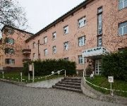
The Royal Inn Regent
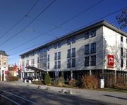
pentahotel Gera
Novotel Gera
City Partner Servicehotel Gewürzmühle
Am Galgenberg
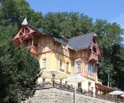
Zwergschlösschen Nichtraucherhotel
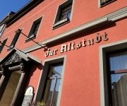
Zur Altstadt
Zum Aumatal Restaurant & Pension
Gasthof & Pension Frankenthal
Waldmeisterei Restaurant
Videos from this area
These are videos related to the place based on their proximity to this place.
Fahrerkabinenmitfahrt Linie 2 - 2009 - Gera und seine Straßenbahn
Auch kostenlos für Blu-ray Disc. Mehr Informationen dazu unter www.peter-ruppert.de Gera und seine Straßenbahn - Fahrerkabinenmitfahrt mit der Linie 2. Die Haltestellen für eine direkte...
Löschzug BF Gera FW Süd
rescueman112 auf Facebook! http://www.facebook.com/pages/Rescueman112/169198463108592 Einsatzfahrt Löschzug der Berufsfeuerwehr Gera FW Süd 05.2012.
GERA TRAMS JUNE 2010
a trailer for www.pmpfilms.com , the worlds largest range of transport films, see website for shopping, links and list.
MTW + LKW mt Radlader THW OV Gera
Einsatzfahrt des THW Gera zu einem Brandeinsatz im Altenburger Land (Monstab) am 18.10.09 gegen 19:30 Uhr.
TSF-W FF Gera-Frankenthal [Unwetter 05.07.2012]
rescueman112 auf Facebook! http://www.facebook.com/pages/Rescueman112/169198463108592 Einsatzfahrt Tragkraftspritzenfahrzeug mit Wasser (TSF-W) der Freiwilligen Feuerwehr ...
Gera und seine Straßenbahn - DVD1 - Zusammenfassung
Mehr Informationen und Bilder: http://www.peter-ruppert.de Und dort auf "Video-Serie" klicken. . .
RTW ASB Gera [Unwetter 05.07.2012]
rescueman112 auf Facebook! http://www.facebook.com/pages/Rescueman112/169198463108592 Einsatzfahrt Rettungswagen (RTW) des ASB Gera beim schweren Unwetter am 05.07.2012.
HGrKw LPI Gera Einsatzunterstützung
rescueman112 auf Facebook! http://www.facebook.com/pages/Rescueman112/169198463108592 Einsatzfahrt Halbgruppenkraftwagen (HGrKw) der Landespolizeiinspektion (LPI) Gera ...
Videos provided by Youtube are under the copyright of their owners.
Attractions and noteworthy things
Distances are based on the centre of the city/town and sightseeing location. This list contains brief abstracts about monuments, holiday activities, national parcs, museums, organisations and more from the area as well as interesting facts about the region itself. Where available, you'll find the corresponding homepage. Otherwise the related wikipedia article.
Greiz (district)
Greiz is a Kreis in the east of Thuringia, Germany. Neighboring districts are (from the west clockwise) Saale-Holzland, Saale-Orla, district-free city Gera, the Burgenlandkreis in Saxony-Anhalt, Altenburger Land, and the two Saxon districts Zwickauer Land and Vogtlandkreis.
Triebes
Triebes is a suburb of Zeulenroda-Triebes in Thuringia, Germany. Triebes was mentioned in a document the first time in 1209. 2006 Triebes merged with Zeulenroda.
1. FC Gera 03
1. FC Gera 03 is a German association football club located in Gera, Thuringia.
Weida (river)
The Weida is a non-navigable river in eastern Thuringia, Germany, left tributary of the Weiße Elster. Most of its course is situated in the district of Greiz. The Weida's source is near Pausa in Saxony; it then flows through the Thüringer Schiefergebirge passing Zeulenroda-Triebes and through the eponymous Weida. It then feeds into the Weiße Elster near Wünschendorf. Its tributaries include the Auma and the Leuba.
Leubatal
Leubatal is a Verwaltungsgemeinschaft ("collective municipality") in the district of Greiz, in Thuringia, Germany. The seat of the Verwaltungsgemeinschaft is in Hohenleuben. The Verwaltungsgemeinschaft Leubatal consists of the following municipalities: Hain Hohenleuben Hohenölsen Kühdorf Lunzig Neugernsdorf Schömberg Steinsdorf Teichwitz
Am Brahmetal
Am Brahmetal is a Verwaltungsgemeinschaft ("collective municipality") in the district of Greiz, in Thuringia, Germany. Since 1991 the seat of the Verwaltungsgemeinschaft is in Großenstein. One year later the name of the Verwaltungsgemeinschaft changed from Oberes Sprottetal to Am Brahmetal. The Verwaltungsgemeinschaft Am Brahmetal consists of the following municipalities: Bethenhausen Brahmenau Großenstein Hirschfeld Korbußen Pölzig Reichstädt
Auma-Weidatal (Verwaltungsgemeinschaft)
Auma-Weidatal was a Verwaltungsgemeinschaft ("collective municipality") in the district of Greiz, in Thuringia, Germany. The seat of the Verwaltungsgemeinschaft was in Auma. The Verwaltungsgemeinschaft was disbanded on 1 December 2011, when its constituent municipalities were merged into the towns Auma-Weidatal (formed at the same date) and Zeulenroda-Triebes.
Ländereck
Ländereck is a Verwaltungsgemeinschaft ("collective municipality") in the district of Greiz, in Thuringia, Germany. The seat of the Verwaltungsgemeinschaft is in Seelingstädt. The Verwaltungsgemeinschaft Ländereck consists of the following municipalities: Braunichswalde Endschütz Gauern Hilbersdorf Kauern Linda bei Weida Paitzdorf Rückersdorf Seelingstädt
Münchenbernsdorf (Verwaltungsgemeinschaft)
Münchenbernsdorf is a Verwaltungsgemeinschaft ("administrative municipality community") in the district of Greiz, in Thuringia, Germany. The seat of the Verwaltungsgemeinschaft is in the town of Münchenbernsdorf.
Heideland-Elstertal-Schkölen
Heideland-Elstertal-Schkölen is a Verwaltungsgemeinschaft ("collective municipality") in the district Saale-Holzland, in Thuringia, Germany. The seat of the Verwaltungsgemeinschaft is in Crossen an der Elster. The Verwaltungsgemeinschaft Heideland-Elstertal-Schkölen consists of the following municipalities: Crossen an der Elster Hartmannsdorf Heideland Rauda Schkölen Silbitz
Crossen Palace
Crossen Palace is a Baroque palace in the municipality of Crossen an der Elster in the east of the German federal state of Thuringia, located between Gera in the south and Zeitz in the north. It is situated on the hillside of Weiße Elster valley. The palace houses a ballroom with Italian Trompe-l'œil decorations in Baroque style. Currently, the palace is vacant and not open for public. Since 2007, it is owned by two investors from Ireland. Previously, it was owned by the State of Thuringia.
Stadion der Freundschaft (Gera)
Stadion der Freundschaft is a multi-use stadium in Gera, Germany. It is currently used for football and is the home stadium of 1. FC Gera 03. The stadium is able to hold 15,900 spectators and was built in 1954.
Botanischer Garten Gera
The Botanischer Garten Gera (0.7 hectares), also known as the Botanischer Garten der Museum für Naturkunde Gera, is a botanical garden located on the grounds of the Museum für Naturkunde der Stadt Gera at Nicolaistrasse 6, Gera, Thuringia, Germany. It is open daily without charge. The garden was created from 1897-1900 in the English garden style, and is the last surviving garden in front of the eastern wall. It was linked to the municipal Museum of Natural History in 1947.
Gera Central Station
Gera Central Station (Gera Hauptbahnhof) is the main station of the Thuringian town of Gera. Gera is one of the largest cities in Germany with no long-distance rail connections and no electrified lines. The station is a significant regional transport hub. The station is classified by Deutsche Bahn as a category 3 station.
Forstgraben
Forstgraben is a river of Bavaria, Germany.
Trams in Gera
The Gera tramway network forms part of the public transport system in Gera, in the federal state of Thuringia, Germany. Opened in 1883, the network is currently operated by Geraer Verkehrsbetrieb GmbH (GVB).
Auma (river)
Auma is a river of Thuringia, Germany.






!['TSF-W FF Gera-Frankenthal [Unwetter 05.07.2012]' preview picture of video 'TSF-W FF Gera-Frankenthal [Unwetter 05.07.2012]'](https://img.youtube.com/vi/1lOJJsnfSJw/mqdefault.jpg)

!['RTW ASB Gera [Unwetter 05.07.2012]' preview picture of video 'RTW ASB Gera [Unwetter 05.07.2012]'](https://img.youtube.com/vi/9p9h3kE_n-M/mqdefault.jpg)
