Safety Score: 3,0 of 5.0 based on data from 9 authorites. Meaning we advice caution when travelling to Germany.
Travel warnings are updated daily. Source: Travel Warning Germany. Last Update: 2024-08-13 08:21:03
Touring Blatterndorf
Blatterndorf in Free State of Thuringia is a town located in Germany about 179 mi (or 288 km) south-west of Berlin, the country's capital place.
Time in Blatterndorf is now 08:18 AM (Friday). The local timezone is named Europe / Berlin with an UTC offset of one hour. We know of 11 airports nearby Blatterndorf, of which 5 are larger airports. The closest airport in Germany is Bamberg-Breitenau Airport in a distance of 32 mi (or 52 km), South. Besides the airports, there are other travel options available (check left side).
There are several Unesco world heritage sites nearby. The closest heritage site in Germany is Town of Bamberg in a distance of 35 mi (or 56 km), South. Need some hints on where to stay? We compiled a list of available hotels close to the map centre further down the page.
Being here already, you might want to pay a visit to some of the following locations: Bachfeld, Sonneberg, Lautertal, Sachsenbrunn and Judenbach. To further explore this place, just scroll down and browse the available info.
Local weather forecast
Todays Local Weather Conditions & Forecast: -1°C / 30 °F
| Morning Temperature | -3°C / 26 °F |
| Evening Temperature | -2°C / 29 °F |
| Night Temperature | -1°C / 30 °F |
| Chance of rainfall | 4% |
| Air Humidity | 88% |
| Air Pressure | 1005 hPa |
| Wind Speed | Moderate breeze with 11 km/h (7 mph) from East |
| Cloud Conditions | Overcast clouds, covering 100% of sky |
| General Conditions | Snow |
Saturday, 23rd of November 2024
-0°C (31 °F)
-1°C (30 °F)
Light snow, moderate breeze, overcast clouds.
Sunday, 24th of November 2024
4°C (39 °F)
1°C (35 °F)
Light rain, light breeze, overcast clouds.
Monday, 25th of November 2024
5°C (42 °F)
5°C (40 °F)
Light rain, light breeze, overcast clouds.
Hotels and Places to Stay
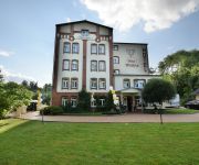
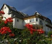
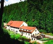
Triniushütte
Alte Mühle
Schöne Aussicht
Thomas-Müntzer Gasthof
Videos from this area
These are videos related to the place based on their proximity to this place.
Heftiger Donnerschlag eines positiven Blitzes (Gewitter, Unwetter, Naheinschlag)
Extrem gewaltiger Donnerschlag nach einem Naheinschlag eines positiven Blitzes. Leider konnte ich den Blitz nicht auf Film bannen. Das Gewitter brachte 32 mm Niederschlag, im 10 km entfernten...
NecAzubi 6.0
Die Ausbildungsmesse in Neustadt bei Coburg am 04. Mai 2012. 25 Unternehmen, 60 Berufe und mehr als 140 Ausbildungsstellen. Über 300 Schülerinnen und Schüler aus Neustadt, Ebersdorf und...
Einschlag eines positiven Blitzes (Gewitter, Unwetter, Naheinschlag)
Ein positiver Blitzeinschlag in ca. 4 km Entfernung. Neustadt bei Coburg 26.04.2014.
Toyota Starlet P8 beim Slalom vom AMC Coburg am 12.08.2012
Diesmal bin ich den Slalom in Neustadt bei Coburg mitgefahren. Auf dem sehr engen Kurs bin ich fast mit dem Lenken nicht nachgekommen und dementsprechend sind die Hütchen geflogen...
Stationäres Gewitter bringt 100 mm Niederschlag 26.07.2010
Am 26.07.2010 entlud dieses Gewitter innerhalb von ca. 4 Stunden 100 mm Niederschlag über Neustadt bei Coburg. Da blieb kein Keller trocken.
Blickpunkt Coburger Land - Stadt Neustadt b.Coburg - II. Quart. 2013
Die Stadt Neustadt b.Coburg im Landkreis Coburg stellt sich vor.
THE SILHOUETTES, Southern Cross
Die Silhouettes spielen zum Tanz in den Mai im Grüntal, Neustadt b. Coburg.
Videos provided by Youtube are under the copyright of their owners.
Attractions and noteworthy things
Distances are based on the centre of the city/town and sightseeing location. This list contains brief abstracts about monuments, holiday activities, national parcs, museums, organisations and more from the area as well as interesting facts about the region itself. Where available, you'll find the corresponding homepage. Otherwise the related wikipedia article.
Effelder (river)
Effelder is a 15km tributary river of the Itz in the Sonneberg and Coburg.
Retschenbach
Retschenbach is a river of Thuringia, Germany.


