Safety Score: 3,0 of 5.0 based on data from 9 authorites. Meaning we advice caution when travelling to Germany.
Travel warnings are updated daily. Source: Travel Warning Germany. Last Update: 2024-08-13 08:21:03
Delve into Bischleben-Stedten
Bischleben-Stedten in Free State of Thuringia is located in Germany about 152 mi (or 244 km) south-west of Berlin, the country's capital town.
Current time in Bischleben-Stedten is now 02:05 PM (Thursday). The local timezone is named Europe / Berlin with an UTC offset of one hour. We know of 11 airports close to Bischleben-Stedten, of which 5 are larger airports. The closest airport in Germany is Erfurt Airport in a distance of 4 mi (or 6 km), North. Besides the airports, there are other travel options available (check left side).
There are several Unesco world heritage sites nearby. The closest heritage site in Germany is Classical Weimar in a distance of 16 mi (or 25 km), East. If you need a hotel, we compiled a list of available hotels close to the map centre further down the page.
While being here, you might want to pay a visit to some of the following locations: Ichtershausen, Kirchheim, Rockhausen, Erfurt and Arnstadt. To further explore this place, just scroll down and browse the available info.
Local weather forecast
Todays Local Weather Conditions & Forecast: 2°C / 36 °F
| Morning Temperature | -1°C / 31 °F |
| Evening Temperature | -1°C / 31 °F |
| Night Temperature | -1°C / 31 °F |
| Chance of rainfall | 0% |
| Air Humidity | 70% |
| Air Pressure | 1001 hPa |
| Wind Speed | Moderate breeze with 13 km/h (8 mph) from East |
| Cloud Conditions | Overcast clouds, covering 96% of sky |
| General Conditions | Light snow |
Friday, 22nd of November 2024
1°C (34 °F)
0°C (33 °F)
Rain and snow, fresh breeze, overcast clouds.
Saturday, 23rd of November 2024
3°C (37 °F)
3°C (37 °F)
Broken clouds, moderate breeze.
Sunday, 24th of November 2024
9°C (49 °F)
10°C (51 °F)
Light rain, fresh breeze, overcast clouds.
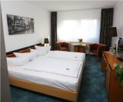
Hotels and Places to Stay
Dorint Hotel am Dom Erfurt
Hotel Krämerbrücke Erfurt
Victors Residenz
Airport
Best Western Plus Excelsior
Pension Wegerich
Zumnorde am Anger
Amplonius Pension
Apartments Junger-Moritz
Altstadtperle
Videos from this area
These are videos related to the place based on their proximity to this place.
MARIENTHALBRÜCKE und die UNSTRUT am 1. Juni 2013
Die Apfelstädt an der Marienthalbrücke bei Molsdorf und die Unstrut bei Schallenburg.
Töpfermühle Möbisburg - vielwert GbR - Imagefilm
Die Töpfermühle Möbisburg bat uns darum einen emotionalen, aber auch realistischen Imagefilm zu erstellen. Der Wunsch war uns wiederum Ausdruck unserer persönlichen Vorstellungen.
HOCHWASSER der GERA am Dreienbrunnenbad in Erfurt zum 1. Juni 2013
Hochwasserbilder der Region: https://plus.google.com/photos/114742080378648360982/albums/5885176186318562977 Siehe auch: https://www.youtube.com/watch?v=MSF1gWqsTW0 Siehe auch: ...
HOCHWASSER der GERA bei Erfurt und Umgebung am 27. Mai 2013
Hochheim - Bischleben - Möbisburg - Apfelstädt So die Reihenfolge im Video. Der Wasserstand der GERA, die durch Erfurt und seine Vororte fließt, hat einen sehr hohen Pegel. Betroffen sind...
Videos provided by Youtube are under the copyright of their owners.
Attractions and noteworthy things
Distances are based on the centre of the city/town and sightseeing location. This list contains brief abstracts about monuments, holiday activities, national parcs, museums, organisations and more from the area as well as interesting facts about the region itself. Where available, you'll find the corresponding homepage. Otherwise the related wikipedia article.
Messehalle
The Messehalle is an indoor arena, in Erfurt, Germany. Its seating capacity is roughly 12,000 people. The arena has hosted concerts by many famous artists, spanning many different genres.
Thörey
For the German village, see Thörey Thorey Thorey is located in FranceThoreyThorey Location within Burgundy region BurgundyThoreyThorey Administration Country France Region Burgundy Department Yonne Arrondissement Avallon Canton Cruzy-le-Châtel Statistics Elevation 182–336 m ( ) Land area 6.93 km Population 52 - Density 8 /km INSEE/Postal code 89413/ 89430 French Land Register data, which excludes lakes, ponds, glaciers > 1 km² (0.386 sq mi or 247 acres) and river estuaries.
Apfelstädt (Gera)
Apfelstädt (Gera) is a river of Thuringia, Germany.


