Safety Score: 3,0 of 5.0 based on data from 9 authorites. Meaning we advice caution when travelling to Germany.
Travel warnings are updated daily. Source: Travel Warning Germany. Last Update: 2024-08-13 08:21:03
Discover Sewekow
Sewekow in Brandenburg is a place in Germany about 59 mi (or 95 km) north-west of Berlin, the country's capital city.
Current time in Sewekow is now 11:22 AM (Friday). The local timezone is named Europe / Berlin with an UTC offset of one hour. We know of 11 airports near Sewekow, of which 5 are larger airports. The closest airport in Germany is Neubrandenburg Airport in a distance of 36 mi (or 58 km), North-East. Besides the airports, there are other travel options available (check left side).
There are several Unesco world heritage sites nearby. The closest heritage site in Germany is Museumsinsel (Museum Island), Berlin in a distance of 59 mi (or 95 km), South-East. If you need a hotel, we compiled a list of available hotels close to the map centre further down the page.
While being here, you might want to pay a visit to some of the following locations: Heiligengrabe, Walsleben, Dabergotz, Neuruppin and Fehrbellin. To further explore this place, just scroll down and browse the available info.
Local weather forecast
Todays Local Weather Conditions & Forecast: 8°C / 47 °F
| Morning Temperature | 4°C / 38 °F |
| Evening Temperature | 9°C / 48 °F |
| Night Temperature | 9°C / 48 °F |
| Chance of rainfall | 0% |
| Air Humidity | 89% |
| Air Pressure | 1023 hPa |
| Wind Speed | Moderate breeze with 10 km/h (6 mph) from East |
| Cloud Conditions | Broken clouds, covering 56% of sky |
| General Conditions | Broken clouds |
Saturday, 16th of November 2024
8°C (47 °F)
7°C (44 °F)
Few clouds, moderate breeze.
Sunday, 17th of November 2024
6°C (43 °F)
4°C (39 °F)
Light rain, moderate breeze, overcast clouds.
Monday, 18th of November 2024
3°C (37 °F)
4°C (39 °F)
Light rain, moderate breeze, overcast clouds.
Hotels and Places to Stay
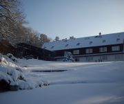
Seehotel Ichlim
Videos from this area
These are videos related to the place based on their proximity to this place.
Copterdrone bei KUHNLE TOURS zu Besuch im Hafendorf Rechlin Müritz
Ein Flug mit der Copter Drone in Rechlin im Hafendorf. Das milde Wetter im Januar 2014 und warme Sonnenstrahlen lockt mehr Urlauber und Touristen an die Müritz. Genießen auch Sie die ...
Yachthafen Rechlin, Müritz 2012 *****
Ein sonniger Tag im Yachthafen Rechlin, an der Müritz. Hier lebst du gut. Ein fünf * Hafen, mit allem Komfort und nettem Hafenmeistern. http://www.yachthafen-rechlin.de/ Created with MAGIX...
Spaziergang durch Rechlin - Tourismusgesellschaft Rechlin mbH
Tourismusgesellschaft Rechlin mbH Tourist-Information im Haus des Gastes Rechlin Müritzstraße 51 17248 Rechlin Tel. 039823 / 21261 Fax. 039823 / 21267 E-Mail: tourismus-rechlin@t-onlin...
Yachthafen Rechlin /Müritz / April 2012
Yachthafen Rechlin /Müritz / April 2012 Der erste warme Tag, mit Grill und Spaß. Created with MAGIX Video deluxe 17.
Yachthafen - Rechlin / Mai 2009 - Puerto de yate-Rechlin en Müritz. (el mayor lago de Alemania)
Der Yachthafen Rechlin , in der südlichen Müritz Region. Ein guter Hafen, mit kompletten Service, in idyllischer Lage. Link: http://www.yachthafen-rechlin.de/ http://www.capitano-online.de...
Yachthafen Rechlin
Die Saison beginnt. Ankunft der "Cuba Libre" im Yachthafen Rechlin an der Müritz., im Mai 2014.
Videos provided by Youtube are under the copyright of their owners.
Attractions and noteworthy things
Distances are based on the centre of the city/town and sightseeing location. This list contains brief abstracts about monuments, holiday activities, national parcs, museums, organisations and more from the area as well as interesting facts about the region itself. Where available, you'll find the corresponding homepage. Otherwise the related wikipedia article.
Thüren
Thüren is a lake in the Mecklenburgische Seenplatte district in Mecklenburg-Vorpommern, Germany. At an elevation of 62.1 m, its surface area is 1.72 km².
Müritzsee
Müritzsee is a lake in the Mecklenburgische Seenplatte district in Mecklenburg-Vorpommern, Germany. At an elevation of 62.1 m, its surface area is 1.385 km².


