Safety Score: 3,0 of 5.0 based on data from 9 authorites. Meaning we advice caution when travelling to Germany.
Travel warnings are updated daily. Source: Travel Warning Germany. Last Update: 2024-08-13 08:21:03
Delve into Mooshütte
Mooshütte in Upper Palatinate (Bavaria) is located in Germany about 234 mi (or 377 km) south of Berlin, the country's capital town.
Current time in Mooshütte is now 11:20 PM (Friday). The local timezone is named Europe / Berlin with an UTC offset of one hour. We know of 11 airports close to Mooshütte, of which 5 are larger airports. The closest airport in Germany is Straubing Airport in a distance of 32 mi (or 52 km), South-West. Besides the airports, there are other travel options available (check left side).
There are several Unesco world heritage sites nearby. The closest heritage site in Germany is Old town of Regensburg with Stadtamhof in a distance of 47 mi (or 76 km), West. We encountered 1 points of interest near this location. If you need a hotel, we compiled a list of available hotels close to the map centre further down the page.
While being here, you might want to pay a visit to some of the following locations: Lohberg, Bayerisch Eisenstein, Drachselsried, Langdorf and Boebrach. To further explore this place, just scroll down and browse the available info.
Local weather forecast
Todays Local Weather Conditions & Forecast: 5°C / 41 °F
| Morning Temperature | 2°C / 35 °F |
| Evening Temperature | 4°C / 39 °F |
| Night Temperature | 1°C / 34 °F |
| Chance of rainfall | 0% |
| Air Humidity | 84% |
| Air Pressure | 1028 hPa |
| Wind Speed | Calm with 2 km/h (1 mph) from North-East |
| Cloud Conditions | Overcast clouds, covering 93% of sky |
| General Conditions | Overcast clouds |
Saturday, 16th of November 2024
7°C (44 °F)
1°C (33 °F)
Sky is clear, light breeze, clear sky.
Sunday, 17th of November 2024
5°C (40 °F)
2°C (36 °F)
Rain and snow, gentle breeze, few clouds.
Monday, 18th of November 2024
1°C (35 °F)
1°C (33 °F)
Snow, gentle breeze, overcast clouds.
Hotels and Places to Stay
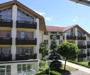
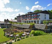
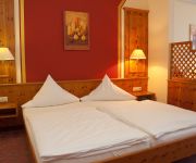
Fürstenbauer Sonnenhotel
Hofbraeuhaus
Hotel Sonnenhof
Böhmhof Wellness- & Vitalhotel
Kronberg
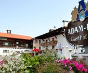
Adam-Braeu Wander und Aktivhotel
Stöberl Gasthof Metzgerei
Zum Hirschen
Hotel Waldblick
Rothbacher Hof
Videos from this area
These are videos related to the place based on their proximity to this place.
Johanneshof Bodenmais - Imagefilm
Mit einem wunderschönen, kleinen Film schenken wir Ihnen nun einen Einblick in den Johanneshof und seinem vielfältigen Programmangebot. Auch Aufnahmen vom Bayerischen Wald und ...
Rieslochfälle bei Bodenmais im Januar 2009
Rieslochfälle, der höchste Wasserfall des Bay.Waldes. Sie liegen unweit des Gr. Arber.
Joggingtour am 18.09.2014 im Bayerischen Wald von Bodenmais über die Rieslochfälle zum Großen Arber
Joggingtour am 18.09.2014 im Bayerischen Wald von Bodenmais über die Rieslochfälle zum Großen Arber - Film von Gaby und Thomas Schmidtkonz Mehr dazu: ...
Sonnenuntergang bei Bodenmais, Bayerischer Wald
Standpunkt Hochzell, unterhalb dem Startplatz der Gleitschimflieger. Liegt am Wanderweg Nr. 1 Bodenmais-Mittagsplatzl.
Glasparadies Bodenmais (HD)
Erlebniswelten http://bit.ly/14E3x9S * Joska Bodenmais - Information http://youtu.be/tDTXjOkbEYU bilderbunt * free ecards * www.bilderbunt.eu.
Bodenmais,Bayerischer Wald, Goldsteig
Unterwegs auf dem Goldsteig mit herrlichem Blick auf Großem und Kleinem Arber.
Johanneshof Bodenmais - virtueller Rundgang
Mit einem wunderschönen, kleinen Film schenken wir Ihnen nun einen Einblick in den Johanneshof und seinem vielfältigen Programmangebot. Auch Aufnahmen vom Bayerischen Wald und ...
Buchhüttenschachten bei Bodenmais, Bayerischer Wald
Zu errreichen über die Tourenabfahrt Arber-Bodenmais, oder den Winterwanderweg 2 und 2a ab Bodenmais oder Arberhochstraße.
Riesloch Wasserfälle in Bodenmais
Die Risßloch Wasserfälle liegen im schönen Bodenmais (Regen) nahe der tschechischen Grenze. Auf interessanten Wanderwegen bilden diese Wasserfälle immer wieder einen schönen ...
Videos provided by Youtube are under the copyright of their owners.
Attractions and noteworthy things
Distances are based on the centre of the city/town and sightseeing location. This list contains brief abstracts about monuments, holiday activities, national parcs, museums, organisations and more from the area as well as interesting facts about the region itself. Where available, you'll find the corresponding homepage. Otherwise the related wikipedia article.
Großer Arber
Großer Arber is the highest peak of the Bavarian-Bohemian-mountain ridge, with an elevation of 1,456 metres . Although geographically belonging to the Bohemian Forest, it is often referred to as "King of the Bavarian Forest". It is one of Germany's most famous skiing resorts besides the Bavarian Alps. Großer Arber and the woodlands down to Bayerisch Eisenstein are in the possession of the Prince of Hohenzollern.
Großer Arbersee
Großer Arbersee is a lake in Bayerischer Wald, Bavaria, Germany. At an elevation of 935 m, its surface area is 7.7 ha.
Kleiner Arbersee
Kleiner Arbersee is a lake in Bayerischer Wald, Bavaria, Germany. At an elevation of 918 m, its surface area is 9.4 ha.
Kleiner Arber
Kleiner Arber is a mountain of Bavaria, Germany.
Hindenburgkanzel
Hindenburgkanzel is a mountain of Bavaria, Germany.
Mittagsplatzl
Mittagsplatzl is a mountain of Bavaria, Germany.
Zwercheck
Zwercheck is a mountain of Bavaria, Germany.


