Safety Score: 3,0 of 5.0 based on data from 9 authorites. Meaning we advice caution when travelling to Germany.
Travel warnings are updated daily. Source: Travel Warning Germany. Last Update: 2024-08-13 08:21:03
Discover Jägershof
Jägershof in Upper Palatinate (Bavaria) is a place in Germany about 223 mi (or 360 km) south of Berlin, the country's capital city.
Current time in Jägershof is now 01:26 AM (Saturday). The local timezone is named Europe / Berlin with an UTC offset of one hour. We know of 11 airports near Jägershof, of which 5 are larger airports. The closest airport in Germany is Straubing Airport in a distance of 36 mi (or 57 km), South-West. Besides the airports, there are other travel options available (check left side).
There are several Unesco world heritage sites nearby. The closest heritage site in Germany is Old town of Regensburg with Stadtamhof in a distance of 46 mi (or 74 km), South-West. We encountered 1 points of interest in the vicinity of this place. If you need a hotel, we compiled a list of available hotels close to the map centre further down the page.
While being here, you might want to pay a visit to some of the following locations: Arrach, Hohenwarth, Rimbach, Lohberg and Grafenwiesen. To further explore this place, just scroll down and browse the available info.
Local weather forecast
Todays Local Weather Conditions & Forecast: 1°C / 34 °F
| Morning Temperature | 0°C / 33 °F |
| Evening Temperature | -1°C / 30 °F |
| Night Temperature | 1°C / 35 °F |
| Chance of rainfall | 3% |
| Air Humidity | 86% |
| Air Pressure | 1026 hPa |
| Wind Speed | Fresh Breeze with 13 km/h (8 mph) from East |
| Cloud Conditions | Overcast clouds, covering 98% of sky |
| General Conditions | Snow |
Sunday, 24th of November 2024
7°C (44 °F)
6°C (43 °F)
Overcast clouds, gentle breeze.
Monday, 25th of November 2024
10°C (50 °F)
4°C (38 °F)
Few clouds, light breeze.
Tuesday, 26th of November 2024
7°C (44 °F)
4°C (39 °F)
Light rain, gentle breeze, overcast clouds.
Hotels and Places to Stay
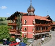
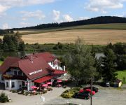
Parkhotel Böhmerwald
Pension Všeruby
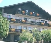
Schamberger Gasthof - Pension
Kolping Ferienhaus Lambach
Gasthaus-Pension Kolmsteiner Hof
Videos from this area
These are videos related to the place based on their proximity to this place.
Robin Haxhi Krasniqi (42-3-0 (16)) auf der Höllhöhe
Der Internationale Meister im Halbschwergewicht (WBO) in der allgemeinen Trainingsvorbereitung.
Hohenbogen (Neukirchen-Bayerischer Wald)
dieser Kurzfilm zeigt gesammelte Eindrücke rund um den Hohenbogen nahe Neukirchen beim Heiligen Blut. Man kann zu Fuß - oder so wie wir mit der Sesselbahn hochfahren und dann die ...
Der F.C. Moas Legends spielt Fußball Teil 1
Spieler des F.C. Moas Legends zeigen ihre Fußballkünste.
Powerlifting: Oggy kurz vor dem Jahreswechsel...
Christian aus dem Team Eisenhart der Sportschule Vitalis in Neukirchen beim Heiligen Blut bei seiner Abschlusseinheit für das Jahr 2014...
The 2012 DM/BM - OK/PL SOTA Tour
The 2012 DM/BM - OK/PL SOTA Tour by Franz ON9CBQ and Peter ON4UP. Following summits were activated: OK/PL-028 (Koráb), OK/PL-043 (Rýzmberk), OK/PL-010 (Mustek), OK/PL-013 (Pancír), ...
Wannderung zum großen Osser
Ein kleines Video von einem Wunderbahren Wander-Tag auf den großen Osser im Bayrischen Wald.
Videos provided by Youtube are under the copyright of their owners.
Attractions and noteworthy things
Distances are based on the centre of the city/town and sightseeing location. This list contains brief abstracts about monuments, holiday activities, national parcs, museums, organisations and more from the area as well as interesting facts about the region itself. Where available, you'll find the corresponding homepage. Otherwise the related wikipedia article.
Rothenbaum
Rothenbaum was a Sudetenland hamlet, situated about 1 km east of the border to Bavaria. Following the Expulsion of Germans from Czechoslovakia after World War II, the deserted place, now called Červené Dřevo, was destroyed, and Czechoslovakian border fortifications during the Cold War were installed. In the late 1990s, the expellees erected a memorial in the ruins of the church. In today's Czech Republic, the closest inhabited place is Fleky (Flecken, German for spot).


