Safety Score: 3,0 of 5.0 based on data from 9 authorites. Meaning we advice caution when travelling to Germany.
Travel warnings are updated daily. Source: Travel Warning Germany. Last Update: 2024-08-13 08:21:03
Discover Seubersdorf
Seubersdorf in Upper Franconia (Bavaria) is a city in Germany about 195 mi (or 314 km) south-west of Berlin, the country's capital city.
Local time in Seubersdorf is now 04:06 AM (Friday). The local timezone is named Europe / Berlin with an UTC offset of one hour. We know of 12 airports in the vicinity of Seubersdorf, of which 5 are larger airports. The closest airport in Germany is Bayreuth Airport in a distance of 16 mi (or 25 km), East. Besides the airports, there are other travel options available (check left side).
There are several Unesco world heritage sites nearby. The closest heritage site in Germany is Margravial Opera House Bayreuth in a distance of 14 mi (or 23 km), South-East. Looking for a place to stay? we compiled a list of available hotels close to the map centre further down the page.
When in this area, you might want to pay a visit to some of the following locations: Weismain, Stadelhofen, Altenkunstadt, Konigsfeld and Plankenfels. To further explore this place, just scroll down and browse the available info.
Local weather forecast
Todays Local Weather Conditions & Forecast: -0°C / 32 °F
| Morning Temperature | -3°C / 27 °F |
| Evening Temperature | -1°C / 31 °F |
| Night Temperature | -0°C / 32 °F |
| Chance of rainfall | 2% |
| Air Humidity | 88% |
| Air Pressure | 1006 hPa |
| Wind Speed | Moderate breeze with 12 km/h (8 mph) from East |
| Cloud Conditions | Overcast clouds, covering 93% of sky |
| General Conditions | Snow |
Saturday, 23rd of November 2024
1°C (34 °F)
1°C (34 °F)
Light snow, moderate breeze, overcast clouds.
Sunday, 24th of November 2024
6°C (43 °F)
2°C (35 °F)
Overcast clouds, gentle breeze.
Monday, 25th of November 2024
7°C (45 °F)
5°C (40 °F)
Light rain, light breeze, overcast clouds.
Hotels and Places to Stay
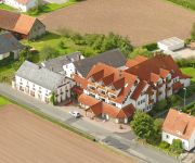
Fränkischer Hof
Videos from this area
These are videos related to the place based on their proximity to this place.
Wandern Franken: Felsengarten Sanspareil und Burg Zwernitz bei Wonsees
Herrlicher Spaziergng durch den Felsengarten der Markgräfin Wilhelmine und Besuch der Burg Zwernitz.
Die Kunstausstellung Drei Künstler aus Positano in Thurnau.mp4
THURNAU: Museumsfest und Ausstellungen zu den zweiten Kunst- und Kulturwochen -- Großer Andrang THURNAU: Gleich vierfachen Anlass zum Feiern hatten am Samstag die Besucher in Thurnau: ...
Feuerwerk Schloss Thurnau bei Kulmbach
Feuerwerk Thurnau, Feuerwerk am Schloss Thurnau by Event Pyrotechnik Kulmbach.
Burgenstraße im Spätherbst
Die Burgenstraße im Spätherbst, Diese Aufnahmen entstanden in Thurnau, Kulmbach, Pottenstein, Tüchersfeld, Gößweinstein, Rabeneck, Rabenstein und anderen Orten in der Fränkischen Schweiz...
100km - 1100Hm RR - Ausschnitte & GOILE Abfahrten [Virb ELITE] [HD]
Ich würde behaupten, dass diese Route hier in Oberfranken einer meiner Lieblingstrainingsstrecken ist. Insgesamt sind auf 102km 1116 Höhenmeter zu bewältigen, welche sich in mehreren Anstiegen.
NPD-Bayerntag 2012 - Sascha Roßmüller [2/2]
Sascha Roßmüller, stellv. NPD-Landesvorsitzender von Bayern spricht auf dem Bayerntag 2012 [Video 2/2] - Die Kommentare werden vor Veröffentlichung geprüft. - Aufnahme und Bearbeitung:...
NPD-Bayerntag 2012 - Holger Apfel [1/3]
Holger Apfel, NPD-Parteivorsitzender spricht auf dem Bayerntag 2012 [Video 1/3] - Aufnahme und Bearbeitung: © NPD Pforzheim http://bayerntag.npd-bayern.de/index.php -Das erneute Hochladen...
ASV Hollfeld - SpVgg Bayreuth (25.Spieltag Landesliga Nord 2011/12)
Hollfeld: Eck - Schmidt (74. Schorn), Gubitz, Goller, Taschner -Hollfelder, Hillemeier - Persigehl (83. Eberlein) - Sommerer, Jahrsdörfer, Heißenstein Bayreuth: Freiberger - Eckert, Mayr,...
Videos provided by Youtube are under the copyright of their owners.


!['100km - 1100Hm RR - Ausschnitte & GOILE Abfahrten [Virb ELITE] [HD]' preview picture of video '100km - 1100Hm RR - Ausschnitte & GOILE Abfahrten [Virb ELITE] [HD]'](https://img.youtube.com/vi/ps5GdE0d2VI/mqdefault.jpg)


!['NPD-Bayerntag 2012 - Sascha Roßmüller [2/2]' preview picture of video 'NPD-Bayerntag 2012 - Sascha Roßmüller [2/2]'](https://img.youtube.com/vi/m48ulSvKSwU/mqdefault.jpg)
!['NPD-Bayerntag 2012 - Holger Apfel [1/3]' preview picture of video 'NPD-Bayerntag 2012 - Holger Apfel [1/3]'](https://img.youtube.com/vi/olMKxDUfMBE/mqdefault.jpg)
