Safety Score: 3,0 of 5.0 based on data from 9 authorites. Meaning we advice caution when travelling to Germany.
Travel warnings are updated daily. Source: Travel Warning Germany. Last Update: 2024-08-13 08:21:03
Explore Lechenroth
Lechenroth in Upper Franconia (Bavaria) is a city in Germany about 196 mi (or 316 km) south-west of Berlin, the country's capital.
Local time in Lechenroth is now 10:36 PM (Saturday). The local timezone is named Europe / Berlin with an UTC offset of one hour. We know of 12 airports in the vicinity of Lechenroth, of which 5 are larger airports. The closest airport in Germany is Bamberg-Breitenau Airport in a distance of 21 mi (or 34 km), South. Besides the airports, there are other travel options available (check left side).
There are several Unesco world heritage sites nearby. The closest heritage site in Germany is Town of Bamberg in a distance of 23 mi (or 37 km), South. We found 3 points of interest in the vicinity of this place. If you need a place to sleep, we compiled a list of available hotels close to the map centre further down the page.
Depending on your travel schedule, you might want to pay a visit to some of the following locations: Pfarrweisach, Hellingen, Weitramsdorf, Untermerzbach and Ermershausen. To further explore this place, just scroll down and browse the available info.
Local weather forecast
Todays Local Weather Conditions & Forecast: 10°C / 50 °F
| Morning Temperature | 7°C / 45 °F |
| Evening Temperature | 9°C / 48 °F |
| Night Temperature | 3°C / 38 °F |
| Chance of rainfall | 0% |
| Air Humidity | 87% |
| Air Pressure | 1030 hPa |
| Wind Speed | Light breeze with 4 km/h (2 mph) from South-West |
| Cloud Conditions | Overcast clouds, covering 100% of sky |
| General Conditions | Overcast clouds |
Sunday, 3rd of November 2024
9°C (48 °F)
4°C (40 °F)
Broken clouds, light breeze.
Monday, 4th of November 2024
12°C (54 °F)
5°C (41 °F)
Sky is clear, light breeze, clear sky.
Tuesday, 5th of November 2024
11°C (52 °F)
6°C (42 °F)
Overcast clouds, calm.
Hotels and Places to Stay
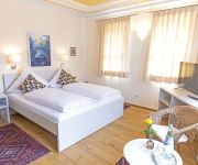
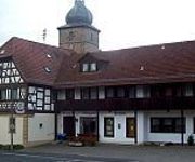
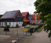
Pörtnerhof
Zur Sonne
Eisfelder Gasthof
Landgasthaus zum Seysingshof
Videos from this area
These are videos related to the place based on their proximity to this place.
Faschingsumzug Seßlach 12 02 2013
Der grosse Gaudiwurm in Seßlach der Faschingshochburg im Coburger Land am 12.02.2013 des Faschingsverein Seßlach e.V. bei etwa 8000 Zuschauern.
Blickpunkt Coburger Land - Stadt Sesslach - III. Quart. 2013
Die Stadt Seßlach im Landkreis Coburg stellt sich vor.
10 Jahre AN650 Forum
Treffen anlässlich des 10 jährigen bestehens des AN650 Forum, Treffen in Authenhausen bei Seßlach.
Christenstein 2005 Teil2
Felsenführung 2005 von Irene und Oswald Tränkenschuh am Christenstein bei Heilgersdorf Ufr. Germany. Felsgruppe Schalensteine, Partnerstein, Hexentanzplatz. Siehe auch Hompage www.
Fischotter im Tierpark Schloss Tambach
Leider war der Akku leer, somit blieb es bei diesem Schnipsel.
Cross Country Tambach Meyer Baumaschinen Promo ;)
Auch dieses Jahr durften wir in Tambach zum Cross-Country genannten Outdoorsportsfestival im Wildpark Tambach eine Mountainbiketrail anlegen. StepUp-StepDown und Kicker standen noch von ...
Renovierungsbedürftiges Bauernhaus mit Scheune und Waldgrundstück in Maroldsweisach
Renovierungsbedürftiges Bauernhaus mit Scheune und Waldgrundstück - Bauernhaus in Maroldsweisach - ObjNr: 6231-907 Hier sind Handwerker gefragt, die noch ordentlich zupacken können und...
Videos provided by Youtube are under the copyright of their owners.
Attractions and noteworthy things
Distances are based on the centre of the city/town and sightseeing location. This list contains brief abstracts about monuments, holiday activities, national parcs, museums, organisations and more from the area as well as interesting facts about the region itself. Where available, you'll find the corresponding homepage. Otherwise the related wikipedia article.
Erlebach
Erlebach was a village in Germany, founded in 837 A D. It was destroyed by the East German authorities in 1986 as it stood too close to the Inner German border (part of the larger "Iron Curtain"), the border between the post-war states of East and West Germany. It lay in the extreme south of Thuringia in the district of Hildburghausen, only a few hundred metres away from the Thuringian-Bavarian border. In December 1986, the last family left the village.


