Safety Score: 3,0 of 5.0 based on data from 9 authorites. Meaning we advice caution when travelling to Germany.
Travel warnings are updated daily. Source: Travel Warning Germany. Last Update: 2024-08-13 08:21:03
Delve into Grundfeld
Grundfeld in Upper Franconia (Bavaria) is a town located in Germany about 195 mi (or 314 km) south-west of Berlin, the country's capital town.
Time in Grundfeld is now 07:07 PM (Sunday). The local timezone is named Europe / Berlin with an UTC offset of one hour. We know of 12 airports closer to Grundfeld, of which 5 are larger airports. The closest airport in Germany is Bamberg-Breitenau Airport in a distance of 15 mi (or 24 km), South. Besides the airports, there are other travel options available (check left side).
There are several Unesco world heritage sites nearby. The closest heritage site in Germany is Town of Bamberg in a distance of 17 mi (or 28 km), South. We saw 3 points of interest near this location. In need of a room? We compiled a list of available hotels close to the map centre further down the page.
Since you are here already, you might want to pay a visit to some of the following locations: Lichtenfels, Untersiemau, Grossheirath, Niederfuellbach and Wattendorf. To further explore this place, just scroll down and browse the available info.
Local weather forecast
Todays Local Weather Conditions & Forecast: 10°C / 51 °F
| Morning Temperature | 2°C / 36 °F |
| Evening Temperature | 8°C / 46 °F |
| Night Temperature | 5°C / 41 °F |
| Chance of rainfall | 0% |
| Air Humidity | 71% |
| Air Pressure | 1019 hPa |
| Wind Speed | Light breeze with 5 km/h (3 mph) from North |
| Cloud Conditions | Overcast clouds, covering 96% of sky |
| General Conditions | Overcast clouds |
Monday, 25th of November 2024
10°C (50 °F)
9°C (48 °F)
Broken clouds, light breeze.
Tuesday, 26th of November 2024
9°C (48 °F)
4°C (39 °F)
Moderate rain, gentle breeze, broken clouds.
Wednesday, 27th of November 2024
7°C (45 °F)
9°C (47 °F)
Light rain, moderate breeze, overcast clouds.
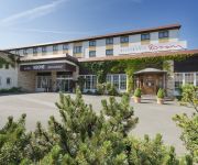
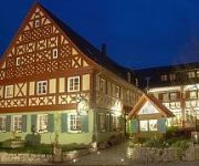
Hotels and Places to Stay
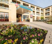
Best Western Plus Kurhotel an der Obermaintherme
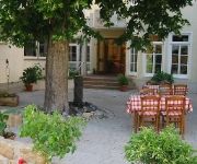
Zur schönen Schnitterin Gasthof
Schöpke Pension
Sankt Veit Pension
Krone Rist. Rossini
Staffelsteiner Hof
Erich Rödiger
Banzer Wald Berggasthof
Augustin Landferienhotel
Sonnenblick
Videos from this area
These are videos related to the place based on their proximity to this place.
Staffelberg Franken
So schön sieht man den Staffelberg selten. Schönes Wetter und wunderbare Perspektiven aus der Luft. Der Staffelberg ist ein 539 m ü. NN hoher, der Fränkischen Alb vorgelagerter Zeugenberg...
Zeltlager in Altenbanz des KJR Lichtenfels
In der ersten Augustwoche 2014 veranstaltete der Kreisjugendring Lichtenfels ein Zeltlager in Altenbanz, Oberfranken. Es war ein einmaliges Erlebnis für die Kids und ihre Betreuer. Ganz ohne...
Besuch der Freiwilligen Feuerwehr Stadt Lichtenfels
Bilder und mehr auf: http://www.ju-lichtenfels.de/kreis/
Videos provided by Youtube are under the copyright of their owners.
Attractions and noteworthy things
Distances are based on the centre of the city/town and sightseeing location. This list contains brief abstracts about monuments, holiday activities, national parcs, museums, organisations and more from the area as well as interesting facts about the region itself. Where available, you'll find the corresponding homepage. Otherwise the related wikipedia article.
Basilica of the Fourteen Holy Helpers
The Basilica of the Fourteen Holy Helpers (also Basilika Vierzehnheiligen) is a church located near the town of Bad Staffelstein near Bamberg, in Bavaria, southern Germany. The late Baroque-Rococo basilica, designed by Balthasar Neumann, was constructed between 1743 and 1772. It is dedicated to the Fourteen Holy Helpers, a group of saints venerated together in the Catholic Church, especially in Germany at the time of the Black Death.
Horsdorf
Horsdorf is a district of Bad Staffelstein in Upper Franconia. It has around 200 residents and won the gold in the state contest Unser Dorf soll schöner werden in 1995. It also won the gold in the European contest Entente Florale in 1997. In Horsdorf, there was an area of 5.08 Hectares in 1887, where wine was grown. This winery was ruined by the infestation of Grape Phylloxera. Today there is once again a vineyard in Horsdorf, where red wine is made.
Banz Abbey
Banz Abbey, now known as Banz Castle, is a former Benedictine monastery, since 1978 a part of the town of Bad Staffelstein north of Bamberg, Bavaria, southern Germany.
Staffelberg
Staffelberg is a mountain of Bavaria, Germany. It is part of the Franconian Switzerland and one of the most important landmarks in Franconia. First settlements date from the neolithic Stone Age. Romans, Celts and Franconians followed. Nowadays, it is a famous tourists' attraction - not only because of the great view over the Main valley. The Staffelberg is located next to Vierzehnheiligen and the district capitol of Lichtenfels. At the foot of the mountain there is the city Bad Staffelstein.
Lichtenfels station
Lichtenfels station is in the town of Lichtenfels in Upper Franconia in the German state of Bavaria. It is a regional rail hub and an ICE stop on the Hamburg–Berlin Munich route and is classified by Deutsche Bahn as a station of category 3.


