Safety Score: 3,0 of 5.0 based on data from 9 authorites. Meaning we advice caution when travelling to Germany.
Travel warnings are updated daily. Source: Travel Warning Germany. Last Update: 2024-08-13 08:21:03
Explore Dietersgrün
Dietersgrün in Upper Franconia (Bavaria) is located in Germany about 177 mi (or 285 km) south of Berlin, the country's capital.
Local time in Dietersgrün is now 09:32 PM (Thursday). The local timezone is named Europe / Berlin with an UTC offset of one hour. We know of 12 airports in the wider vicinity of Dietersgrün, of which 5 are larger airports. The closest airport in Germany is Hof-Plauen Airport in a distance of 21 mi (or 33 km), North-West. Besides the airports, there are other travel options available (check left side).
There are several Unesco world heritage sites nearby. The closest heritage site in Germany is Margravial Opera House Bayreuth in a distance of 29 mi (or 46 km), West. If you need a place to sleep, we compiled a list of available hotels close to the map centre further down the page.
Depending on your travel schedule, you might want to pay a visit to some of the following locations: Pechbrunn, Leonberg, Bad Brambach, Bad Alexandersbad and Wunsiedel. To further explore this place, just scroll down and browse the available info.
Local weather forecast
Todays Local Weather Conditions & Forecast: 0°C / 32 °F
| Morning Temperature | -2°C / 29 °F |
| Evening Temperature | -1°C / 31 °F |
| Night Temperature | -1°C / 30 °F |
| Chance of rainfall | 0% |
| Air Humidity | 81% |
| Air Pressure | 1002 hPa |
| Wind Speed | Moderate breeze with 11 km/h (7 mph) from East |
| Cloud Conditions | Overcast clouds, covering 94% of sky |
| General Conditions | Light snow |
Friday, 22nd of November 2024
-0°C (32 °F)
-1°C (31 °F)
Snow, fresh breeze, overcast clouds.
Saturday, 23rd of November 2024
-0°C (32 °F)
0°C (32 °F)
Light snow, fresh breeze, overcast clouds.
Sunday, 24th of November 2024
4°C (39 °F)
1°C (33 °F)
Overcast clouds, gentle breeze.
Hotels and Places to Stay
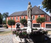
Weisses Ross
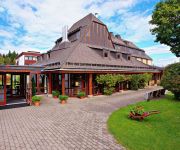
Haus Silberbach
Gasthof im Gsteinigt
Videos from this area
These are videos related to the place based on their proximity to this place.
Niemcy (Duetschland) A93 Marktredwitz Süd - Kreuz Oberpfälzer Wald x3
Przejazd drogą A93 Marktredwitz Süd - Kreuz Oberpfälzer Wald Niemcy (Duetschland)
backvorführung
Backvorführung von Küchle und Quarkspitzen beim Hoffest des Bauernladen Purucker und des Bauernhofcafes "Cafe Blüte" in Marktredwitz.
Foto Diashow
Rundflug vom Tröstauer Flugplatz nach Waldershof und Marktredwitz mit Umgebung. Flugdauer ca. 1 Stunde. Höhe bis zu 1100 Meter.
Bilder vom Hoffest 2012 des Bauernladens Purucker 2/3
Bilder von der Livecam des Bauernladens Purucker und des Hofcafes "Cafe Blüte" beim Hoffest am 01.07.2012.
[Schengen] Pomezí n. O. - Schirnding 07/14
Byłe przejście graniczne Pomezí nad Ohří - Schirnding. Kierunek Niemcy. Former border crossing Pomezi nad Ohri - Schirnding towards Germany.
Grenzübergang Schirnding Pomezi Mühlbach Border Crossing
Situation am Grenzübergang Situation at the border crossing after Schengen entry in July 2008 Driving from the Czech Republic to Germany.
Imagefilm Burg Hohenberg
Die telegen Filmproduktion von Kilian Reichert hat 2013 diesen Imagefilm für die Burg Hohenberg (Hohenberg an der Eger) produziert. Hochauflösend, bewegt und bewegend. So geht Imagefilm heute ...
Arzberg Eine Stadt im Wandel
Bericht des Bayern 3. Alle Rechte von Bayern 3. Original Link zum Bericht: http://br.de/s/10hmnwl Das Kraftwerk gesprengt, die Porzellanfabrik verfallen, die Aussichten düster. Mittlerweile...
20 Jahre PURUS PLASTICS - Arzberg
Nachhaltigkeit zeigt sich im Handeln, nicht nur im Denken. Oft bemängeln wir Dinge im Alltag ohne selbst an der Lösung mitzuwirken. So halten sich die Müllverbrennung und die zurückhaltende...
Videos provided by Youtube are under the copyright of their owners.
Attractions and noteworthy things
Distances are based on the centre of the city/town and sightseeing location. This list contains brief abstracts about monuments, holiday activities, national parcs, museums, organisations and more from the area as well as interesting facts about the region itself. Where available, you'll find the corresponding homepage. Otherwise the related wikipedia article.
Libá
Libá, formerly Libštejn, is a village and municipality in Cheb District in the Karlovy Vary Region of the Czech Republic.
Feisnitz
The Feisnitz is a river in Bavaria, Germany.


!['[Schengen] Pomezí n. O. - Schirnding 07/14' preview picture of video '[Schengen] Pomezí n. O. - Schirnding 07/14'](https://img.youtube.com/vi/PYLLnZls7Tw/mqdefault.jpg)


