Safety Score: 3,0 of 5.0 based on data from 9 authorites. Meaning we advice caution when travelling to Germany.
Travel warnings are updated daily. Source: Travel Warning Germany. Last Update: 2024-08-13 08:21:03
Discover Wolferkam
Wolferkam in Upper Bavaria (Bavaria) is a city in Germany about 327 mi (or 527 km) south of Berlin, the country's capital city.
Local time in Wolferkam is now 12:54 PM (Friday). The local timezone is named Europe / Berlin with an UTC offset of one hour. We know of 12 airports in the vicinity of Wolferkam, of which 5 are larger airports. The closest is airport we know is Salzburg Airport in Austria in a distance of 35 mi (or 57 km). The closest airport in Germany is Munich International Airport in a distance of 41 mi (or 57 km), East. Besides the airports, there are other travel options available (check left side).
There are several Unesco world heritage sites nearby. The closest heritage site is Historic Centre of the City of Salzburg in Austria at a distance of 37 mi (or 59 km). The closest in Germany is Pilgrimage Church of Wies in a distance of 64 mi (or 59 km), East. Looking for a place to stay? we compiled a list of available hotels close to the map centre further down the page.
When in this area, you might want to pay a visit to some of the following locations: Riedering, Frasdorf, Stephanskirchen, Prutting and Sochtenau. To further explore this place, just scroll down and browse the available info.
Local weather forecast
Todays Local Weather Conditions & Forecast: 6°C / 43 °F
| Morning Temperature | 1°C / 34 °F |
| Evening Temperature | 2°C / 36 °F |
| Night Temperature | 0°C / 33 °F |
| Chance of rainfall | 0% |
| Air Humidity | 61% |
| Air Pressure | 1029 hPa |
| Wind Speed | Light breeze with 3 km/h (2 mph) from North |
| Cloud Conditions | Overcast clouds, covering 100% of sky |
| General Conditions | Overcast clouds |
Saturday, 16th of November 2024
8°C (47 °F)
2°C (36 °F)
Sky is clear, light breeze, clear sky.
Sunday, 17th of November 2024
9°C (48 °F)
7°C (44 °F)
Light rain, gentle breeze, few clouds.
Monday, 18th of November 2024
4°C (39 °F)
2°C (35 °F)
Rain and snow, light breeze, overcast clouds.
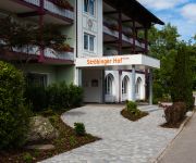
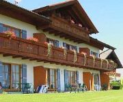
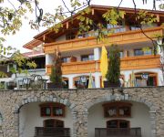
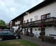
Hotels and Places to Stay
Residenz Heinz Winkler
Thermenhotel Ströbinger Hof
Weingarten Berggasthof
Kurfer Hof Landgasthaus
Hotel Blankhof Garni
Endorfer Hof
Goldener Pflug Landgasthof
Zur Post Gasthof
Hotel Alpenblick
Gschwingerhof
Videos from this area
These are videos related to the place based on their proximity to this place.
Zementlaster verliert bei Prutting seinen Sattelanhänger
11.03.2013: Ein Zementlaster ist am Montagmorgen zwischen Prutting und Söchtenau von der Fahrbahn abgekommen. Sein Anhänger löste sich und kippte um. Mehr Nachrichten aus der Region gibt...
Stimmung Tanz , Ring of Fire, Musikerschorsch
Geburtstagsfeier mit Stimmung Tanz und Frohsinn (Teil 2)
Schlaglöcher zwischen Bachham und Frasdorf
08.10.2013 - Unser User Johannes hat uns auf die vielen Schlaglöcher, auf der Staatsstraße 2093, zwischen Bachham und Frasdorf, aufmerksam gemacht. Wir haben uns die Situation jetzt selbst...
Tourismus in der Region: Christina Pfaffinger
Christina Pfaffinger, die Geschäftsleiterin der Chiemsee-Alpenland Tourismus GmbH über die Anforderungen an den moderne Tagungstourismus, vielfältige Rahmenprogramme und den Unterschied...
BikePark Samerberg 2014 Season Ending
Der letzte tag in der Saison bestes wetter / die nächste saison kann kommen.
Michi bei der Arbeit - 27.04.2013
Am 27.04.2013 - ein Samstag - was macht man da?! Richtig, der lieben Heidi helfen und einfach mal den Pferdestall ausmisten - und da das nicht so spektakulär wäre :) Habe ich mich etwas beeilt....
Timezone Bikepark Samerberg - Komplette Abfahrt
Abfahrt Timezone Bikepark Samerberg 29. Juni 2012 Gefahren mit Specialized Status FSR I Gefilmt mit GoPro HD Hero 2.
Videos provided by Youtube are under the copyright of their owners.
Attractions and noteworthy things
Distances are based on the centre of the city/town and sightseeing location. This list contains brief abstracts about monuments, holiday activities, national parcs, museums, organisations and more from the area as well as interesting facts about the region itself. Where available, you'll find the corresponding homepage. Otherwise the related wikipedia article.
Simssee
Simssee is a lake in Alpenvorland, Bavaria, Germany. At an elevation of 470.1 m, its surface area is 6.5 km².
Sims (river)
Sims is a river of Bavaria, Germany, near the country's southern border. It is approximately six kilometers long, and is fed by the Simssee, a small lake.


