Safety Score: 3,0 of 5.0 based on data from 9 authorites. Meaning we advice caution when travelling to Germany.
Travel warnings are updated daily. Source: Travel Warning Germany. Last Update: 2024-08-13 08:21:03
Discover Grattenbach
Grattenbach in Upper Bavaria (Bavaria) is a city in Germany about 336 mi (or 540 km) south of Berlin, the country's capital city.
Local time in Grattenbach is now 06:57 AM (Friday). The local timezone is named Europe / Berlin with an UTC offset of one hour. We know of 12 airports in the vicinity of Grattenbach, of which 5 are larger airports. The closest is airport we know is Salzburg Airport in Austria in a distance of 34 mi (or 54 km). The closest airport in Germany is Munich International Airport in a distance of 50 mi (or 54 km), East. Besides the airports, there are other travel options available (check left side).
There are several Unesco world heritage sites nearby. The closest heritage site is Historic Centre of the City of Salzburg in Austria at a distance of 35 mi (or 57 km). The closest in Germany is Pilgrimage Church of Wies in a distance of 65 mi (or 57 km), East. We discovered 1 points of interest in the vicinity of this place. Looking for a place to stay? we compiled a list of available hotels close to the map centre further down the page.
When in this area, you might want to pay a visit to some of the following locations: Rettenschoss, Walchsee, Frasdorf, Niederndorf and Schleching. To further explore this place, just scroll down and browse the available info.
Local weather forecast
Todays Local Weather Conditions & Forecast: 5°C / 42 °F
| Morning Temperature | -1°C / 30 °F |
| Evening Temperature | 1°C / 34 °F |
| Night Temperature | -0°C / 31 °F |
| Chance of rainfall | 0% |
| Air Humidity | 59% |
| Air Pressure | 1028 hPa |
| Wind Speed | Light breeze with 4 km/h (2 mph) from North |
| Cloud Conditions | Overcast clouds, covering 100% of sky |
| General Conditions | Overcast clouds |
Saturday, 16th of November 2024
8°C (47 °F)
1°C (34 °F)
Sky is clear, light breeze, clear sky.
Sunday, 17th of November 2024
8°C (47 °F)
5°C (41 °F)
Light rain, light breeze, scattered clouds.
Monday, 18th of November 2024
3°C (38 °F)
1°C (34 °F)
Rain and snow, light breeze, overcast clouds.
Hotels and Places to Stay
Residenz Heinz Winkler
Golf- und Sporthotel Moarhof Walchsee TIROL
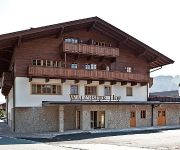
Walchseer Hof
Die Verwöhnhotels 4*s Seehof-Seeresidenz
Seehotel Brunner
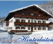
Ferien-Hof Hinterleiten
Wildauerhof
Appartement Zangerl
ILGERHOF
Apartm. & Zimmer Pension Sonnenhof
Videos from this area
These are videos related to the place based on their proximity to this place.
FPV winter drone flying low with a GoPro HD
Drone flying low through the country side with a GoPro Hero HD. Chassing dogs, cars and birds.
Aschau im Chiemgau Schlossie's photos around Aschau, Germany (osterreich highland games bilder)
Preview of Schlossie's blog at TravelPod. Read the full blog here: http://www.travelpod.com/travel-blog-entries/schlossie/2007-home/1179507000/tpod.html This blog preview was made by TravelPod...
Maloja Store & Onlineshop
Sportschrank der Maloja Online-Shop mit Store in Aschau i. Chiemgau. http://www.sportschrank.de/ Riesen Auswahl der Maloja Kollektion durch die Verbindung aus Ladengeschäft und Online-Lager.
Tandem fliegen an der Kampenwand_09.04.10.wmv
Tandem fliegen an der Kampenwand, Pilot: Petz Christian (Video von Heinz Langhammer)(Drachenfliegerclub Ingolstadt) http://www.dfci.de Siehe auch : http://xc.dhv.de/xc/modules/leonardo/index.ph...
Kampenwand nach Aschau, MTB
Abfahrt MTB mit Doris von der Kampenwand nach Aschau. Dann weiter nach Prien zum Eis essen. Schee war`s, auch wenn wir auf sehr viele Fußgänger Rücksicht nehmen mussten und teilweise sehr.
Peter Solnar - der Bürgermeisterkandidat der FWG-Aschau.
Peter Solnar ist Bürgermeisterkandidat der Freien Wahlgemeinschaft Aschau im Chiemgau (FWGA). In diesem Kurzvideo stellt er sich und die Ziele der FWGA vor. Die Kommunalwahl in Bayern findet...
Videos provided by Youtube are under the copyright of their owners.
Attractions and noteworthy things
Distances are based on the centre of the city/town and sightseeing location. This list contains brief abstracts about monuments, holiday activities, national parcs, museums, organisations and more from the area as well as interesting facts about the region itself. Where available, you'll find the corresponding homepage. Otherwise the related wikipedia article.
Hochries
Hochries is a mountain in Bavaria, Germany. It is 1569 m high, and is located in the north-western part of the Chiemgauer Alpen. \t\t \t\t\tHochries Panorama Nord. jpg \t\t\t View from Hochries direction north \t\t\t \t\t \t\t \t\t\tHochries Panorama Nordwest. jpg \t\t\t northwest \t\t\t \t\t \t\t \t\t\tHochries Panorama Sued. jpg \t\t\t south
Klausenberg (Chiemgau Alps)
Klausenberg (Chiemgauer Alpen) is a mountain of Bavaria, Germany.
Spitzstein
Spitzstein is a mountain of Bavaria, Germany.


