Safety Score: 3,0 of 5.0 based on data from 9 authorites. Meaning we advice caution when travelling to Germany.
Travel warnings are updated daily. Source: Travel Warning Germany. Last Update: 2024-08-13 08:21:03
Explore Ferchen
Ferchen in Upper Bavaria (Bavaria) is located in Germany about 319 mi (or 513 km) south of Berlin, the country's capital.
Local time in Ferchen is now 09:46 AM (Friday). The local timezone is named Europe / Berlin with an UTC offset of one hour. We know of 12 airports in the wider vicinity of Ferchen, of which 5 are larger airports. The closest airport in Germany is Munich International Airport in a distance of 30 mi (or 48 km), North-West. Besides the airports, there are other travel options available (check left side).
There are several Unesco world heritage sites nearby. The closest heritage site is Historic Centre of the City of Salzburg in Austria at a distance of 45 mi (or 72 km). The closest in Germany is Pilgrimage Church of Wies in a distance of 60 mi (or 72 km), East. If you need a place to sleep, we compiled a list of available hotels close to the map centre further down the page.
Depending on your travel schedule, you might want to pay a visit to some of the following locations: Ramerberg, Griesstatt, Schechen, Emmering and Pfaffing. To further explore this place, just scroll down and browse the available info.
Local weather forecast
Todays Local Weather Conditions & Forecast: 6°C / 42 °F
| Morning Temperature | 1°C / 34 °F |
| Evening Temperature | 2°C / 36 °F |
| Night Temperature | -0°C / 32 °F |
| Chance of rainfall | 0% |
| Air Humidity | 70% |
| Air Pressure | 1029 hPa |
| Wind Speed | Light breeze with 3 km/h (2 mph) from East |
| Cloud Conditions | Broken clouds, covering 78% of sky |
| General Conditions | Broken clouds |
Saturday, 16th of November 2024
6°C (43 °F)
1°C (34 °F)
Sky is clear, light breeze, clear sky.
Sunday, 17th of November 2024
9°C (48 °F)
5°C (41 °F)
Light rain, moderate breeze, clear sky.
Monday, 18th of November 2024
3°C (37 °F)
1°C (33 °F)
Moderate rain, moderate breeze, overcast clouds.
Hotels and Places to Stay
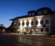
Egger-Stüberl Landgasthotel
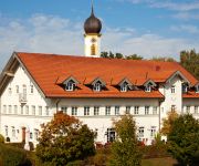
Pfaffinger Hof
Videos from this area
These are videos related to the place based on their proximity to this place.
Automobilslalom der Rallye Gemeinschaft Rosenheim
Tagesbestzeit beim Automobilslalom in Kirchsteig im Landkreis Rosenheim. Alexander Pleier vom Motorsport-Club Indersdorf fährt den 2 Kilometer langen Autoslalom mit seinem Opel Kadett C ...
LUNGAU 2014 ! Skiing time ! PHARELL WILLIAMS - HAPPY :)
Relaxing time in Lungau :) 'Because I'm happy..!' ;) ENJOY !
Zürich Stickerei&Textildruck Hoiß Ihr Profi fürs Shirt besticken,Shirt bedrucken, Shirt beflocken
Unsere für Zürich Stickerei & Textildruck Hoiß erreichen Sie unter info@stickerei-hoiss.de oder 0049(0)8067/7528 unterbreiten wir Ihnen gerne ein unverbindliches Angebot! Unser April Angebot...
-HOCHWASSER - Meldestufe1 in der Feldkirchner Aue
26.8.2012 - Altwasser in der Aue rechts vom KW Feldkirchen- Inn steigt schnell an und überschreitet in Wasserburg die Meldestufe 1. Das Wasser läuft vom Kraftwerk her aufwärts in das Altwasser...
-Renaturierung durch Biber- 1.5.2012
Die Renaturierung der Innaue zwischen dem Kraftwerk Feldkirchen und dem Ort Entfelden/Vogtareuth durch die wieder angesiedelten Biber. Aus einer wasserarmen Aue mit verockerten Gewässern ...
- Hochwasser - Anstieg in der Feldkirchener Aue am 26.8.12
Hochwasser am Inn am 26.8.2012 - Vom KW Feldkirchen kommt das Wasser entgegen und füllte bereits das Altwasser in der Vogtareuther Aue. HW-Meldestufe 1 in Wasserburg wird überschritten....
21-Jährige stirbt nach Unfall auf der B15
02.02.2013 - Eine 21-jährige Autolenkerin verstarb nach einem schweren Verkehrsunfall auf der B15 bei Rott am Inn. Die junge Frau war mit ihrem Wagen von der Straße abgekommen und mit einem...
Orangensaft aus dem Boden (DSCF0889) VEROCKERUNG am Inn
Völlig verockerter nördlicher Zulauf zum Pumpwerk "Altermanngraben" bei Ramerberg/Sendling an der B15. Das "Abwasser tangiert das NSG 7939-401 Laienhafte Beschreibung des seit 1982 ...
Videos provided by Youtube are under the copyright of their owners.
Attractions and noteworthy things
Distances are based on the centre of the city/town and sightseeing location. This list contains brief abstracts about monuments, holiday activities, national parcs, museums, organisations and more from the area as well as interesting facts about the region itself. Where available, you'll find the corresponding homepage. Otherwise the related wikipedia article.
Rott Abbey
Rott Abbey (Kloster Rott) was a Benedictine monastery in Rott am Inn in Bavaria, Germany.


