Safety Score: 3,0 of 5.0 based on data from 9 authorites. Meaning we advice caution when travelling to Germany.
Travel warnings are updated daily. Source: Travel Warning Germany. Last Update: 2024-08-13 08:21:03
Touring Enterfels
Enterfels in Upper Bavaria (Bavaria) is a town located in Germany about 345 mi (or 556 km) south of Berlin, the country's capital place.
Time in Enterfels is now 06:22 PM (Friday). The local timezone is named Europe / Berlin with an UTC offset of one hour. We know of 12 airports nearby Enterfels, of which 5 are larger airports. The closest is airport we know is Innsbruck Airport in Austria in a distance of 32 mi (or 52 km). The closest airport in Germany is Oberpfaffenhofen Airport in a distance of 37 mi (or 52 km), South-West. Besides the airports, there are other travel options available (check left side).
There are several Unesco world heritage sites nearby. The closest heritage site in Germany is Pilgrimage Church of Wies in a distance of 39 mi (or 63 km), West. We collected 1 points of interest near this location. Need some hints on where to stay? We compiled a list of available hotels close to the map centre further down the page.
Being here already, you might want to pay a visit to some of the following locations: Kreuth, Rottach-Egern, Bad Wiessee, Achenkirch and Hausham. To further explore this place, just scroll down and browse the available info.
Local weather forecast
Todays Local Weather Conditions & Forecast: 5°C / 41 °F
| Morning Temperature | -3°C / 27 °F |
| Evening Temperature | 4°C / 39 °F |
| Night Temperature | -0°C / 32 °F |
| Chance of rainfall | 0% |
| Air Humidity | 60% |
| Air Pressure | 1027 hPa |
| Wind Speed | Light breeze with 3 km/h (2 mph) from North |
| Cloud Conditions | Broken clouds, covering 79% of sky |
| General Conditions | Broken clouds |
Saturday, 16th of November 2024
8°C (47 °F)
2°C (36 °F)
Sky is clear, light breeze, clear sky.
Sunday, 17th of November 2024
7°C (45 °F)
2°C (35 °F)
Rain and snow, gentle breeze, scattered clouds.
Monday, 18th of November 2024
0°C (32 °F)
-1°C (31 °F)
Snow, light breeze, overcast clouds.
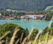
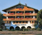
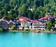
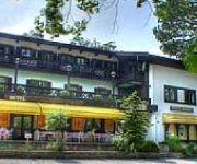
Hotels and Places to Stay
Althoff Seehotel Überfahrt
Bachmair Weissach
Park-Hotel Egerner-Höfe
garni Haltmair am See
Waltershof Seehotel
Bachmair am See
Gästehaus Heimgarten
Bauernhof Haus Kleinbuch
Hotel Carrera
garni Bergspatz
Videos from this area
These are videos related to the place based on their proximity to this place.
Rodeln am Wallberg
Ein wirklich gelungener Tag auf der Rodelpiste (6,5km Länge) der Wallbergbahn bei Rottach-Egern. Sie ist sehr gut mit den öffentlichen von München aus zu erreichen (Bayern-Ticket, BOB-MVV)...
Ferienwohnungen Kimpfbeck in Kreuth am Tegernsee
Zwischen Rottach-Egern und Kreuth im schönen Tegernseer Tal finden Sie unsere idyllisch gelegenen Ferienwohnungen. Die Ferienwohnungen haben einen eigenen Eingang, Südbalkon oder ...
Kreuth Flowtrail | Tegernsee MTB
Flowiger MTB Trail nach Kreuth in der Nähe des schönen Tegernsees. Idealer Trail auch für Ein-/Aufsteiger, wobei der Uphill etwas Kondition erfordert. Bike: Canyon Torque Trailflow Cam:...
Herbstwanderung auf den Roß-und Buchstein (Wildbad Kreuth)
Herbstwanderung auf den Roß-und Buchstein (Wildbad Kreuth)
Schloss Ringberg in Kreuth am Tegernsee
Video vom Tag der offenen Tür auf Schloss Ringberg in Kreuth am Tegernsee am 26.6. von 10.00 bis 17.00Uhr.
Ausflug zur Siebenhütten Alm bei Wildbad Kreuth
Ein Ausflug zur Siebenhütten Alm http://www.wandernbayern.com/html/siebenhuetten.html.
Videos provided by Youtube are under the copyright of their owners.
Attractions and noteworthy things
Distances are based on the centre of the city/town and sightseeing location. This list contains brief abstracts about monuments, holiday activities, national parcs, museums, organisations and more from the area as well as interesting facts about the region itself. Where available, you'll find the corresponding homepage. Otherwise the related wikipedia article.
Schloss Ringberg
Schloss Ringberg (Ringberg Castle) is located in the Bavarian Alps, 50 km south of Munich, on a foothill overlooking the Tegernsee. Not open to the general public, it is a property of the Max Planck Society and used for conferences.
Tegernsee Mountains
The Tegernsee Mountains form a mountain region between the River Isar in the west and the lake of Tegernsee as well as the Rottach, weißen Valepp and Grundache south of the Tegernsee, in the east, and so form a part of the Bavarian Prealps. The Tegernsee Mountains are also the westernmost part of the Mangfall Mountains (Mangfallgebirge).
Leonhardstein
Leonhardstein is a mountain of Bavaria, Germany.
Schildenstein
Schildenstein is a mountain of Bavaria, Germany.


