Safety Score: 3,0 of 5.0 based on data from 9 authorites. Meaning we advice caution when travelling to Germany.
Travel warnings are updated daily. Source: Travel Warning Germany. Last Update: 2024-08-13 08:21:03
Delve into Alt Wiessee
The district Alt Wiessee of Bad Wiessee in Upper Bavaria (Bavaria) is a district located in Germany about 341 mi south of Berlin, the country's capital town.
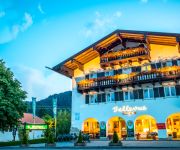
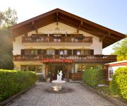
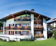
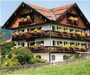
In need of a room? We compiled a list of available hotels close to the map centre further down the page.
Since you are here already, you might want to pay a visit to some of the following locations: Rottach-Egern, Kreuth, Waakirchen, Reichersbeuern and Hausham. To further explore this place, just scroll down and browse the available info.
Local weather forecast
Todays Local Weather Conditions & Forecast: 1°C / 33 °F
| Morning Temperature | -2°C / 28 °F |
| Evening Temperature | -1°C / 30 °F |
| Night Temperature | -1°C / 30 °F |
| Chance of rainfall | 0% |
| Air Humidity | 80% |
| Air Pressure | 1028 hPa |
| Wind Speed | Moderate breeze with 11 km/h (7 mph) from East |
| Cloud Conditions | Broken clouds, covering 55% of sky |
| General Conditions | Light snow |
Sunday, 24th of November 2024
6°C (43 °F)
3°C (37 °F)
Overcast clouds, gentle breeze.
Monday, 25th of November 2024
10°C (50 °F)
4°C (39 °F)
Sky is clear, gentle breeze, clear sky.
Tuesday, 26th of November 2024
8°C (47 °F)
3°C (38 °F)
Light rain, light breeze, overcast clouds.
Hotels and Places to Stay
Am Stein Landhaus
Terrassenhof
Christl am See Landhaus
Pension Ostler am Tegernsee
Hotel Bellevue
Quellenhof
Schnitzer
Ertle Landhaus
Land-gut-Hotel Askania
Setzberg zum See
Videos from this area
These are videos related to the place based on their proximity to this place.
Der Tegernsee 2010
Der Tegernsee hat viele Fassetten. Von spiegelglattem Wasser bis zum Nebel am Hang gibt es viele schöne Sichten. Gmund, Rottach-Egern und Bad Wiessee bilden einen schönen Anschluß zum See ...
Ein klingender Professor, das Drachenschloss und der Lindwurm
Skulpturenweg an der Bad Wiesseer Seepromenade am Tegernsee. Ein Projekt im Rahmen des Kunstunterrichts der Schüler der 9. Klasse VS Rottach-Egern. Musik: "Kids then Age" by ...
TEGERNSEE
Mal ein Liebeslied nicht nur an eine Frau, sondern an (m)einen See, den Tegernsee - schließlich wohne ich schon das 5.Jahr dort... Bilder von "www.suche.aol.de" und von mir. Verbreitung...
Skulpturenausstellung Bad Wiessee am Tegernsee
Vom 7.5. bis 31.10.2010 findet an der Seepromenade Bad Wiessee am Tegernsee eine Skulpturenausstellung statt.
Aquadome Bad Wiessee am Tegernsee
So spannend wie eine Safari: Einheimische Fische mal aus nächster Nähe betrachten: Wie groß ist denn so ein Karpfen? Ist ein Hecht gefährlich? Was ist der Unterschied zwischen Blaufelchen...
Ballonglühen auf der Montgolfiade 2015 @ Bad Wiessee am Tegernsee / Bayern (HD)
Heißluftballone-Glühen auf der Montgolfiade am 7. Februar 2015 in Bad Wiessee am Tegernsee - Oberbayern. Impressions from night glow at hot air balloon festival at lake Tegernsee / Bavaria...
Flamingo im Tegernsee, Feb. 2015
Die Kälte macht dem schönen Vogel gar nichts aus. "Solange der See nicht zugefroren ist, findet er genug Nahrung." Am Montag wurde der Flamingo übrigens nicht mehr gesehen. Wer weiß, an...
Die Genießerlandregion Tegernsee
13 Gastgeber rund um den Tegernsee spiegeln hier die Bandbreite des kulinarischen Angebotes der Region wider -- von traditioneller Wirtshauskultur bis hin zu erlesener Spitzengastronomie. So...
Videos provided by Youtube are under the copyright of their owners.
Attractions and noteworthy things
Distances are based on the centre of the city/town and sightseeing location. This list contains brief abstracts about monuments, holiday activities, national parcs, museums, organisations and more from the area as well as interesting facts about the region itself. Where available, you'll find the corresponding homepage. Otherwise the related wikipedia article.
Principal passes of the Alps
This article lists the principal mountain passes and tunnels in the Alps, and gives a history of transport across the Alps.
Miesbach (district)
Miesbach is a district in Bavaria, Germany. It is bounded by (from the west and clockwise) the districts of Bad Tölz-Wolfratshausen, Munich and Rosenheim, and by the Austrian state of Tyrol.
Warngau
Warngau is a municipality in the Miesbach District of Bavaria, Germany. It is located at {{#invoke:Coordinates|coord}}{{#coordinates:47|50|N|11|44|E||| | |name= }} and has a population of 3,489. During the Nazi period, Warngau was falsely proclaimed to be the birthplace of Heinrich Himmler in order to obtain more support from rural voters; Himmler was actually born just outside Munich.
Schloss Ringberg
Schloss Ringberg (Ringberg Castle) is located in the Bavarian Alps, 50 km south of Munich, on a foothill overlooking the Tegernsee. Not open to the general public, it is a property of the Max Planck Society and used for conferences.
Tegernsee Abbey
Tegernsee Abbey or the Imperial Abbey of Tegernsee (German Kloster Tegernsee, Abtei or Reichsabtei Tegernsee) is a former Benedictine monastery in the town and district of Tegernsee in Bavaria. Both the abbey and the town that grew up around are named after the Tegernsee, the lake on the shores of which they are located. The name is from the Old High German tegarin seo, meaning great lake. Tegernsee Abbey was first built in the 8th century.
Tegernsee (lake)
The Tegernsee is a Zungenbecken lake in the Bavarian Alps in southern Germany. The lake is the centre of a popular recreation area 50 kilometres south-east of Munich. Resorts on the lake include the eponymous Tegernsee, as well as Bad Wiessee, Kreuth, Gmund, and Rottach-Egern. The lake is some 6.5 kilometres in length, with a width of 1.4 kilometres and an area of 8.934 square kilometres .
Schliersee (lake)
Schliersee is a natural lake in Upper Bavaria in the Bavarian Alps. It is located next to the small town of Schliersee in the Miesbach district. The lake has a surface of 2.241 square kilometres at an elevation of 777 metres AMSL, expanding 2.3 kilometres by 1.3 kilometres maximum. The average depth is 20 metres The maximum depth is 40 metres . The only island is Wörth island, located almost in the middle of the lake.
Marienstein
Marienstein is a village in the municipality of Waakirchen in the west Upper Bavarian district of Miesbach.
Tegernsee Mountains
The Tegernsee Mountains form a mountain region between the River Isar in the west and the lake of Tegernsee as well as the Rottach, weißen Valepp and Grundache south of the Tegernsee, in the east, and so form a part of the Bavarian Prealps. The Tegernsee Mountains are also the westernmost part of the Mangfall Mountains (Mangfallgebirge).
Blauberge
The Blauberge ("Blue Mountains") or Blauberg are a mountain range in the Bavarian Prealps on the border between the states of Bavaria in Germany and Tyrol in Austria. Its highest summit is the Halserspitze, or Halserspitz at 1,862 m.
Fockenstein
Fockenstein is a mountain of Bavaria, Germany.
Geierstein
Geierstein is a mountain of Bavaria, Germany.
Kampen (mountain)
Kampen (Berg) is a mountain of Bavaria, Germany.
Leonhardstein
Leonhardstein is a mountain of Bavaria, Germany.
Neureut (mountain)
Neureut (Berg) is a mountain of Bavaria, Germany.
Rechelkopf
Rechelkopf is a mountain of Bavaria, Germany.
Risserkogel
Risserkogel is a mountain of Bavaria, Germany.
Rinnerspitz
The Rinnerspitz is a 1,611 m high peak in the Schliersee Mountains in the Mangfall mountain range in the German Free State of Bavaria. It is also known by locals as the Peißenberg (not to be confused with the Hoher Peißenberg). It was here on 6 November 1877 that the poacher, Georg Jennerwein, was shot in the back.
Roß- und Buchstein
The Roß- und Buchstein (1,701 m) is a mountain of the Tegernsee Mountains range, in the Bavarian Prealps, Bavaria, Germany. The Tegernsee cabin is lodged between the Roßstein and the Buchstein. \t\t \t\t\tCross on the Roßstein, Bavaria, Germany. JPG \t\t\t Cross on the Roßstein. \t\t\t \t\t \t\t \t\t\tBuchstein, Bavaria, Germany. JPG \t\t\t The Tegernsee cabin and the Buchstein.
Taubenberg
Taubenberg is a mountain of Bavaria, Germany.
Wallberg
for the surname see Wahlberg link =This article may be expanded with text translated from the corresponding article in the German Wikipedia. View a machine-translated version of the German article. Google's machine translation is a useful starting point for translations, but translators must revise errors as necessary and confirm that the translation is accurate, rather than simply copy-pasting machine-translated text into the English Wikipedia.
Schildenstein
Schildenstein is a mountain of Bavaria, Germany.
Schönberg (Bavarian Prealps)
Schönberg (Bayerische Voralpen) is a mountain of Bavaria, Germany.
Seekarkreuz
Seekarkreuz is a mountain of Bavaria, Germany.
Grambach (Tegernsee)
Grambach is a river of Bavaria, Germany.


