Safety Score: 3,0 of 5.0 based on data from 9 authorites. Meaning we advice caution when travelling to Germany.
Travel warnings are updated daily. Source: Travel Warning Germany. Last Update: 2024-08-13 08:21:03
Touring Rufen
Rufen in Swabia (Bavaria) is a town located in Germany about 338 mi (or 544 km) south-west of Berlin, the country's capital place.
Time in Rufen is now 12:32 PM (Friday). The local timezone is named Europe / Berlin with an UTC offset of one hour. We know of 13 airports nearby Rufen, of which 5 are larger airports. The closest airport in Germany is Memmingen Allgau Airport in a distance of 7 mi (or 12 km), West. Besides the airports, there are other travel options available (check left side).
There are several Unesco world heritage sites nearby. The closest heritage site in Germany is Pilgrimage Church of Wies in a distance of 33 mi (or 54 km), South-East. Need some hints on where to stay? We compiled a list of available hotels close to the map centre further down the page.
Being here already, you might want to pay a visit to some of the following locations: Sontheim, Stetten, Oberrieden, Unteregg and Westerheim. To further explore this place, just scroll down and browse the available info.
Local weather forecast
Todays Local Weather Conditions & Forecast: -2°C / 29 °F
| Morning Temperature | -4°C / 25 °F |
| Evening Temperature | -2°C / 28 °F |
| Night Temperature | -2°C / 29 °F |
| Chance of rainfall | 5% |
| Air Humidity | 90% |
| Air Pressure | 1012 hPa |
| Wind Speed | Fresh Breeze with 14 km/h (9 mph) from North-East |
| Cloud Conditions | Clear sky, covering 8% of sky |
| General Conditions | Snow |
Saturday, 23rd of November 2024
1°C (34 °F)
0°C (33 °F)
Overcast clouds, fresh breeze.
Sunday, 24th of November 2024
5°C (40 °F)
-0°C (32 °F)
Broken clouds, light breeze.
Monday, 25th of November 2024
5°C (42 °F)
5°C (41 °F)
Light rain, gentle breeze, broken clouds.
Hotels and Places to Stay
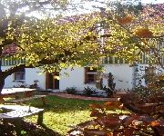
Kirschenfee Bio-Pension
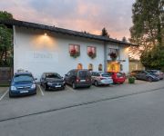
Erkheimer Landhaus
Videos from this area
These are videos related to the place based on their proximity to this place.
Schwerer Motorradunfall bei Sontheim 05.08.2013
Bericht: http://memmingernews.blogspot.de/2013/08/schwerer-motorradunfall-auf.html.
Gesundes für die Pause: 1750 Unterallgäuer Erstklässler bekommen Allgäuer Bio-Brotzeitdose
Iss was gscheits - das hören tagtäglich viele Allgäuer Schulkinder. Ein wesentlicher Bestandteil einer gesunden Ernährung ist die richtige Pausenmahlzeit. Und deswegen verteilt der Bio-Ring...
Helfen ohne Gegenleistung: Freistaat dankt engagierten Bürgern mit Ehrenamtskarte
Morgens helfen Schülerlotsen Kindern über gefährliche Straßen, nachmittags engagieren sich Trainer in den Sportvereinen und sollte sich nachts mal ein Unfall ereignen, dann sind die örtlichen...
Fasching in Mindelheim: Hanselaufzug 2013
Mit lautem Böllern eröffnete die Mindelonia Mindelhoim ihre Faschingssaison 2013 zu Füßen des "Durahansels" wir waren für Sie dabei.
Rüstzug Feuerwehr Mindelheim
Einsatzübung des Rüstzuges der Freiwilligen Feuerwehr Mindelheim. Vorausfahrend NEF und RTW BRK Mindelheim (zu einem Realeinsatz) nachfolgend Tanklöschfahrzeug (TLF16/25), ...
Frundsbergfähnlein Mindelheim Fechtgruppe Mittelalter Showfechten
Die Fechtgruppe des Frundsbergfähnleins Mindelheim - Abteilung im Frundsbergfestring Mindelheim e. V. Buchung und Kontakt: info@frundsberg.de.
Faschingsauftakt der Mindelonia in Mindelheim 2012
Um 11.11 Uhr hieß es heute wieder "Willkommen 5. Jahreszeit" - Mit großer Vorfreude starteten heute in ganz Schwaben die Narren und Närrinnen in die Faschingssaison 2012/2013 - wir waren...
Hasl Computertechnik in Mindelheim - ein exzellenter IT-Service- und Software-Betrieb im Allgäu
Handwerker aufgepasst! Hasl Computertechnik aus Mindelheim ist DER I.T.-Partner für kleine und mittelständische Unternehmen im Unterallgäu! Die Computerprofis aus Mindelheim statten ...
Mindelheim / B18: Verkehrsunfall mit 10 Verletzten
Bericht: https://www.facebook.com/media/set/?set=a.305160059657307.1073741925.191070394399608&type=1.
Videos provided by Youtube are under the copyright of their owners.
Attractions and noteworthy things
Distances are based on the centre of the city/town and sightseeing location. This list contains brief abstracts about monuments, holiday activities, national parcs, museums, organisations and more from the area as well as interesting facts about the region itself. Where available, you'll find the corresponding homepage. Otherwise the related wikipedia article.
Kammel
The Kammel is a river in Bavaria, southern Germany. The Kammel originates west of Mindelheim, in the district Unterallgäu, and flows generally north. It flows into the Mindel (left tributary) south of Offingen at the Danube, east of Günzburg in the district Günzburg. So it is an indirect right tributary of the Danube. The difference in altitude between the origin and the mouth is 265 m.


