Safety Score: 3,0 of 5.0 based on data from 9 authorites. Meaning we advice caution when travelling to Germany.
Travel warnings are updated daily. Source: Travel Warning Germany. Last Update: 2024-08-13 08:21:03
Discover Mittelberg
The district Mittelberg of Oy-Mittelberg in Swabia (Bavaria) is a district in Germany about 362 mi south of Berlin, the country's capital city.
Looking for a place to stay? we compiled a list of available hotels close to the map centre further down the page.
When in this area, you might want to pay a visit to some of the following locations: Jungholz, Goerisried, Durach, Betzigau and Ruckholz. To further explore this place, just scroll down and browse the available info.
Local weather forecast
Todays Local Weather Conditions & Forecast: 9°C / 49 °F
| Morning Temperature | 1°C / 35 °F |
| Evening Temperature | 5°C / 41 °F |
| Night Temperature | 2°C / 35 °F |
| Chance of rainfall | 0% |
| Air Humidity | 74% |
| Air Pressure | 1014 hPa |
| Wind Speed | Gentle Breeze with 6 km/h (4 mph) from North |
| Cloud Conditions | Clear sky, covering 6% of sky |
| General Conditions | Sky is clear |
Tuesday, 26th of November 2024
4°C (39 °F)
1°C (33 °F)
Rain and snow, gentle breeze, overcast clouds.
Wednesday, 27th of November 2024
7°C (45 °F)
3°C (37 °F)
Overcast clouds, light breeze.
Thursday, 28th of November 2024
1°C (33 °F)
-2°C (29 °F)
Rain and snow, gentle breeze, overcast clouds.
Hotels and Places to Stay
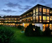
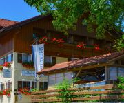
Die Mittelburg Vitalhotel
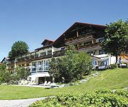
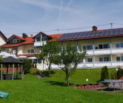
Parkhotel Tannenhof
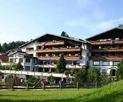
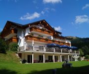
Berghotel Tirol
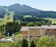
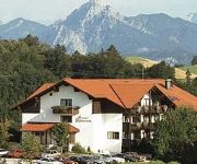
Nesselwanger Hof
Rose Gasthof
Naturhotel Sonnenhang
Alpenhof Reuterwanne
Alpenrose
Explorer Hotel Neuschwanstein
Post Brauerei-Gasthof
Videos from this area
These are videos related to the place based on their proximity to this place.
Wertach im Allgäu erwacht
Das Video zeigt den Sonnenaufgang und die frühe Morgenstimmung in der noch schlafenden Marktgemeinde Wertach. Hellwach ist die Gemeinde und ihre Gäste spätestens beim diesjährigen ...
Wanderung auf der Reuterwanne bei Wertach im Allgäu
Die bei Wertach gelegene 1541 Meter hohe Reuterwanne ist ein schöner Wanderberg ohne alpinistischen Anspruch. In eineinhalb Stunden kann sie bei moderatem Tempo erstiegen werden. Sie ist nicht...
Viehscheid Wertach 2010
Für die Wertacher selbst war der Viehscheid schon immer ein Festtag. Wenn das Vieh gut geälpt und wohlbehalten wieder in die heimatlichen Ställe zuückgekehrt war, traf man sich mit den...
Wertach im im Zeitraffer (Mai 2012)
Blick von der Webcam an der Kolping Familienferienstätte Allgäuhaus auf Wertach und den Grünten.
Blick auf Wertach im Dezember 2012
Film aus Sicht der Webcam am Kolping Allgäuhaus auf die Marktgemeinde Wertach im Zeitraum vom 1. bis 31.12.2012.
Viehscheid Wertach 2010 im Zelt
Nachdem die Besucherzahlen zum Wertacher Viehscheid jährlich zunahmen, wurde im Jahr 1973 erstmals ein großes Festzelt für dieses Ereignis aufgestellt. Seither wird mit dem Viehscheid gleichzeit ...
Ortsgeschichte erhalten: Heimatmuseum Wertach präsentiert sich nach Renovierung in neuem Glanz
Was macht eine Ortschaft aus, wie hat sie sich entwickelt und welche Persönlichkeiten sind hier geboren? Fragen, auf die oft das Heimatmuseum Antworten geben kann. So auch in Wertach. Über...
Videos provided by Youtube are under the copyright of their owners.
Attractions and noteworthy things
Distances are based on the centre of the city/town and sightseeing location. This list contains brief abstracts about monuments, holiday activities, national parcs, museums, organisations and more from the area as well as interesting facts about the region itself. Where available, you'll find the corresponding homepage. Otherwise the related wikipedia article.
Ostallgäu
Ostallgäu is a district in Bavaria, Germany. It is bounded by (from the west and clockwise) the districts of Oberallgäu, Unterallgäu, Augsburg, Landsberg, Weilheim-Schongau and Garmisch-Partenkirchen, and by the Austrian state of Tyrol. The city of Kaufbeuren is enclosed by but does not belong to the district.
Ordensburg Sonthofen
The Generaloberst-Beck-Kaserne are barracks of the armed forces of Germany, the Bundeswehr, in Sonthofen in Oberallgäu.
Niedersonthofener See
Niedersonthofener See is a lake in Oberallgäu, Bavaria, Germany. At an elevation of 703,30 m, its surface area is 135.30 ha. The lake is known for having a shape that is strikingly similar to that of a whale.
Kempten University of Applied Sciences
The Kempten University of Applied Sciences or Hochschule Kempten is a University of applied sciences in Kempten im Allgäu, Germany.
Breitenberg (Allgäu Alps)
Breitenberg (Allgäuer Alpen) is a mountain of Bavaria, Germany.
Bschießer
Bschießer is a mountain in Bavaria, Germany.
Hirschberg (Allgäu)
Hirschberg (Allgäu) is a mountain of Bavaria, Germany.
Iseler
Iseler is a mountain of Bavaria, Germany.
Kühgundkopf
Kühgundkopf is a mountain of Bavaria, Germany.
Wertacher Hörnle
Wertacher Hörnle is a mountain of Bavaria, Germany.
Imperial Ducal Abbey of Kempten
The Imperial Ducal Abbey of Kempten in the Allgäu, was a city state in the Holy Roman Empire.
Haldensee
Haldensee is a lake of Tyrol, Austria.
Tannheim Mountains
The Tannheim Mountains are a sub-group of the Allgäu Alps in the Bavarian-Tyrolean border region. Their name is derived from the village of Tannheim in the Tannheim Valley in the Austrian state of Tyrol. The highest elevations in the Tannheim Mountains are the Kellenspitze (2,238 m) and Gimpel (2,176 m), that may easily be ascended from Nesselwängle in the Tannheim valley.
Schwaltenweiher
The Schwaltenweiher is a reservoir lake in the Ostallgäu foothills of the Alps. It lies 14 km from the Allgäu Alps between the towns of Seeg and Rückholz. It was named after the Schwaltenmühle mill built beside it, which was in turn named after the Schwalt or Schwald family. It is now used for bathing and fishing.
Kotbach
Kotbach is a river of Baden-Württemberg, Germany.
Köllerbach (Saar)
Köllerbach (Saar) is a river of Saarland, Germany.
Stadttheater Kempten
Stadttheater Kempten is a theatre in Bavaria, Germany.
Kempten Central Station
Kempten Central Station (Kempten Hauptbahnhof) is a railway station in Kempten in the German state of Bavaria. It is the most important station of Kempten and a hub for the Iller Valley Railway, the Allgäu Railway and the Ausserfern Railway. The original Kempten station was built in 1852 as a terminal station near the centre of town and was replaced by a through station in 1969.
Kempten Abbey
Kempten Abbey was a Benedictine Monastery in Kempten in the Allgäu, Bavaria. For much of its life it was the Imperial Ducal Abbey of Kempten.
St. Lorenz Basilica
St. Lorenz Basilica is a baroque minor Basilica in Kempten, Bavaria. It is the former abbey church of the Benedictine Kempten Abbey. It is currently used as the parish church of the Roman Catholic parish of St. Lawrence in the Diocese of Augsburg. A church was built on the site in the 13th Century but was burned down in 1478. Roman Giel of Gielsberg, the Abbot of Kempten, commissioned the master builder Michael Beer from Graubünden to build a new church to serve the parish and monastery.





![Webcam: Oy-Mittelberg: A7/E532, bei Rottachtalbrücke, zwischen AD Allgäu und AS O.-Mittelbg. [km 936,4], Blickrichtung: Grenztunnel Füssen D/A capture of the webcam Oy-Mittelberg: A7/E532, bei Rottachtalbrücke, zwischen AD Allgäu und AS O.-Mittelbg. [km 936,4], Blickrichtung: Grenztunnel Füssen D/A](https://images.webcams.travel/daylight/preview/1472375808.jpg)