Safety Score: 3,0 of 5.0 based on data from 9 authorites. Meaning we advice caution when travelling to Germany.
Travel warnings are updated daily. Source: Travel Warning Germany. Last Update: 2024-08-13 08:21:03
Explore Niederschönenfeld
Niederschönenfeld in Swabia (Bavaria) with it's 1,419 inhabitants is a city in Germany about 285 mi (or 458 km) south of Berlin, the country's capital.
Local time in Niederschönenfeld is now 03:31 PM (Sunday). The local timezone is named Europe / Berlin with an UTC offset of one hour. We know of 11 airports in the vicinity of Niederschönenfeld, of which 5 are larger airports. The closest airport in Germany is Augsburg Airport in a distance of 20 mi (or 32 km), South. Besides the airports, there are other travel options available (check left side).
There are several Unesco world heritage sites nearby. The closest heritage site in Germany is Old town of Regensburg with Stadtamhof in a distance of 57 mi (or 92 km), East. If you need a place to sleep, we compiled a list of available hotels close to the map centre further down the page.
Depending on your travel schedule, you might want to pay a visit to some of the following locations: Marxheim, Genderkingen, Daiting, Muenster and Tagmersheim. To further explore this place, just scroll down and browse the available info.
Local weather forecast
Todays Local Weather Conditions & Forecast: 7°C / 45 °F
| Morning Temperature | 1°C / 33 °F |
| Evening Temperature | 5°C / 41 °F |
| Night Temperature | 5°C / 41 °F |
| Chance of rainfall | 2% |
| Air Humidity | 71% |
| Air Pressure | 1016 hPa |
| Wind Speed | Moderate breeze with 9 km/h (6 mph) from North-East |
| Cloud Conditions | Scattered clouds, covering 43% of sky |
| General Conditions | Light rain |
Monday, 18th of November 2024
8°C (46 °F)
6°C (43 °F)
Light rain, moderate breeze, overcast clouds.
Tuesday, 19th of November 2024
7°C (45 °F)
8°C (47 °F)
Light rain, fresh breeze, overcast clouds.
Wednesday, 20th of November 2024
2°C (36 °F)
0°C (32 °F)
Rain and snow, fresh breeze, overcast clouds.
Hotels and Places to Stay
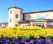
Dehner Blumen Hotel
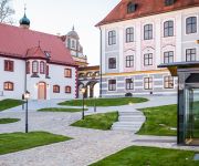
Hotel Schloss Leitheim
Gasthof Lutz
Videos from this area
These are videos related to the place based on their proximity to this place.
Friseur Rain am Lech: Haarstudio Schneider - Friseursalon im Landkreis Donau-Ries
Ein Blick in den Spiegel und man stellt fest: Es ist wieder einmal Zeit für eine Typveränderung! Dafür ist das Haarstudio Schneider in Rain am Lech im Landkreis Donau-Ries eine ganz hervorragend...
Feuerwerk Schau nachts Rain
Nachdem die Geschäfte in Rain geschlossen hatten, wurde im Blumenpark der Firma Dehner ein etwa 10 Minütiges Feuerwerk abgeschossen,welches den Himmel erleuchtete.
35. Bayerische Film + Video Festspiele in Rain 2014 - Trailer #2
Link zum Festival: http://filmfestival-rain.de Herzlich Willkommen in Rain! Zum dritten Male nach 2011 (Südbayerischer Landeswettbewerb) und 2007 (Bayerische...
Air Race @ HORIZON Airmeet 2013
"The Galloping Ghost", "SUPERBOLT" and "Czech Mate" doing Air Race Model data: P-47 "SUPERBOLT" Pilot: Franz Obenauf "FOB" Maßstab / Scale: 1/4 Spw. /Wingspan: 2.8 m Länge / Lenght: 2.9...
Videos provided by Youtube are under the copyright of their owners.
Attractions and noteworthy things
Distances are based on the centre of the city/town and sightseeing location. This list contains brief abstracts about monuments, holiday activities, national parcs, museums, organisations and more from the area as well as interesting facts about the region itself. Where available, you'll find the corresponding homepage. Otherwise the related wikipedia article.
Lech (river)
The Lech is a river in Austria and Germany. It is a right tributary of the Danube 264 kilometres in length with a drainage basin ofBad rounding here{{#invoke:Math|precision_format| 2,550*2,589,988.110336/1,000,000 | 1-3 }} square kilometres (2,550 sq mi). Its source is located in the Austrian state of Vorarlberg, where the river rises from lake Formarinsee in the Alps at an altitude ofBad rounding here{{#invoke:Math|precision_format| 6,120*0.3048/1 | 1-3 }} metres (6,120 ft).


