Safety Score: 3,0 of 5.0 based on data from 9 authorites. Meaning we advice caution when travelling to Germany.
Travel warnings are updated daily. Source: Travel Warning Germany. Last Update: 2024-08-13 08:21:03
Touring Simmerberg
The district Simmerberg of Nagelshub in Swabia (Bavaria) is a subburb located in Germany about 374 mi south-west of Berlin, the country's capital place.
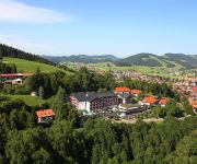
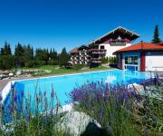
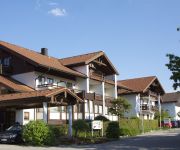
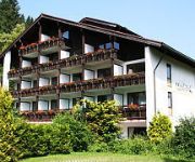
Need some hints on where to stay? We compiled a list of available hotels close to the map centre further down the page.
Being here already, you might want to pay a visit to some of the following locations: Oberreute, Stiefenhofen, Sulzberg, Gestratz and Gruenenbach. To further explore this place, just scroll down and browse the available info.
Local weather forecast
Todays Local Weather Conditions & Forecast: 5°C / 41 °F
| Morning Temperature | 5°C / 41 °F |
| Evening Temperature | 2°C / 36 °F |
| Night Temperature | 2°C / 35 °F |
| Chance of rainfall | 8% |
| Air Humidity | 99% |
| Air Pressure | 1025 hPa |
| Wind Speed | Light breeze with 4 km/h (3 mph) from East |
| Cloud Conditions | Overcast clouds, covering 100% of sky |
| General Conditions | Moderate rain |
Wednesday, 27th of November 2024
7°C (45 °F)
4°C (40 °F)
Overcast clouds, light breeze.
Thursday, 28th of November 2024
2°C (35 °F)
1°C (33 °F)
Rain and snow, gentle breeze, overcast clouds.
Friday, 29th of November 2024
3°C (37 °F)
-4°C (24 °F)
Sky is clear, light breeze, clear sky.
Hotels and Places to Stay
Allgäu Sonne Kur- und Sporthotel
Hotel Bavaria
Tannenhof Sport & Spa
Dein Engel Ihr Wohlfühlhotel
Concordia Wellnesshotel & SPA
WellVital Hotel Tyrol
Lindner Parkhotel & Spa
Bergkristall Mein Resort im Allgäu
Haser Kur- und Ferienhotel
Zur Rose Gasthof
Videos from this area
These are videos related to the place based on their proximity to this place.
Hopfen bei Stiefenhofen (D) Martinskapelle: BVG-Glocke
Im kleinen Dachreiter der Martinskapelle zu Hopfen hängt eine besondere Glocke. Bei der kleinen h''-Glocke handelt es sich nämlich um eine Stahlglocke des Bochumer Gussstahlvereins. Sie kam...
Muskelkraft mit Tradition: Ellhofer Trachtler stellen ihren Maibaum noch von Hand auf
Rund 30 Meter lang und etwa 700 kg schwer - der Maibaum in Ellhofen bei Simmerberg. Wie auch in anderen Ortschaften überragt er alles andere und ist schon von Weitem zu sehen. Anders als bei...
Lindenberg im Allgäu - Maibaum - Mit den Grundtvig Workshop Teilnehmern - 2012
Die Trachtengruppe "Die Mühlbachtaler" errichten jedes Jahr den Maibaum auf dem Stadtplatz in Lindenberg. Auch diese Jahr kamen wieder viele Schaulustige zu diesem Traditionsfest. Mit dabei...
Drohnenflug über winterliches Lindenberg im Allgäu, 03.02.2015, 13 Uhr
Ihr erinnert Euch nach an unser Video über die Schneemassen in Lindenberg im Allgäu heute Morgen? Reporter Richy von NonstopNews hat für uns um 13 Uhr seine Drohne dort fliegen lassen.
Arbeit, Job, Existenz, Familie, Leben im Allgäu
Allgäu: Arbeit suchen und finden, Wohnung suchen und finden.
Lindenberg im Westallgäu | Montaregio
Der anerkannte Luftkurort Lindenberg im Allgäu liegt im Herzen des Westallgäus und hat rund 11000 Einwohner. http://www.montaregio.de/orte/orte-allgaeu/westallgaeu/lindenberg/
Feuerwehr Lindenberg Aktionstag 2011
Vorführung eins Brandeinsatzes im Rahmen des Aktionstages. Mehr Infos und Bilder unter http://www.feuerwehrleben.de/aktionstag-bei-der-freiwilligen-feuerwehr-lindenberg/
Jubiläumsfeuerwerk - 100 Jahre Stadt Lindenberg - 2014
Über tausend Besucher erlebten an Silvester 2013/14 ein spektakuläres Klang-Feuerwerk mit dem Lindenberg in das Jubiläumsjahr 2014 startet. Waldemar Stiefenhofer hat das pyrotechnische ...
Stadtbild von Lindenberg im Allgäu zum Grundtvig Workshop Lust am Hut - 2012
Info Video 01 zum Grundtvig Workshop vom 30.April bis 7.Mai 2012 zu dem Thema "Lust am Hut" in Lindenberg. Ein Stadtbild über Lindenberg im Allgäu für die Teilnehmer.
Videos provided by Youtube are under the copyright of their owners.
Attractions and noteworthy things
Distances are based on the centre of the city/town and sightseeing location. This list contains brief abstracts about monuments, holiday activities, national parcs, museums, organisations and more from the area as well as interesting facts about the region itself. Where available, you'll find the corresponding homepage. Otherwise the related wikipedia article.
Natural Science and Technical Academy Isny
The Natural Science and Technical Academy Isny (Naturwissenschaftlich-Technische Akademie Isny, NTA or NTA Isny) is a privately run, state-approved German university focusing in applied sciences, located in Isny im Allgäu. Since its founding in 1945, it has had a steadily expanding scope, including food chemistry (1967, expanded 1994 to include environmental analysis), physical electronics (1968), pharmaceutical chemistry (1972), and computer science (1992).
Pfänder
The Pfänder is a mountain in western Austria close to Lake Constance (Bodensee). The town of Bregenz lies at the foot of the mountain on the shores of the lake. With its views over the lake and the surrounding mountain peaks, the Pfänder is one of the most famous lookout points of the region.
Subersach
The Subersach originates near the „Hehlekopf“ (1.700 m SL) and is a bigger river in the district „Zerwall“ in Vorarlberg. The river course is strongly bent and looks like a bow in the landscape. The river merges with the Bregenzer Ach near the village of Egg.
St. George's Abbey, Isny
St. George's Abbey, Isny (German: Kloster St. Georg) in Isny im Allgäu in Baden-Württemberg, Germany, is a former Benedictine abbey founded in 1096 and secularised in 1802.
Thalkirchdorf
Thalkirchdorf is part of the municipality of Oberstaufen in Oberallgäu in the German state of Bayern. The area was occupied since at least 250 BC, when the Roman road Via Decia was built through the Konstanz valley. In the AD 14th century, this was an important route for the transport of salt, an important good at the time.
Meggen Lawn Cross
Meggen Lawn Cross is a mutual overnatural ground picture in Meggen a village, which belongs to Argenbühl in Ravensburg District. Meggen Lawn Cross occurred first on June 30, 1972 in form of a spot without vegetation. Later a cross with a length of 3.3 metres and a width of 1.6 metres occurred. The cross appears each year again. Its origin is unknown. According to investigations of Hohenheim university it is not caused by chemicals or by physical influence.
Iberg (Allgäu)
Iberg (Allgäu) is a mountain of Bavaria, Germany.
Riedholzer Kugel
Riedholzer Kugel is a mountain of Bavaria, Germany.
Rindalphorn
Rindalphorn is a mountain of Bavaria, Germany.
Hittisau Women's Museum
Hittisau Women's Museum is a museum in Hittisau, Austria, devoted to women. It was founded in 2000 and is the only museum of its kind in the country. The museum displays the cultural achievements of women – particularly from the local Bregenzerwald region – through exhibitions, cultural events, teaching activities for children, presentations and workshops.
Leiblach
The Leiblach is a 33 km long tributary of Lake Constance and the Rhine River. Its source is near the German municipality of Heimenkirch, flowing to the southwest. Near the Austrian town of Hohenweiler, the river joins a small tributary, the Rickenbach. This tributary forms a part of the Austrian-German border, and below the confluence the border continues to follow the Leiblach, eventually emptying into Lake Constance between the German town of Lindau and the Austrian town of Lochau.
Mariastern Abbey
Mariastern Abbey is a Cistercian nunnery in Hohenweiler, Austria. It is the mother house of Marienfeld Abbey, founded in 1974.
Hergatz station
Hergatz station is the station of the Bavarian town of Hergatz. It has three platforms sidings and is classified by Deutsche Bahn as a category 5 station. The station is served by about 75 trains daily operated by Deutsche Bahn and Regentalbahn. Hergatz station is a separation station at the junction of the Bavarian Allgäu Railway and the Kißlegg–Hergatz railway. Apart from Hergatz station, the municipality of Hergatz includes the closed stations of Maria Thann and Wohmbrechts.


