Safety Score: 3,0 of 5.0 based on data from 9 authorites. Meaning we advice caution when travelling to Germany.
Travel warnings are updated daily. Source: Travel Warning Germany. Last Update: 2024-08-13 08:21:03
Discover Lendraß
Lendraß in Swabia (Bavaria) is a place in Germany about 358 mi (or 577 km) south-west of Berlin, the country's capital city.
Current time in Lendraß is now 10:05 PM (Friday). The local timezone is named Europe / Berlin with an UTC offset of one hour. We know of 13 airports near Lendraß, of which 5 are larger airports. The closest airport in Germany is Memmingen Allgau Airport in a distance of 15 mi (or 24 km), North. Besides the airports, there are other travel options available (check left side).
There are several Unesco world heritage sites nearby. The closest heritage site in Germany is Pilgrimage Church of Wies in a distance of 36 mi (or 58 km), East. If you need a hotel, we compiled a list of available hotels close to the map centre further down the page.
While being here, you might want to pay a visit to some of the following locations: Lautrach, Kronburg, Aichstetten, Woringen and Maierhofen. To further explore this place, just scroll down and browse the available info.
Local weather forecast
Todays Local Weather Conditions & Forecast: -2°C / 28 °F
| Morning Temperature | -4°C / 25 °F |
| Evening Temperature | -2°C / 28 °F |
| Night Temperature | -2°C / 29 °F |
| Chance of rainfall | 8% |
| Air Humidity | 91% |
| Air Pressure | 1012 hPa |
| Wind Speed | Fresh Breeze with 14 km/h (8 mph) from East |
| Cloud Conditions | Broken clouds, covering 71% of sky |
| General Conditions | Snow |
Saturday, 23rd of November 2024
0°C (33 °F)
-2°C (28 °F)
Light snow, fresh breeze, overcast clouds.
Sunday, 24th of November 2024
4°C (40 °F)
-1°C (30 °F)
Overcast clouds, light breeze.
Monday, 25th of November 2024
5°C (40 °F)
1°C (34 °F)
Few clouds, light breeze.
Hotels and Places to Stay
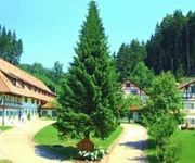
Allgäu Hotel Hofgut Kürnach
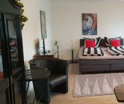
Goldenes Kreuz
Videos from this area
These are videos related to the place based on their proximity to this place.
Pension Ferienhof Haggenmüller
Erleben sie Ihren Urlaub nach Ihren Wünschen - ganz in Ruhe - mit Wanderungen oder als Gipfelstürmer. Der nahegelegene Eschacher Weiher lädt Sie zum schwimmen, verweilen und sonnen ein....
Altusried im Oberallgäu | Montaregio
Die Gemeinde Altusried liegt im Oberallgäu, zwischen Kempten und Memmingen, und setzt sich aus mehreren ehemals selbstständigen Dörfern zusammen.
Brauchtum und Sicherheit: In Altusried wurde heute der Maibaum aufgestellt
In Immenstadt musste heute auf eine alte Tradition verzichtet werden: die Verantwortlichen hatten das Aufstellen des Maibaums abgesagt. Zu groß sei das Risiko, dass bei der Prozedur etwas...
Noch zwei Tag bis zur Erstaufführung: In Altusried laufen die Generalproben zu My Fair Lady
Am Freitag ist es soweit. Dann wird das Musical My Fair Lady auf der Altusrieder Freilichtbühne zum ersten Mal aufgeführt. Seit Wochen wird für die Produktion, übrigens die bisher teuerste...
Ein ganzer Ort spielt Theater: Vor der Premiere von Don Quijote in Altusried
Es ist jedes Mal ein Höhepunkt im Allgäuer Kulturkalender. Das Freilichtspiel in Altusried ist weit über die Grenzen der Region bekannt. Quasi der ganze Ort engagiert sich und trägt zum...
Es grünt so grün wenn Spaniens Blüten blühen: My Fair Lady feiert in Altusried Premiere
Lange wurde in Altusried gebaut, geprobt und vorbereitet und jetzt am Freitagabend war´s endlich soweit. My Fair Lady feierte auf der Freilichtbühne Premiere. Fast alle hochkarätig besetzten...
Ziach - Trekklavier - Acordeão - Accordeon [Beiere]
Kultur- und Brauchtumswochenende der bayerischen Trachtenjugend 2007 09. / 10. Juni 2007, Altusried.
2 Säulen Hebebühne, PKW Hebebühne, Zavagli Santi Z-41/3S
Die Eurolift Zavagli Sanit Z-41/3S mit 2,7t Tragkraft wird in Italien hergestellt. Sie ist eine sehr hochwertig verarbeitete 2 Säulen Hebebühne, mit Grundrahmen. Die perfekte PKW-Hebebühne...
Videos provided by Youtube are under the copyright of their owners.
Attractions and noteworthy things
Distances are based on the centre of the city/town and sightseeing location. This list contains brief abstracts about monuments, holiday activities, national parcs, museums, organisations and more from the area as well as interesting facts about the region itself. Where available, you'll find the corresponding homepage. Otherwise the related wikipedia article.
Allgäu
The Allgäu is a southern German region in Swabia. It covers the south of Bavarian Swabia and southeastern Baden-Württemberg. The region stretches from the prealpine lands up to the Alps. The main rivers flowing through the Allgäu are the Lech and Iller.
Molasse basin
The Molasse basin is a foreland basin north of the Alps, that formed during the Oligocene and Miocene epochs. The basin formed due to the flexure of the European plate under the weight of the orogenic wedge of the Alps that was forming to the south. In geology, the name "molasse basin" is sometimes also used in a general sense for a synorogenic (formed contemporaneously with the orogen) forelandbasin of the type north of the Alps.
Kürnach (Eschach)
Kürnach is a river of Bavaria, Germany.


!['Ziach - Trekklavier - Acordeão - Accordeon [Beiere]' preview picture of video 'Ziach - Trekklavier - Acordeão - Accordeon [Beiere]'](https://img.youtube.com/vi/b9lrcXr7eQ8/mqdefault.jpg)

