Safety Score: 3,0 of 5.0 based on data from 9 authorites. Meaning we advice caution when travelling to Germany.
Travel warnings are updated daily. Source: Travel Warning Germany. Last Update: 2024-08-13 08:21:03
Delve into Tiefenbach
The district Tiefenbach of Bellenberg in Swabia (Bavaria) is a subburb in Germany about 329 mi south-west of Berlin, the country's capital town.
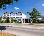
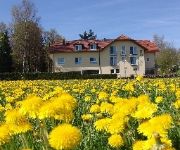
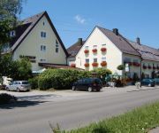
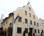
If you need a hotel, we compiled a list of available hotels close to the map centre further down the page.
While being here, you might want to pay a visit to some of the following locations: Illerrieden, Unterroth, Oberroth, Osterberg and Roggenburg. To further explore this place, just scroll down and browse the available info.
Local weather forecast
Todays Local Weather Conditions & Forecast: -1°C / 30 °F
| Morning Temperature | -5°C / 23 °F |
| Evening Temperature | -2°C / 28 °F |
| Night Temperature | -2°C / 29 °F |
| Chance of rainfall | 3% |
| Air Humidity | 89% |
| Air Pressure | 1011 hPa |
| Wind Speed | Fresh Breeze with 14 km/h (9 mph) from North-East |
| Cloud Conditions | Clear sky, covering 8% of sky |
| General Conditions | Snow |
Saturday, 23rd of November 2024
0°C (33 °F)
-2°C (29 °F)
Overcast clouds, fresh breeze.
Sunday, 24th of November 2024
3°C (38 °F)
0°C (32 °F)
Broken clouds, gentle breeze.
Monday, 25th of November 2024
5°C (42 °F)
5°C (40 °F)
Light rain, moderate breeze, broken clouds.
Hotels and Places to Stay
Hotel am Schloss GmbH
Sentio
Illertisser Hof
Sporthotel Ihle
Dornweiler Hof
Zur Rose
Zum Löwen Gasthof
RiKu Hotel Weißenhorn
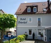
Hotel Peterhof
Zur Linde Gasthof
Videos from this area
These are videos related to the place based on their proximity to this place.
Nautilla Illertissen - Riesenrutsche Onride
Onride-Video der Tunnelrutsche (Riesenrutsche) im Freizeitbad Nautilla Illertissen. Mehr Infos und Bilder zum Freizeitbad Nautilla Illertissen gibt es unter http://www.rutscherlebnis.de/schwimmbad...
Blade 350 am Vöhlinschloß Illertissen
Mit dem Blade 350 am Vöhlinschloß in Illertissen. http://www.liposhop24.com/de/quadcopter/auswahl FPV und Copter Infos: http://www.fpv-copter-forum.de.
Nautilla Illertissen - Kinderrutsche Onride
Onride-Video der Edelstahl-Kinderrutsche im Freizeitbad Nautilla Illertissen. Mehr Infos und Bilder zum Freizeitbad Nautilla Illertissen gibt es unter http://www.rutscherlebnis.de/schwimmbadverzei...
Schach in der Schranne in Illertissen
Schach in der Schranne in Illertissen 3 Schach-Mannschaftsspiele an einem Tag in der wunderschönen historischen Schranne in Illertissen. Ausgetragen durch den Schachverein Jedesheim.
Charlotte og Ganti i Illertissen 120km CEI**
Jeg har redigeret denne video med YouTubes videoredigeringsværktøj (http://www.youtube.com/editor)
38. Int. Deutsche Meisterschaft im Schachproblemlösen in Illertissen
38. Int. Deutsche Meisterschaft im Schachproblemlösen in Illertissen. Organisator und Veranstalter -Die Schwalbe- und die Schachabteilung des SV Jedesheim.
Videos provided by Youtube are under the copyright of their owners.
Attractions and noteworthy things
Distances are based on the centre of the city/town and sightseeing location. This list contains brief abstracts about monuments, holiday activities, national parcs, museums, organisations and more from the area as well as interesting facts about the region itself. Where available, you'll find the corresponding homepage. Otherwise the related wikipedia article.
Iller
İller means provinces in Turkish, see Provinces of Turkey The Iller (ancient name Ilargus) is a river in Bavaria and Baden-Württemberg in Germany. It is a right tributary of the Danube, 147 km in length. The source is located near Oberstdorf in the Allgäu region of the Alps, close to the Austrian border. From there it runs northwards, passing the towns of Sonthofen, Immenstadt, and Kempten.
Neu-Ulm (district)
Neu-Ulm is a district in Bavaria, Germany. It is bounded by (from the east and clockwise) the districts of Günzburg and Unterallgäu and the state of Baden-Württemberg. The district was established in 1972 by merging the former districts of Neu-Ulm and Illertissen with the previously district-free city of Neu-Ulm. The district includes the eastern metropolitan area of the city of Ulm. The Danube and its tributary, the Iller, form the western border of the district.
Battle of Ulm
The Battle of Ulm on 16–19 October 1805 was a series of minor skirmishes at the end of Emperor Napoleon's Ulm Campaign. It culminated in the surrender of Karl Freiherr Mack von Leiberich and a significant part of his army near Ulm in Württemberg.
Rechberg and Rothenlöwen
Rechberg and Rothenlöwen was a country in the Holy Roman Empire. Rechberg and Rothenlöwen was a renaming of Osterberg, and it inherited Osterberg in 1767. Rechberg and Rothenlöwen was mediatised to Württemberg in 1806. The family of the Grafen von Rechberg und Rothenlöwen would be an important one in the 19th century. Aloys was a prominent Bavarian statesman, while his son Johann Bernhard, would enter the Austrian diplomatic service and rise eventually to the post of Minister of Foreign Affairs.
Radio 7
Radio 7 is a German radio station. It is broadcast in southeastern Baden-Württemberg and can also be received in neighboring Switzerland. Its main studio is located in Ulm, it also has local studios in Aalen, Ravensburg and Tuttlingen. Radio 7 has about 164,000 listeners per hour in Germany and 73,000 listeners per hour in Switzerland.
Gutenzell Abbey
Gutenzell Abbey was a Cistercian nunnery in the municipality of Gutenzell-Hürbel in the district of Biberach, Baden-Württemberg, Germany. The origins of the monastery are unknown. According to legend, the monastery was founded in the 12th century by two sisters of the aristocratic family Schlossberg (in later tradition called Schlüsselberg), whose castle was nearby, and called in Cella Dei, rendering Gottes Zelle in German.
Donaustadion
The Donaustadion is a multi-purpose stadium in Ulm, Germany. It is currently used mostly for football matches and is the home stadium of SSV Ulm 1846. The stadium is able to hold 19,500 people. In 1999, a new stand was constructed, filling the last open gap of the former horseshoe shaped ground. This all-seated affair was the first non-smoking stand within a professional football ground in Germany.
Wiblingen Abbey
Wiblingen Abbey was a former Benedictine abbey which was later used as barracks. Today its buildings house several departments of the medical faculty of the University of Ulm. The former abbey is located south of the confluence of the rivers Danube and Iller, south of the city of Ulm in the German state of Baden-Württemberg. Administratively, the former independent village of Wiblingen now belongs to the city of Ulm. The abbey is part of the Upper Swabian Baroque Route.
Ulm Central Station
Ulm Central Station (Ulm Hauptbahnhof) is the main station in the city of Ulm, which lies on the Danube, on the border of the German states of Baden-Württemberg and Bavaria in the Danube-Iller region (Region Donau-Iller). Ulm station has twelve platforms, of which five are terminating platforms, and forms a major railway junction. Other stations in the city are Ulm-Söflingen to the west and Ulm Ost (east) to the east and Ulm-Donautal (Danube valley) in the industrial area.
Roggenburg Abbey
Roggenburg Abbey (Kloster Roggenburg or Reichsstift Roggenburg) is a Premonstratensian canonry in Roggenburg near Neu-Ulm, Bavaria, in operation between 1126 and 1802, and again from its re-foundation in 1986. Since 1992 it has been an independent priory of Windberg Abbey in Lower Bavaria (Roggenburg Priory). The monastery manages a training centre and a museum, and is widely known for its almost unchanged Baroque building and the organ concerts that are held in the church.
Söflingen Abbey
Söflingen Abbey was a nunnery of the Order of Poor Ladies, also known as the Poor Clares, the Poor Clare Sisters, the Clarisse, the Minoresses, or the Second Order of St. Francis. It was situated in the village of Söflingen, now part of Ulm in Baden-Württemberg, Germany. Being the oldest nunnery of this order in Germany, it was also its most important and most affluent.
Oberrieder Weiher
The Oberrieder Weiher is like many other ponds in the valleys of Günz and Mindel a former gravel pit which is filled with ground water. The pond is located near the river Günz in the municipality of Breitenthal in the district of Günzburg. Because of this origin as gravel pit the form of the Oberrieder Weiher is nearly a square. the specific feature of the Oberrieder Weiher is its area of 34,7 hectare. Sometimes it is said that it is the biggest flooded gravel pit in Bavarian Swabia.
Stadthaus Ulm
The Stadthaus Ulm is an assembly hall and art exhibition centre in the city centre of Ulm. As an international landmark of modern architecture it is a building that encourages encounters with art, people, and culture. At the foot of the famous Ulm Minster, forming both a contrast and a complement to this dominating late-Gothic building, the Stadthaus and Münsterplatz (minster square) were designed by the renowned US architect Richard Meier.
Arena Ulm/Neu-Ulm
Max Bögl group plans, builds and operates. On the evening of 11 November met the council of Ulm, together with the City of Neu-Ulm by a large majority a landmark decision to build a modern multifunction hall on the Neu-Ulm Volksfestplatz. After a design & build process, the group was Max Bögl to the arenas in Nuremberg and Varazdin again convince the construction and operation of a multipurpose hall.
Memminger Aach
The Memminger Aach or Memminger Ach is a river of Bavaria, Germany. It is a tributary of the Iller, part of the Danube river system and forms an important part of the landscape in the town of Memmingen. The river flows for 20 kilometres.
Rötelbach (Donau)
Rötelbach (Donau) is a river of Baden-Württemberg, Germany.
Weihung
Weihung is a river of Baden-Württemberg, Germany.
Klosterbeurener Bach
Klosterbeurener Bach is a river of Bavaria, Germany.
Memminger Ach
Memminger Ach is a river of Bavaria, Germany.
Trams in Ulm
The Ulm tramway network forms part of the public transport system in Ulm, in the federal state of Baden-Württemberg, Germany. Opened in 1897, the network is currently operated by Stadtwerken Ulm/Neu-Ulm GmbH (SWU).
AuGuSTheater Neu-Ulm
AuGuSTheater Neu-Ulm is a theatre in Bavaria, Germany.
Historisches Stadttheater Weißenhorn
Historisches Stadttheater Weißenhorn is a theatre in Bavaria, Germany.
Theater Ulm
Theater Ulm is a theatre in Baden-Württemberg, Germany.
Theater Ulüm
Theater Ulüm is a theatre in Baden-Württemberg, Germany.
Neu-Ulm station
Neu-Ulm station is the largest railway station of the Bavarian Große Kreisstadt (major district town) of Neu-Ulm. Other station in Neu-Ulm are Gerlenhofen and Finninger Straße, both on the Neu-Ulm–Kempten railway, and the disused Burlafingen station on the Ulm–Augsburg railway. The station was opened in 1853 and was rebuilt in 2007 as part of the Neu-Ulm 21 project in an open trough structure, which is covered to the northeast and southwest of the platforms.


