Safety Score: 3,0 of 5.0 based on data from 9 authorites. Meaning we advice caution when travelling to Germany.
Travel warnings are updated daily. Source: Travel Warning Germany. Last Update: 2024-08-13 08:21:03
Discover Unterbreitenlohe
Unterbreitenlohe in Regierungsbezirk Mittelfranken (Bavaria) is a town in Germany about 255 mi (or 411 km) south-west of Berlin, the country's capital city.
Current time in Unterbreitenlohe is now 05:12 PM (Sunday). The local timezone is named Europe / Berlin with an UTC offset of one hour. We know of 12 airports near Unterbreitenlohe, of which 5 are larger airports. The closest airport in Germany is Ansbach-Petersdorf Airport in a distance of 20 mi (or 32 km), North-West. Besides the airports, there are other travel options available (check left side).
There are several Unesco world heritage sites nearby. The closest heritage site in Germany is Town of Bamberg in a distance of 51 mi (or 82 km), North. Looking for a place to stay? we compiled a list of available hotels close to the map centre further down the page.
When in this area, you might want to pay a visit to some of the following locations: Georgensgmund, Rottenbach, Hottingen, Ettenstatt and Buchenbach. To further explore this place, just scroll down and browse the available info.
Local weather forecast
Todays Local Weather Conditions & Forecast: 8°C / 46 °F
| Morning Temperature | 4°C / 39 °F |
| Evening Temperature | 5°C / 40 °F |
| Night Temperature | 4°C / 38 °F |
| Chance of rainfall | 0% |
| Air Humidity | 74% |
| Air Pressure | 1021 hPa |
| Wind Speed | Moderate breeze with 10 km/h (6 mph) from North |
| Cloud Conditions | Overcast clouds, covering 98% of sky |
| General Conditions | Overcast clouds |
Monday, 25th of November 2024
8°C (47 °F)
4°C (39 °F)
Scattered clouds, gentle breeze.
Tuesday, 26th of November 2024
7°C (45 °F)
2°C (36 °F)
Light rain, gentle breeze, overcast clouds.
Wednesday, 27th of November 2024
5°C (41 °F)
6°C (43 °F)
Overcast clouds, moderate breeze.
Hotels and Places to Stay
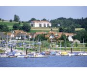
Seehotel Zur Hopfenkönigin
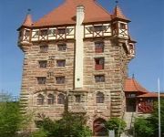
Burg Abenberg
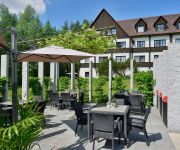
Sonnenhof
Blauer Bock
Krone Hotel Gasthof
Kaiser Landhaus
Zum Böhm Landhotel
Landgasthof Krone
Videos from this area
These are videos related to the place based on their proximity to this place.
Rundfahrt durch Georgensgmünd im Zeitraffer 2015/03/10
Google Street View hatte noch immer keine Zeit, aber da man Aufgaben von nationaler Bedeutung ohnehin keinen Dilettanten überlassen sollte, drehen wir eben auch 2015. Wie seine erfolgreichen...
Rundfahrt durch Georgensgmünd im Zeitraffer 2014/03/12
Verpasst nicht die zweite Gelegenheit, uns bei der ereignisreichen Rundfahrt durch das malerische Georgensgmünd zu begleiten. In Farbe und HD und aus traditionellen Gründen in 3facher ...
DJI Phantom 2 #06 - Viadukt Georgensgmünd
Viadukt kommt aus dem Lateinischen (via = Weg + ducere = führen; PPP ductum) und bedeutet Wegleitung oder Wegführung oder sehr frei übersetzt Trasse. Als Viadukt werden auch mehr oder minder ...
Niki´s Schreibwaren - und Spielzeug-Paradies in Georgensgmünd, Franken
https://www.firmen.tv Zu Niki´s Schreibwaren - und Spielzeug-Paradies aus Georgensgmünd in Franken finden Sie ein ausführliches Porträt unter https://www.firmen.tv/nikis-schreib-und-spielparad...
Kirchweih Georgensgmund 2010 - Musikverein Röttenbach
Musikverein Röttenbach tijdens Kirchweih Georgensgmünd op 31 juli 2010.
2013 Bayern3 Dorffest Silbermond by OnAirCam
Luftaufnahmen vom Bayern3-Dorffest 2013 in Georgensgmünd mit Silbermond, Madcon, der Bayern3-Band... www.onaircam.com.
Enduro 2013 Schweres November Enduro Pleinfeld
1 1/2 ungefilterte Runden in Pleinfeld mit allen Höhen und Tiefen :-)
Bauernhaus im fränkischen Seenland mit einer Menge Optionen! in Pleinfeld
Bauernhaus im fränkischen Seenland mit einer Menge Optionen! - Bauernhaus in Pleinfeld - ObjNr: 2786-923 Diese ca. 200 Jahre alte Hofstelle mit Nebengebäude liegt innerorts in einem kleinen...
Seenlandmarathon 2012 - Kurzversion
Der Seenlandmarathon 2012 war ein wahres Lauffestival: Strahlender Sonnenschein, die traumhafte Laufstrecke in einzigartigem Panorama, motivierende Stimmungsnester rund um den Brombachsee ...
Videos provided by Youtube are under the copyright of their owners.
Attractions and noteworthy things
Distances are based on the centre of the city/town and sightseeing location. This list contains brief abstracts about monuments, holiday activities, national parcs, museums, organisations and more from the area as well as interesting facts about the region itself. Where available, you'll find the corresponding homepage. Otherwise the related wikipedia article.
Fränkische Rezat
The Fränkische Rezat is a 64 km long river in southern Germany. It is the western, left source river of the Rednitz. It rises in the Frankenhöhe hills, near Oberdachstetten. It flows generally east through the towns Lehrberg, Ansbach, Windsbach and Spalt. It flows into the Rednitz in Georgensgmünd.
Schwäbische Rezat
The Schwäbische Rezat is a river in southern Germany. It is the southern, right source river of the Rednitz. It rises in the Franconian Jura hills, near Weißenburg in Bayern. It flows generally north through the towns Weißenburg in Bayern, Ellingen and Pleinfeld. It flows into the Rednitz in Georgensgmünd.
Brombach (Schwäbische Rezat)
Brombach (Schwäbische Rezat) is a river of Bavaria, Germany.


