Safety Score: 3,0 of 5.0 based on data from 9 authorites. Meaning we advice caution when travelling to Germany.
Travel warnings are updated daily. Source: Travel Warning Germany. Last Update: 2024-08-13 08:21:03
Discover Bonhof
Bonhof in Regierungsbezirk Mittelfranken (Bavaria) is a city in Germany about 268 mi (or 431 km) south-west of Berlin, the country's capital city.
Local time in Bonhof is now 06:18 PM (Sunday). The local timezone is named Europe / Berlin with an UTC offset of one hour. We know of 11 airports in the vicinity of Bonhof, of which 5 are larger airports. The closest airport in Germany is Ansbach-Petersdorf Airport in a distance of 30 mi (or 48 km), North-West. Besides the airports, there are other travel options available (check left side).
There are several Unesco world heritage sites nearby. The closest heritage site in Germany is Old town of Regensburg with Stadtamhof in a distance of 52 mi (or 84 km), East. Looking for a place to stay? we compiled a list of available hotels close to the map centre further down the page.
When in this area, you might want to pay a visit to some of the following locations: Langenaltheim, Solnhofen, Hottingen, Alesheim and Rogling. To further explore this place, just scroll down and browse the available info.
Local weather forecast
Todays Local Weather Conditions & Forecast: 10°C / 50 °F
| Morning Temperature | 3°C / 37 °F |
| Evening Temperature | 8°C / 47 °F |
| Night Temperature | 4°C / 39 °F |
| Chance of rainfall | 0% |
| Air Humidity | 68% |
| Air Pressure | 1021 hPa |
| Wind Speed | Gentle Breeze with 8 km/h (5 mph) from North-East |
| Cloud Conditions | Overcast clouds, covering 99% of sky |
| General Conditions | Overcast clouds |
Monday, 25th of November 2024
8°C (47 °F)
4°C (39 °F)
Few clouds, gentle breeze.
Tuesday, 26th of November 2024
8°C (46 °F)
3°C (38 °F)
Light rain, gentle breeze, overcast clouds.
Wednesday, 27th of November 2024
6°C (43 °F)
7°C (44 °F)
Light rain, moderate breeze, overcast clouds.
Hotels and Places to Stay
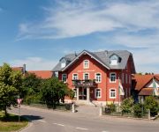
Zum Goldenen Lamm Gasthof
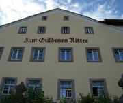
Zum Güldenen Ritter
Hotel Adler
Adventure Campus
Am Ellinger Tor Flair Hotel
Zur Sonne Gasthof
Videos from this area
These are videos related to the place based on their proximity to this place.
Grundsteinlegung und Einweihung Heilig-Kreuz-Kirche in Weissenburg in Bayern im Jahr 1963
Grundsteinlegung und Einweihung Heilig-Kreuz-Kirche in Weissenburg in Bayern im Jahr 1963, aufgenommen von Wilhelm Schlereth.
Kirchweih 2008 in Weißenburg in Bayern
Finale des Großfeuerwerks zur Kirchweih 2008 in Weißenburg in Bayern.
Weissenburg/Bayern
Schon vor 100 Jahren wurde für Konsumprodukte geworben. Damals nannte man die Werbung jedoch Reklame und jede Firma welche was auf sich hielt, produzierte kleine Briefmarken ähnliche ...
stabilo aquacolor
Zeichnung mit wasservermalbarenstiften von Stabilo. Stadtmauer von Weissenburg in Bayern. Stifte Stabilo Aquacolor. März 2912, Zeichner Gerhard Ruff.
5. MundART Festival Weißenburg
Schlusslied (Einfach Schee) mit Konstanze Kraus (Harfe), Otto Göttler (Trompete) und Arthur Rosenbauer (Gitarre + Gesang). Schwaben und Bayern trifft auf Franken.
Kirchweihdonnerstag mit Troglauer Buam - Weißenburg 2010
Raiffeisentag toppt die Bierprobe, bereits um 20:00 stand nahezu das gesamte Publikum zur Musik auf den Bänken...
42. Reimnacht Poetry Slam Weißenburg - Vorrunde - Doris Schreibfall
Doris Schreibfall (Steiner) Vorrunde Tut mir leid, dass jemand durchs Bild gelaufen ist, aber es war so voll, dass er nur vorne reingekommen ist. https://www.facebook.com/dorisschreibfall?ref=hl.
Sportakrobatik - Sports on Black.mov
"Sports on Black" Fotoshootings im November 2011 in Weißenburg in Zusammenarbeit mit den Sportakrobaten des TSV 1860 Weißenburg. Mehr Bilder unter ...
ehemaliger Bauernhof in Weißenburg
ehemaliger Bauernhof - Reitanlage in Weißenburg - ObjNr: 5546-904 Großzügiger ehemaliger Bauernhof in einwandfreiem Zustand. Zentral und doch sehr ruhig gelegen mit direktem Zugang zu ...
Videos provided by Youtube are under the copyright of their owners.
Attractions and noteworthy things
Distances are based on the centre of the city/town and sightseeing location. This list contains brief abstracts about monuments, holiday activities, national parcs, museums, organisations and more from the area as well as interesting facts about the region itself. Where available, you'll find the corresponding homepage. Otherwise the related wikipedia article.
Pappenheim (state)
Pappenheim was a German statelet in western Bavaria, Germany, located on the Altmühl river between Treuchtlingen and Solnhofen, and south of Weißenburg. Pappenheim originated as a Lordship around 1030, and was raised to a county in 1628. Pappenheim was partitioned twice: between itself, Aletzheim, Gräfenthal and Treutlingen in 1439; and between itself and Stühlingen in 1558. Pappenheim absorbed: Aletzheim 1697; Gräfenthal 1536; and Treutlingen 1647.
Fossa Carolina
The Fossa Carolina (or Karlsgraben in German) was a navigable channel connecting the Swabian Rezat river to the Altmühl river. It was created during the Middle Ages long before the Ludwig Canal and the Rhine-Main-Danube Canal. This Channel was the first to link the Rhine basin to the Danube basin In 793 Charlemagne gave orders to dig a 3 kilometers long channel from Treuchtlingen to Weißenburg in Bayern.


