Safety Score: 3,0 of 5.0 based on data from 9 authorites. Meaning we advice caution when travelling to Germany.
Travel warnings are updated daily. Source: Travel Warning Germany. Last Update: 2024-08-13 08:21:03
Explore Saldenburg
Saldenburg in Lower Bavaria (Bavaria) with it's 2,040 inhabitants is a city in Germany about 259 mi (or 417 km) south of Berlin, the country's capital.
Local time in Saldenburg is now 04:33 PM (Sunday). The local timezone is named Europe / Berlin with an UTC offset of one hour. We know of 11 airports in the vicinity of Saldenburg, of which 5 are larger airports. The closest airport in Germany is Straubing Airport in a distance of 39 mi (or 63 km), West. Besides the airports, there are other travel options available (check left side).
There are several Unesco world heritage sites nearby. The closest heritage site is Holašovice Historical Village Reservation in Czechia at a distance of 43 mi (or 69 km). The closest in Germany is Old town of Regensburg with Stadtamhof in a distance of 60 mi (or 69 km), East. If you need a place to sleep, we compiled a list of available hotels close to the map centre further down the page.
Depending on your travel schedule, you might want to pay a visit to some of the following locations: Furstenstein, Witzmannsberg, Neukirchen vorm Wald, Zenting and Innernzell. To further explore this place, just scroll down and browse the available info.
Local weather forecast
Todays Local Weather Conditions & Forecast: 4°C / 39 °F
| Morning Temperature | -0°C / 31 °F |
| Evening Temperature | 3°C / 38 °F |
| Night Temperature | 3°C / 38 °F |
| Chance of rainfall | 6% |
| Air Humidity | 77% |
| Air Pressure | 1016 hPa |
| Wind Speed | Gentle Breeze with 7 km/h (4 mph) from North-East |
| Cloud Conditions | Broken clouds, covering 68% of sky |
| General Conditions | Moderate rain |
Monday, 18th of November 2024
3°C (38 °F)
4°C (39 °F)
Rain and snow, gentle breeze, overcast clouds.
Tuesday, 19th of November 2024
4°C (40 °F)
5°C (42 °F)
Moderate rain, moderate breeze, overcast clouds.
Wednesday, 20th of November 2024
0°C (32 °F)
-2°C (29 °F)
Snow, moderate breeze, overcast clouds.
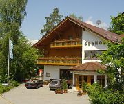
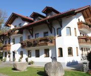
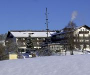
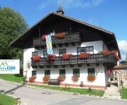
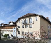
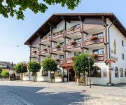
Hotels and Places to Stay
Familotel Schreinerhof
Seehof Tauer
Schmalhofer Landhotel & Gasthof
Schürger Wellnesshotel
Haibach Gästehaus
Zum Jägerstöckl
Zur Ohe Familotel Landhaus
Akzent Hotel Antoniushof
Zur Post
Neuhof Landhotel
Videos from this area
These are videos related to the place based on their proximity to this place.
Weto SCALINATA programma gratuito per progettare scale in legno
Weto SCALINATA presto disponibile ANCHE IN LINGUA ITALIANA !!!
d'Waidler Musi, Volksfest Tittling, schneidige Volksmusik
schneidige Volksmusik der d'Waidler Musi beim Weißwurstfrühschoppen Volksfest Tittling.
Schuerger Wellness Hotel - Ballooning in Bavaria
Vital- und Wellness-Hotel Schürger in Thurmansbang. Unser Hotel verfügt über 122 Betten mit Dusche und WC, Telefon, Sat-TV, Balkon oder Terrasse. Unseren Hausgästen stehen Hallenbad (5x15m,.
Elefantentreffen 2015
Il viaggio andata e ritorno in Germania, a Thurmansbang - Solla per l'Elefantentreffen 2015.
Des koide Wasserl
http://www.volksmusikant-hermann.de http://www.facebook.com/pages/Hermann-Huber/104113623025586 http://www.myspace.com/thehermannhuber Hermann Huber & Tobias Huber beim Int.
Ilz Flusswanderung 2012.WMV
10 km Rundwanderweg. Ausgangspunkt Schneidermühle. Auf halber Strecke, bei der Schrottenbaummühle, überquert man die Ilz. Auf der anderen Flussseite führt der Weg zurück zur Schneidermühle.
Videos provided by Youtube are under the copyright of their owners.
Attractions and noteworthy things
Distances are based on the centre of the city/town and sightseeing location. This list contains brief abstracts about monuments, holiday activities, national parcs, museums, organisations and more from the area as well as interesting facts about the region itself. Where available, you'll find the corresponding homepage. Otherwise the related wikipedia article.
Dreiburgensee
Dreiburgensee is a lake in Bayerischer Wald, Bavaria, Germany. At an elevation of 440 m, its surface area is 0.8 km².


