Safety Score: 3,0 of 5.0 based on data from 9 authorites. Meaning we advice caution when travelling to Germany.
Travel warnings are updated daily. Source: Travel Warning Germany. Last Update: 2024-08-13 08:21:03
Delve into Noppling
Noppling in Lower Bavaria (Bavaria) is located in Germany about 292 mi (or 470 km) south of Berlin, the country's capital town.
Current time in Noppling is now 08:59 AM (Friday). The local timezone is named Europe / Berlin with an UTC offset of one hour. We know of 11 airports close to Noppling, of which 4 are larger airports. The closest is airport we know is Salzburg Airport in Austria in a distance of 36 mi (or 58 km). The closest airport in Germany is Straubing Airport in a distance of 45 mi (or 58 km), South. Besides the airports, there are other travel options available (check left side).
There are several Unesco world heritage sites nearby. The closest heritage site is Historic Centre of the City of Salzburg in Austria at a distance of 36 mi (or 57 km). The closest in Germany is Old town of Regensburg with Stadtamhof in a distance of 62 mi (or 57 km), South. If you need a hotel, we compiled a list of available hotels close to the map centre further down the page.
While being here, you might want to pay a visit to some of the following locations: Reut, Julbach, Wittibreut, Stammham and Zeilarn. To further explore this place, just scroll down and browse the available info.
Local weather forecast
Todays Local Weather Conditions & Forecast: 6°C / 42 °F
| Morning Temperature | 3°C / 37 °F |
| Evening Temperature | 3°C / 38 °F |
| Night Temperature | 1°C / 34 °F |
| Chance of rainfall | 0% |
| Air Humidity | 76% |
| Air Pressure | 1029 hPa |
| Wind Speed | Light breeze with 3 km/h (2 mph) from North-East |
| Cloud Conditions | Overcast clouds, covering 96% of sky |
| General Conditions | Overcast clouds |
Saturday, 16th of November 2024
6°C (43 °F)
1°C (34 °F)
Sky is clear, light breeze, clear sky.
Sunday, 17th of November 2024
7°C (45 °F)
4°C (40 °F)
Light rain, gentle breeze, few clouds.
Monday, 18th of November 2024
4°C (40 °F)
2°C (36 °F)
Light rain, gentle breeze, overcast clouds.
Hotels and Places to Stay
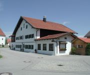
Bonimeier Gasthaus
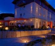
Inntalhof
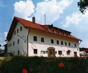
Kirchenwirt
Videos from this area
These are videos related to the place based on their proximity to this place.
Mofa Trophy 2007 in Simbach am Inn
ein kurzer Zusammenschnitt von der Mofatrophy 2007, ausgerichtet vom MSC Simbach/Inn. Sorry für die schlechte Bildqualität ;-)
Tunnelwest
Flug mit Google Earth entlang des möglichen Tunnel für die A94 im Raum Simbach am Inn von Westen nach Osten.
Wohnhaus brennt in Kirchdorf am Inn
Hoher Sachschaden ist in der Nacht zum 1. Mai 2014 beim Brand eines Wohnhauses in Kirchdorf am Inn (Landkreis Rottal-Inn) entstanden. Verletzt wurde glücklicherweise niemand, auch weil die...
KOM Marktl Supermoto 22.12.2012
Beim Supermoto-Einsteiger-Lehrgang über die Indoor Kartbahn mit der YAMAHA WR250X fetzen.
Supermoto Drift Day Marktl GoPro -- TURN # 5
KOM Marktl - Beta Drift Day - 03.12.2011 - Gruppe 1 Supermoto in der Karthalle in Marktl. Leihmotorräder Beta 350cm³. Aufgenommen mit Go Pro Hero HD Dieses Mal sind schon kleine Bremsdrifts...
KOM Marktl | Ssp goes Supermoto | Hero 4 Black
Ride Against Winter Depressions !!! 1080p !!! Draußen ist´s kalt, es regnet bzw. schneit und die Laune ist am Boden. Da gibts nichts besseres als mal auf ner Kartbahn mit der Supermoto...
ARD Buffet Dialekträtsel in der KOM Marktl Kartbahn, Rätselwort Bodschad
Bayrisches Dialekträtsel mit Hans und Sylvia Eder in der KOM Marktl Kartbahn.
Videos provided by Youtube are under the copyright of their owners.


