Neuhütte
in Lower Bavaria of Bavaria, Germany

Noteable things around
Location Summary
Decimal Coordinates (Latitude, Longitude):
49.127 and 13.183 (Lat./Lng.)
Coordinates by Time:
N 49° 7' 38" and E 13° 10' 57"
Currency and Currency Code:
Euro - EUR
Spoken languages:
German
Local electricity:
230 V - 50 Hz (plugs: G)
Mobile phone / cellular frequencies (MHz):
900 MHz, 1800 MHz, 3G, 4G
Local Time: 07:02 AM (Monday)
Timezone: Europe/Berlin
UTC/GMT offset: 1 hours
Sunrise and Sunset:
7:33 am and 4:15 pm
Antipode Coordinates:
-44.033 and -176.367 (Lat./Lng.)
Closest place to antipode coordinates:
Ouwenga
References
This place on Geonames.org
Current travel safety evaluation for Germany in Western Europe

Safety Score: 3,0 of 5.0 based on data from 9 authorites. Meaning we advice caution when travelling to Germany.

Travel warnings are updated daily. Source: Travel Warning Germany. Last Update: 2024-08-13 08:21:03

Explore Neuhütte

Neuhütte in Lower Bavaria (Bavaria) is a city in Germany about 235 mi (or 378 km) south of Berlin, the country's capital.

Local time in Neuhütte is now 07:02 AM (Monday). The local timezone is named Europe / Berlin with an UTC offset of one hour. We know of 11 airports in the vicinity of Neuhütte, of which 5 are larger airports. The closest airport in Germany is Straubing Airport in a distance of 34 mi (or 55 km), South-West. Besides the airports, there are other travel options available (check left side).

There are several Unesco world heritage sites nearby. The closest heritage site is Holašovice Historical Village Reservation in Czechia at a distance of 50 mi (or 80 km). The closest in Germany is Old town of Regensburg with Stadtamhof in a distance of 50 mi (or 80 km), East. We found 1 points of interest in the vicinity of this place. If you need a place to sleep, we compiled a list of available hotels close to the map centre further down the page.

Depending on your travel schedule, you might want to pay a visit to some of the following locations: Bayerisch Eisenstein, Lohberg, Lindberg, Langdorf and Boebrach. To further explore this place, just scroll down and browse the available info.

Local weather forecast

Todays Local Weather Conditions & Forecast: 8°C / 46 °F

Morning Temperature 2°C / 36 °F
Evening Temperature 2°C / 35 °F
Night Temperature 0°C / 33 °F
Chance of rainfall 0%
Air Humidity 83%
Air Pressure 1016 hPa
Wind Speed Light breeze with 4 km/h (2 mph) from North-West
Cloud Conditions Few clouds, covering 16% of sky
General Conditions Few clouds

Tuesday, 26th of November 2024

3°C (38 °F)
-1°C (30 °F)
Light rain, light breeze, overcast clouds.

Wednesday, 27th of November 2024

4°C (39 °F)
3°C (38 °F)
Light rain, light breeze, overcast clouds.

Thursday, 28th of November 2024

0°C (33 °F)
0°C (33 °F)
Rain and snow, moderate breeze, overcast clouds.

Hotels and Places to Stay

Kronberg

Address
5,8 mi
Kronbergweg 4
94249 Bodenmais
Germany

Time Information

Checkout: 11:00 - Checkin: 15:00
Reception
Weekday: 7:00 - 22:00
Weekend: 7:00 - 22:00


Böhmhof Wellness- & Vitalhotel

Address
6,1 mi
Böhmhof 1
94249 Bodenmais
Germany

Time Information

Checkout: 12:00 - Checkin: 14:00
Reception
Weekday: 8:00 - 21:00
Weekend: 8:00 - 21:00


Hofbraeuhaus

Address
5,6 mi
Marktplatz 5
94249 Bodenmais
Germany

Time Information

Checkout: 13:00 - Checkin: 12:00
Reception
Weekday: 7:00 - 22:00
Weekend: 7:00 - 22:00


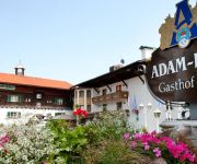
Adam-Braeu Wander und Aktivhotel

Address
5,4 mi
Bahnhofstr. 51
94249 Bodenmais
Germany

Time Information

Checkout: 11:00 - Checkin: 14:00
Reception
Weekday: 8:00 - 21:00
Weekend: 8:00 - 21:00


Bavaria

Address
6,0 mi
Lindenweg 9
94227 Zwiesel
Germany

Time Information

Checkout: 11:00 - Checkin: 15:00
Reception
Weekday: 7:00 - 22:00
Weekend: 7:00 - 22:00


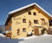
Elan Pension

Address
0,5 mi
Am Buchenacker 11
94252 Bayerisch Eisenstein
Germany

Time Information

Checkout: 10:30 - Checkin: 15:00
Reception
Weekday: 7:00 - 21:00
Weekend: 7:00 - 21:00


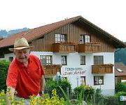
Zum Arber Ferienhotel

Address
5,1 mi
Rechenstr. 32
94249 Bodenmais
Germany

Time Information

Checkout: 11:00 - Checkin: 14:00
Reception
Weekday: 7:00 - 20:00
Weekend: 7:00 - 20:00


Tannenhof

Address
5,7 mi
Jahnstr. 6
94249 Bodenmais
Germany

Time Information

Checkout: 11:00 - Checkin: 14:00
Reception
Weekday: 0:00 - 24:00
Weekend: 0:00 - 24:00


zur Linde Hotel Pension

Address
5,0 mi
Lindenweg 1
93470 Lohberg
Germany

Time Information

Checkout: 10:00 - Checkin: 14:00
Reception
Weekday: 8:00 - 22:00
Weekend: 8:00 - 22:00


Arberblick

Address
5,1 mi
Lindenweg 2
93470 Lohberg
Germany

Time Information

Checkout: 10:00 - Checkin: 14:00
Reception
Weekday: 8:00 - 23:00
Weekend: 8:00 - 23:00


Videos from this area

These are videos related to the place based on their proximity to this place.

Železná Ruda 2012

Published: August 13, 2012
Length: 28:08 min
Rating: 5 of 5
Author: Dopravní web

Vlaky v Železné Rudě v létě 2012 a také 2011.


hranicni nadrazi zelezna ruda

Published: November 20, 2012
Length: 00:15 min
Rating: 0 of 5
Author: BestiaBleu

It is the boarder of the Czech Republic and Germany. The place is called "Grenzbahnhof Eisenstein" / "Hraniční nádraží Železná Ruda". It is the czech train 754 026-3 which I was able...


Border / Grenzübergang Zelezna Ruda - Bayerisch Eisenstein

Published: June 27, 2008
Length: 18:51 min
Rating: 5 of 5
Author: dundee5486

Crossing from Zelezna Ruda Alzbetin / Böhmisch Eisenstein Elisenthal (Czech Republic) to Bayerisch Eisenstein (Germany) on the E53 road after the abolishment of border controls. This came...


Grenzübergang Bayerisch Eisenstein - Železná Ruda (Markt Eisenstein)

Published: October 06, 2014
Length: 00:00 min
Rating: 0 of 5
Author: dundee5486


Situation Border / Übergang Zelezna Ruda - Bay. Eisenstein

Published: June 27, 2008
Length: 43:18 min
Rating: 4 of 5
Author: dundee5486

Situation at the border crossing Bayerisch Eisenstein (Germany) and Zelezna Ruda / Böhmisch Eisenstein (Czech Republic). Situation am Grenzübergang Bayerisch Eisenstein (Deutschland) and...


Rysí slavnosti 2013 - Železná Ruda - Alžbětín

Published: July 07, 2013
Length: 23:05 min
Rating: 5 of 5
Author: Zuna63

Nádraží Železná Ruda - Alžbětín po pdruhém příjezdu parního vlaku od Špičáku. Těsně za šturci je státní hranice.Budova nádraží je zpola v Německu a zpola v ČR. V pozadí...


Rysí slavnosti 2013 - Železná Ruda Alžbětín

Published: July 07, 2013
Length: 30:01 min
Rating: 0 of 5
Author: Zuna63

Posun po příjezdu parního vlaku.


Rysí slavnosti 2013 - Železná Ruda Alžbětín

Published: July 07, 2013
Length: 18:07 min
Rating: 0 of 5
Author: Zuna63

Parní vlak se vrací k nástupišti po té co uhhnul pravidelnému vlaku.Bude náledovat objíždění soupravy přes Bvorské zhlaví.


Rysí slavnosti 2013 - Železná Ruda Alžbětín

Published: July 07, 2013
Length: 22:19 min
Rating: 5 of 5
Author: Zuna63

Návrat parního vlaku ze Špičáku do Alžbětína.


IMZ Železná Ruda 2011

Published: March 07, 2011
Length: 52:14 min
Rating: 5 of 5
Author: Roman Svoboda

Nácvik záchrany z nepřístupného terénu za pomocí vrtulníku.


Videos provided by Youtube are under the copyright of their owners.

Attractions and noteworthy things

Distances are based on the centre of the city/town and sightseeing location. This list contains brief abstracts about monuments, holiday activities, national parcs, museums, organisations and more from the area as well as interesting facts about the region itself. Where available, you'll find the corresponding homepage. Otherwise the related wikipedia article.

Bayerisch Eisenstein station

Bayerisch Eisenstein station is a railway station on the border of southeast Germany and the Czech Republic. It forms the junction between the Bavarian Forest railway from Plattling to Bayerisch Eisenstein, which was started in 1874 by the Bavarian Eastern Railway Company (or Bavarian Ostbahn) and completed by the Royal Bavarian State Railways, and the Pilsen–Markt Eisenstein railway built by the [Pilsen–Priesen railway in what was then Bohemia.

Located at 49.1217, 13.2089 (Lat. / Lng.), about 1 miles away.
Wikipedia Article
Railway stations in Bavaria, Railway stations in Plzeň Region, Bavarian Forest, Registered historic buildings and monuments in Bavaria

Großer Arbersee

Großer Arbersee is a lake in Bayerischer Wald, Bavaria, Germany. At an elevation of 935 m, its surface area is 7.7 ha.

Located at 49.0986, 13.155 (Lat. / Lng.), about 2 miles away.
Wikipedia Article
Lakes of Bavaria

Hindenburgkanzel

Hindenburgkanzel is a mountain of Bavaria, Germany.

Located at 49.1472, 13.1572 (Lat. / Lng.), about 2 miles away.
Wikipedia Article
Mountains of Bavaria

Hochberg (Lower Bavaria)

Hochberg (Niederbayern) is a mountain of Bavaria, Germany.

Located at 49.1075, 13.2072 (Lat. / Lng.), about 2 miles away.
Wikipedia Article
Mountains of Bavaria

Mittagsplatzl

Mittagsplatzl is a mountain of Bavaria, Germany.

Located at 49.0936, 13.1428 (Lat. / Lng.), about 3 miles away.
Wikipedia Article
Mountains of Bavaria

capture of the webcam Brennes: Velký Javor − Grosser Arber

Brennes: Velký Javor − Grosser Arber, Brennes (source)

capture of the webcam Grosser Arber: Bodenmais Tourism & Marketing GmbH − Silberberg − Naturpark Bayerischer Wald e.V. − Czechia

Grosser Arber: Bodenmais Tourism & Marketing GmbH − Silberberg − Naturpark Bayerischer Wald e.V. − Czechia, Grosser Arber (source)

capture of the webcam Brennes: Großer Arber − Bayerischer Wald − Blick nach Süden ins ArberLand

Brennes: Großer Arber − Bayerischer Wald − Blick nach Süden ins ArberLand, Brennes (source)

capture of the webcam Brennes: Großer Arber − Bayerischer Wald − Blick nach Nordosten ins ArberLand

Brennes: Großer Arber − Bayerischer Wald − Blick nach Nordosten ins ArberLand, Brennes (source)

capture of the webcam Brennes › South-West: Grosser Arber Talstation

Brennes › South-West: Grosser Arber Talstation, Brennes (source)

capture of the webcam Brennes: Steinberglift − Bayerischen Wald

Brennes: Steinberglift − Bayerischen Wald, Brennes (source)

Webcams provided by webcam.travel are under the copyright of their owners.