Safety Score: 3,0 of 5.0 based on data from 9 authorites. Meaning we advice caution when travelling to Germany.
Travel warnings are updated daily. Source: Travel Warning Germany. Last Update: 2024-08-13 08:21:03
Discover Meßnerschlagerwaide
Meßnerschlagerwaide in Lower Bavaria (Bavaria) is a town in Germany about 269 mi (or 434 km) south of Berlin, the country's capital city.
Current time in Meßnerschlagerwaide is now 04:46 AM (Friday). The local timezone is named Europe / Berlin with an UTC offset of one hour. We know of 10 airports near Meßnerschlagerwaide, of which 4 are larger airports. The closest is airport we know is Linz Airport in Austria in a distance of 33 mi (or 52 km). The closest airport in Germany is Straubing Airport in a distance of 62 mi (or 52 km), South-East. Besides the airports, there are other travel options available (check left side).
There are several Unesco world heritage sites nearby. The closest heritage site is Historic Centre of Český Krumlov in Czechia at a distance of 26 mi (or 42 km). The closest in Germany is Old town of Regensburg with Stadtamhof in a distance of 82 mi (or 42 km), North-East. Looking for a place to stay? we compiled a list of available hotels close to the map centre further down the page.
When in this area, you might want to pay a visit to some of the following locations: Nebelberg, Breitenberg, Sonnen, Atzesberg and Neureichenau. To further explore this place, just scroll down and browse the available info.
Local weather forecast
Todays Local Weather Conditions & Forecast: 3°C / 38 °F
| Morning Temperature | 1°C / 33 °F |
| Evening Temperature | 0°C / 32 °F |
| Night Temperature | -1°C / 31 °F |
| Chance of rainfall | 0% |
| Air Humidity | 86% |
| Air Pressure | 1029 hPa |
| Wind Speed | Calm with 2 km/h (1 mph) from East |
| Cloud Conditions | Overcast clouds, covering 100% of sky |
| General Conditions | Overcast clouds |
Saturday, 16th of November 2024
6°C (42 °F)
-1°C (31 °F)
Sky is clear, calm, clear sky.
Sunday, 17th of November 2024
2°C (36 °F)
2°C (35 °F)
Rain and snow, gentle breeze, broken clouds.
Monday, 18th of November 2024
0°C (33 °F)
0°C (33 °F)
Snow, moderate breeze, overcast clouds.
Hotels and Places to Stay
Pernsteiner Gasthof
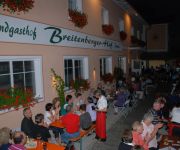
Breitenberger Hof
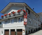
Gasthof Süss
Villa Breitenberg
Hotel-Pension Hochficht
Videos from this area
These are videos related to the place based on their proximity to this place.
Low pass EDPS - Průlet EDPS
Průlet nad dráhou letiště EDPS (Sonnen). Low pass with Zlin Z-142 at EDPS airport (Sonnen airfield). http://www.facebook.com/aeroklubPraha.
Ski Hochficht - Abfahrt Schwarzenberg
Abfahrt vom Restaurant Zwieseltreff zum Talstation der Schwarzenbergbahn im Schigebiet Hochficht, Oberösterreich. Leicht (blau), ideal für Kinder und Anfänger. Odjezd od restaurace Zwieseltreff...
ADRENALIN PŘISTÁNÍ DO KOPCE A PŘEZ LOM S ULTRALIGHTEM TECNAM P-92 LETIŠTĚ SONNEN NĚMECKO
UPOZORNĚNÍ PRO NEZNALÉ (především nepočítačové generace) : kdo má pomalejší internet a PC, po spuštění si zmačkněte stopku (trojúhelníček a dvojčárka vlevo pod obrázkem)...
ADRENALINOVÝ START NA DRÁZE Z KOPCE A PŘEZ LOM S TECNAM P-92 ECHO LETIŠTĚ SONNEN NĚMECKO
UPOZORNĚNÍ PRO NEZNALÉ (především nepočítačové generace) : kdo má pomalejší internet a PC, po spuštění si zmačkněte stopku (trojúhelníček a dvojčárka vlevo pod obrázkem)...
Videos provided by Youtube are under the copyright of their owners.
Attractions and noteworthy things
Distances are based on the centre of the city/town and sightseeing location. This list contains brief abstracts about monuments, holiday activities, national parcs, museums, organisations and more from the area as well as interesting facts about the region itself. Where available, you'll find the corresponding homepage. Otherwise the related wikipedia article.
Friedrichsberg (Lower Bavaria)
Friedrichsberg is a mountain of Bavaria, Germany.


