Safety Score: 3,0 of 5.0 based on data from 9 authorites. Meaning we advice caution when travelling to Germany.
Travel warnings are updated daily. Source: Travel Warning Germany. Last Update: 2024-08-13 08:21:03
Discover Euersdorf
Euersdorf in Lower Bavaria (Bavaria) is a place in Germany about 243 mi (or 392 km) south of Berlin, the country's capital city.
Current time in Euersdorf is now 02:09 AM (Monday). The local timezone is named Europe / Berlin with an UTC offset of one hour. We know of 12 airports near Euersdorf, of which 5 are larger airports. The closest airport in Germany is Straubing Airport in a distance of 11 mi (or 17 km), South-West. Besides the airports, there are other travel options available (check left side).
There are several Unesco world heritage sites nearby. The closest heritage site in Germany is Old town of Regensburg with Stadtamhof in a distance of 24 mi (or 39 km), West. If you need a hotel, we compiled a list of available hotels close to the map centre further down the page.
While being here, you might want to pay a visit to some of the following locations: Stallwang, Rattiszell, Ascha, Falkenfels and Loitzendorf. To further explore this place, just scroll down and browse the available info.
Local weather forecast
Todays Local Weather Conditions & Forecast: 6°C / 42 °F
| Morning Temperature | 1°C / 34 °F |
| Evening Temperature | 3°C / 37 °F |
| Night Temperature | 1°C / 33 °F |
| Chance of rainfall | 0% |
| Air Humidity | 75% |
| Air Pressure | 1018 hPa |
| Wind Speed | Light breeze with 4 km/h (2 mph) from North-West |
| Cloud Conditions | Scattered clouds, covering 35% of sky |
| General Conditions | Scattered clouds |
Tuesday, 26th of November 2024
6°C (43 °F)
3°C (37 °F)
Light rain, light breeze, overcast clouds.
Wednesday, 27th of November 2024
5°C (40 °F)
5°C (41 °F)
Light rain, light breeze, overcast clouds.
Thursday, 28th of November 2024
3°C (37 °F)
2°C (36 °F)
Rain and snow, moderate breeze, overcast clouds.
Hotels and Places to Stay
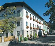
Krone Landhaus
Fischer Veri Landgasthof
Videos from this area
These are videos related to the place based on their proximity to this place.
SNES Megaman 7 Cloudman (flawless + only uncharged shots)
This is Cloudman being beaten with only the Megabuster and by only using uncharged shots, I also "reduced" my health so low that every hit from him would kill me. Cloud Man Looks like:...
Mitterfels Germany area bike ride
Kent Germany Trip with 5 days spent in the small town of Mitterfels about 1 1/2 hour from Munich. Bike path built upon former railraod tracks runs all the way to Passau on the Danube River.
Mit der SUZUKI LT-V 700 Twin Peaks am Feldweg unterwegs
Mit der SUZUKI LT-V 700 Twin Peaks am Feldweg unterwegs.
Die Bavarian Triumph Spring Raid 2010
Das Saisoneröffnungstreffen der Triumph-Fahrer aus Deutschland, Österreich und der Schweiz vom 23. - 25. April 2010 im Gasthof "Zur Schwalbe" in Haibach, Bayerischer Wald.
[HD] CS:GO- Clip: Negev-Ace! auf Dust II
Uuuund hier gleich Clip #2 ^^ Beim 1. sind mir ein paar Fehler unterlaufen aber fuck it! Hab immer noch npaar Clips auf Lager und kann auch noch mehr aufnehmen ;) ---------------------------------...
Motorrad Pfingst Tour 2010 1-4
Kleine Bayerwaldrunde über ein paar der schönsten Motorradstrecken im Bayerischenwald. Teil 1 von 4 Kurz aber knackig. Von Mitterfels über Steinburg nach Neukirchen.
[HD] CS:GO- Clip : Pistol- Round gerettet auf Dust II
Halo loite, hia mahl wida ein klib von mier. Tzwarr kain Eiss aba trohtsden guhd. Eua leckma Ahcja, di verwändede muckä: https://soundcloud.com/beatbruecke/free-beat-anthem-by-bmomusik ----------...
[HD] CS:GO- Clip: P90/ USP-S Ace! auf Dust II
Waaaas geht ab?! Neues Video. Qualität wird langsam besser ;) Lasst ruhig ne bewertung da. Diesmal hats ein wenig länger gedauert, aber die Produktion macht trotzdem Spaß! :D Musik: https://soun.
Впоймал и отпустил. Парри
gefangener Schupfenkkarpfen mit einem Gewicht von 13,5 kg. Weiher Parkstetten, in Bayern, Landkreis Straubing-Bogen.
Videos provided by Youtube are under the copyright of their owners.
Attractions and noteworthy things
Distances are based on the centre of the city/town and sightseeing location. This list contains brief abstracts about monuments, holiday activities, national parcs, museums, organisations and more from the area as well as interesting facts about the region itself. Where available, you'll find the corresponding homepage. Otherwise the related wikipedia article.
Bavarian Forest
The Bavarian Forest is a wooded low-mountain region in Bavaria, Germany. It extends along the Czech border and is continued on the Czech side by the Šumava (Bohemian Forest). Geographically the Bavarian Forest and Bohemian Forest are sections of the same mountain range. A part of the Bavarian Forest belongs to the Bavarian Forest National Park (Nationalpark Bayerischer Wald) (240 km²), established in 1970 as the first national park in Germany.


!['[HD] CS:GO- Clip: Negev-Ace! auf Dust II' preview picture of video '[HD] CS:GO- Clip: Negev-Ace! auf Dust II'](https://img.youtube.com/vi/r6ybsJLu7vY/mqdefault.jpg)

!['[HD] CS:GO- Clip : Pistol- Round gerettet auf Dust II' preview picture of video '[HD] CS:GO- Clip : Pistol- Round gerettet auf Dust II'](https://img.youtube.com/vi/moC1WirIW3c/mqdefault.jpg)
!['[HD] CS:GO- Clip: P90/ USP-S Ace! auf Dust II' preview picture of video '[HD] CS:GO- Clip: P90/ USP-S Ace! auf Dust II'](https://img.youtube.com/vi/OR8FZzbCJRw/mqdefault.jpg)


